Haleakala national park in Hawaii – photo, description, map
Even those who have never been to Hawaii have already heard about the fantastic landscapes, the diversity of the climate and the amazing “relaxation” of the pace of life on these islands. The Hawaiian archipelago are the only islands on the globe that are so far removed from the continent. One of the unique places that will leave a lasting impression is the Haleakala National Park.
Hawaiian archipelago
Consisting of 24 volcanic formations and atolls, the archipelago includes several large and many small islands. Hawaiian legends in their own way explain the volcanic origin of their land. The goddess of fire Pele, the patroness of Hawaii, pursued by the goddess of the sea, hid from her in the bowels of the earth. From time to time, Pele reminds of his existence, throwing out fiery lava and burning stones from volcanic craters.
The most active volcanoes in the world rise above the Hawaiian Islands. The most active and unpredictable volcano is Kilauea. The second active volcano in Hawaii after Kilauea is Mauna Loa. Dormant Mauna Kea, Hualalai and Haleakala. The rest of the volcanoes are considered extinct.
Many people associate a visit to the Hawaiian Islands with beach bliss and unhurried resort life. But this is an erroneous opinion. There is a lot to see in Hawaii. Of course, the main attraction of the islands is nature, in all its conceivable and unthinkable transformations. Volcanoes will be an integral part of all the national parks of the archipelago: extinct, dormant and even active. The seismic situation is monitored every minute, and when entering the volcanic territory of any national park, it is necessary to visit the information center. Here, tourists are provided with data on road patency and possible danger zones.
International Biosphere Reserve
For a trip to the Haleakala National Park, we will be interested in the second largest island of the archipelago – the island of Maui. It is here that the dormant Haleakala volcano is located – the main attraction of the island. At the end of the last century, Maui Island Park was officially named an International Biosphere Reserve.
A good road leads to the volcano that formed the eastern part of Maui, marked in blue on the tourist map of the island. Unlike roads winding along the coast, where vegetation alternates with steep slopes, and the eye does not have time to follow the changing pictures of nature, the road to the Haleakala volcano gradually raises travelers into the clouds. The higher the serpentine rises, the more noticeably the air temperature drops and there is a feeling that nature is “falling asleep”.
The silhouette of a giant volcano is visible from afar. Buses loaded with mountain bikes crawl along the steep road. Cyclists will move out on their own. The event under the slogan “on a bicycle from the volcano” can be confidently called extreme. After 3,000 meters of crazy descent, the bike's brakes get so hot that, if touched, you can get burned. The steep slope of the volcano also attracts horseback riders. Instead of two wheels, four hooves, a saddle and a bridle.
Hawaiian legends
Haleakala, according to ancient Hawaiian beliefs, was the home of the sun conquered by the god Maui. An ancient legend says that the sun moved across the sky very quickly, and Maui's mother did not have time to dry the canvas she wove. The son decided to clean up. From his sister's hair, he wove a long rope and a loop, with which he lassoed a luminous ball. To free itself, the sun had to make a promise to move more slowly across the sky. In this way, Maui provided mankind with long days. After the heroic deed of Maui, the volcano was named Haleakala – “House of the Sun”.
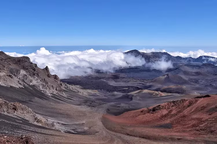
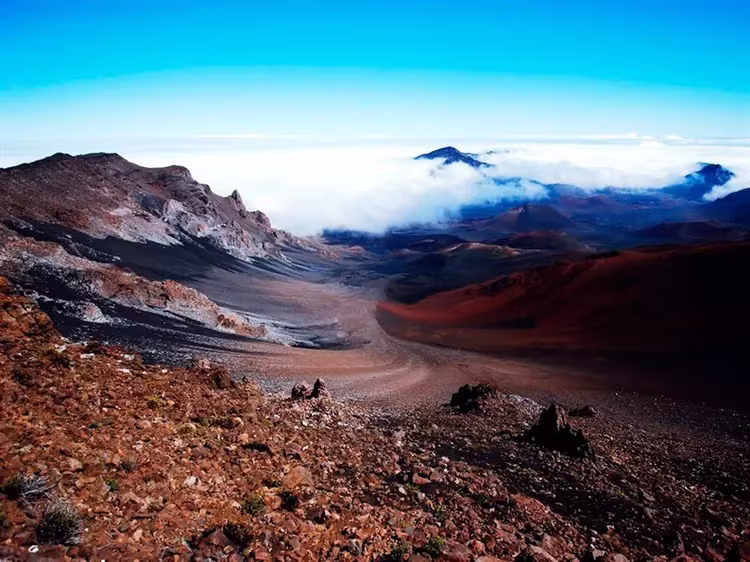
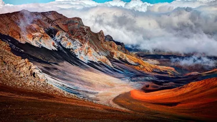
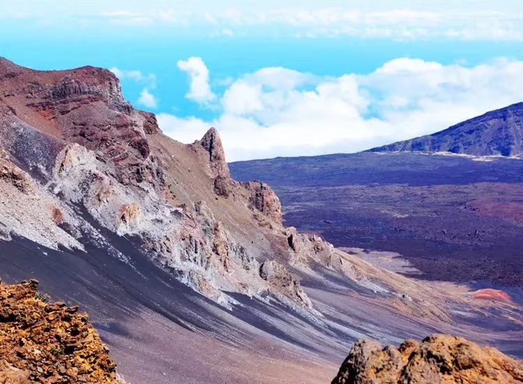
The luminary obediently gives rays to its own dwelling – the largest crater in the world. It is 4 km wide, over 12 km long and over 800 meters deep. Here you can feel like the last person left on the planet, whom the Almighty forgot about. It will seem that you are lost on the peak that connects the earth with the sky.
Tourist routes
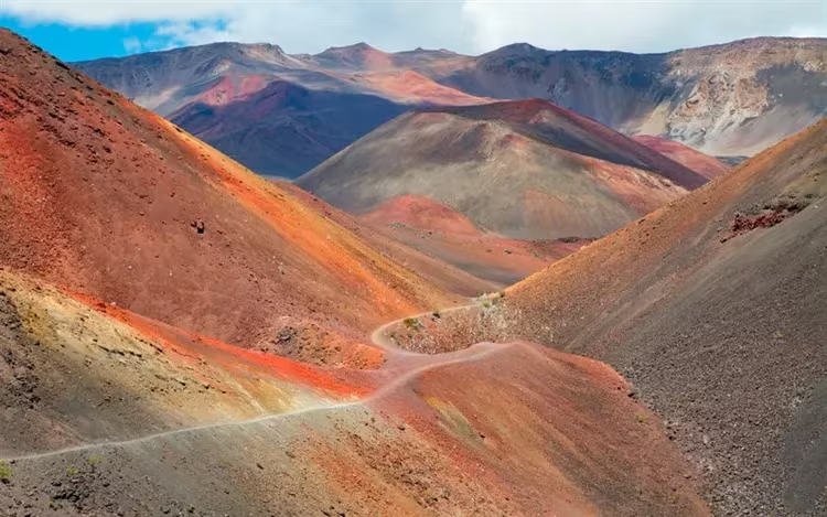
From the heights of a dormant volcano, views resembling the lunar surface open up. Hiking trails with a total length of about 50 kilometers lead tourists past cones of volcanic rocks. At the top of the crater is the Haleakala Volcano Visitor Center. It is open from sunrise to 15:00. In addition to getting acquainted with the exhibits and photographs of the history and geology of the area, tourists can capture sky-high views with their own cameras from the observation deck.
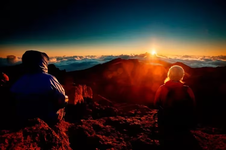
Despite the variability of the weather with low temperatures and gusty winds, the Haleakala volcano attracts travelers both in the predawn hours and at sunset. Here it is possible to set up a campsite and even stop by car overnight.
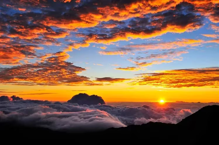
Gradually, fog from the sea envelops the slopes of the volcano. The luminary has fulfilled the daily “norm” and is going to hide in its crater. The last act of a magical performance: the rays of the setting sun paint volcanic islands in the middle of the ocean in dozens of colors. An earthly paradise that arose from the underworld. The incredible starry expanses of the night sky hanging over the top of Haleakala are considered almost iconic among amateur astronomers. This fact is taken into account by the local population. Almost every seller on the island sells a telescope or binoculars.
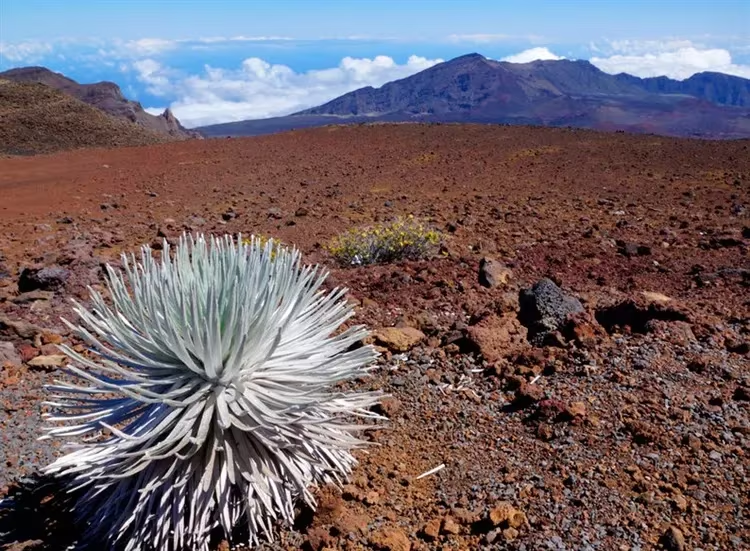
The desert slopes of Haleakala surprise with plant life. There is a plant here that is found only in Hawaii, at the foot of several volcanoes. Endemic achinakhina or “Silver Sword” is an amazing plant of an unusual look and shape. She lives 25 years, while blooming only once, releasing hundreds of flowers from a single stem.
The territory of the park
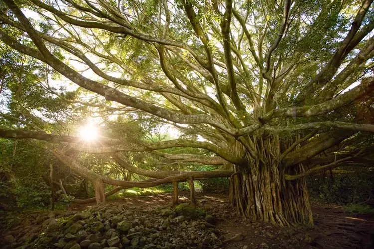
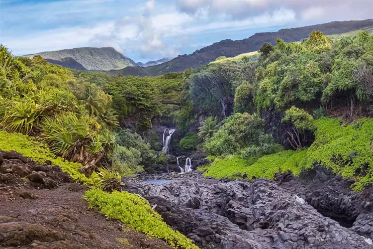
The territory of the National Park is conditionally divided into two parts: the top of the Haleakala crater with the territories adjacent to it and the coast of Kipahulu. In the coastal zone of the park, tourists are recommended to visit Hosmer Grove, where a huge number of rare plant species brought from different parts of the world are concentrated. In contrast to the harsh western coast of Hawaii, the eastern one captivates with its tropical nature. Here our idea of Hawaii is confirmed by the dense impenetrable jungle. Heliconias and bougainvilleas bloom, colorful wild orchids, ginger, balsam and anthurium. After a half-hour journey along the path through the jungle, the sound of water is heard more and more clearly. These are waterfalls of indescribable beauty, carefully hidden from view in the labyrinths of the tropical forest.
After traveling through the Haleakala National Park, its popularity becomes understandable for absolutely everyone. For the 12th year in a row, the authoritative Conde Nast Traveler poll recognizes Hawaii, in particular the island of Maui, as the “best island in the world.”