

Paricutin Volcano in Mexico – photo, description, map
Silent since its creation, the Earth suddenly erupted into a violent roar and fire in Mexico, creating the Paricutin Volcano. There is something mystical about this. Until now, he breathes and attracts people with his mystery.
How did it happen
Farmer Dionisio Pulido was the owner of his land and grew vegetables like an ordinary peasant. In his cornfield, he discovered a hole, or rather a hole. Rejoiced that he had a natural garbage container, for many years he dumped his waste into this hole, disappearing in it, as in an abyss. An underground container with a diameter of about 5 meters turned out to be literally bottomless.
On February 5, 1943, a rumble was heard from under the ground, a rumble and the earth began to tremble. The family, led by Pulido, was working in the field on February 20 when they suddenly heard a growing rumble from the depths of the Earth. Everything around shook, the earth cracked where the “garbage can” was. Frightened, people left the field. The next day, a mound of ashes and slag grew at this place, the height of which grew every hour. A week later it was already a mountain 150 meters high. Explosions, which accompanied the anger of the Earth, were heard for 300 kilometers around. Stones flying out of the hole under enormous pressure could demolish everything in their path and, flying up about a kilometer, fell to the ground with a deafening roar.
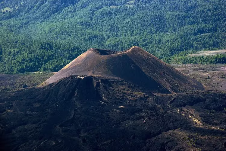
Preparations for the main action continued throughout the year. Thus a new volcano was born. During this time, he reached a height of 336 meters. The mountain occupied the entire cornfield. Lava from the mouth of the volcano began to pour out in June 1944 and with its fiery tongues licked the village of Paricutin, whose inhabitants left with their belongings earlier, realizing that they could no longer live here.
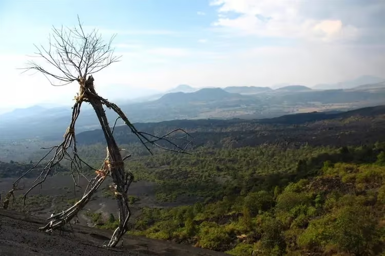
The volcano raged, then calming down, then becoming furious again, for 9 whole years. During this time, ash covered another 10 settlements, and lava filled around 18 km2.
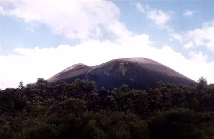
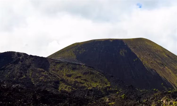
The volcano died down in 1952. During this time, he has risen 472 meters above the surrounding territory and now proudly looks at the human people from this height. The absolute mark of the volcano is 3,172 meters above sea level.
As if the Earth made it clear to man that it should not be used as a garbage can.
Lunar landscapes and paintings
In Mexico at that time, the artist Gerardo Murillo, better known under the pseudonym Dr. Atl, lived and worked. It was a man in love with volcanoes. An enterprising peasant sold him his plot, where the volcano was born, named after the village of Parikutin that died under it. Dr. Atl has been fascinated with volcanoes since 1909. There are plenty of them in Mexico, but he needed this one most of all, because here he could trace and draw the entire life cycle from birth to eruption and extinction. Even after the amputation of his leg, the artist climbed the volcano in order to leave for posterity the unique paintings created by the internal energy of the Earth. There are about 10,000 drawings and about 1,000 paintings of this natural phenomenon. The volcano at night and in the light of the sun, the fire escaping from the mouth – all this the artist tried to capture on his canvases. To do this, he even flew more than once in a helicopter over the volcano in search of a convenient angle. According to the drawings and paintings, you can completely restore everything that happened there.
Not extinguished – just sleeping
This youngest volcano in Mexico has enabled volcanologists from all over the world to study and record the results of their work, tracing the entire life of Paricutin.
Now the volcano is considered extinct, but there is an opinion that it is precisely such volcanoes, from which no one expects active activity, that are dangerous. So it was with Vesuvius in 79 AD. After a thousand-year sleep, in 1956 Bezymyanny volcano woke up near Klyuchevskaya Sopka.
Travelers, tourists and just curious people tend to visit and see this pulse of the Earth.
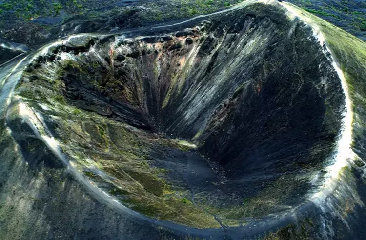
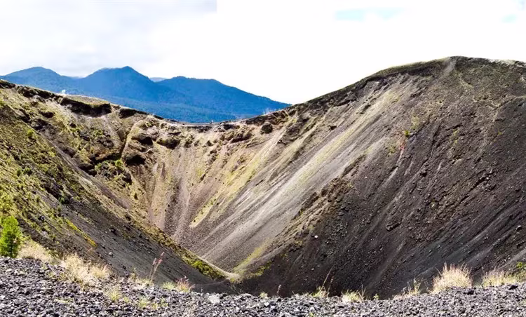
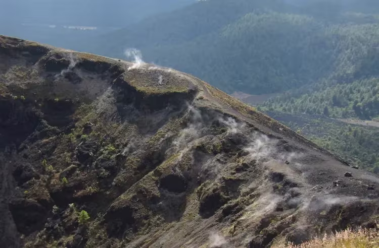
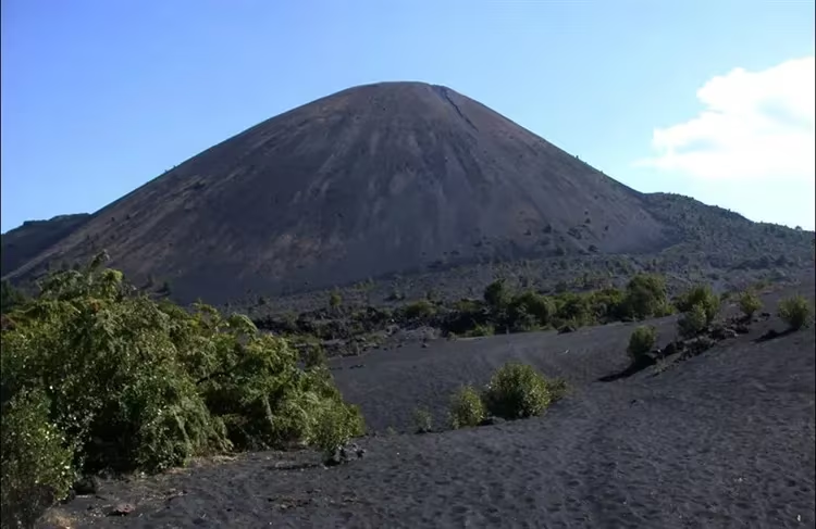
Climbing the slope of the volcano, you can observe floating areas everywhere, as if he were breathing. Soil temperatures on slopes are between 43°C and 67°C. At the top near the edge of the crater, which is almost 800 meters in diameter, in some places it is impossible to stand for a long time. The heat emanating from the inside fries the sole, as in a frying pan. The temperature of the soil here rises to 85°C. If you walk along the path laid by thousands of tourists around the crater, then in many places you can feel a very strong smell of hydrogen sulfide, confirming the ongoing life inside the volcano.
There are no people wishing to descend into the crater itself. The volcano is associated with a sleeping animal. To climb into the mouth of a volcano, even if it has cooled down, means to fall directly into the mouth of a tiger.
Paricutin's birthday
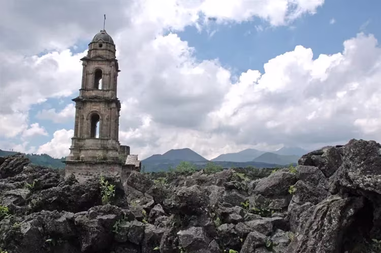
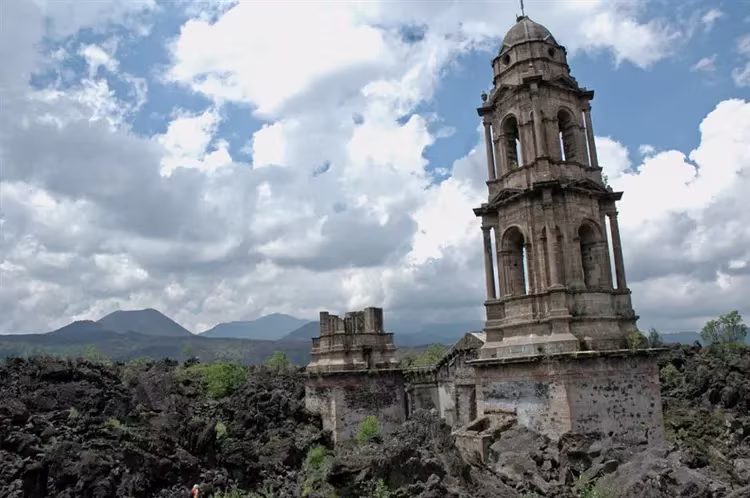
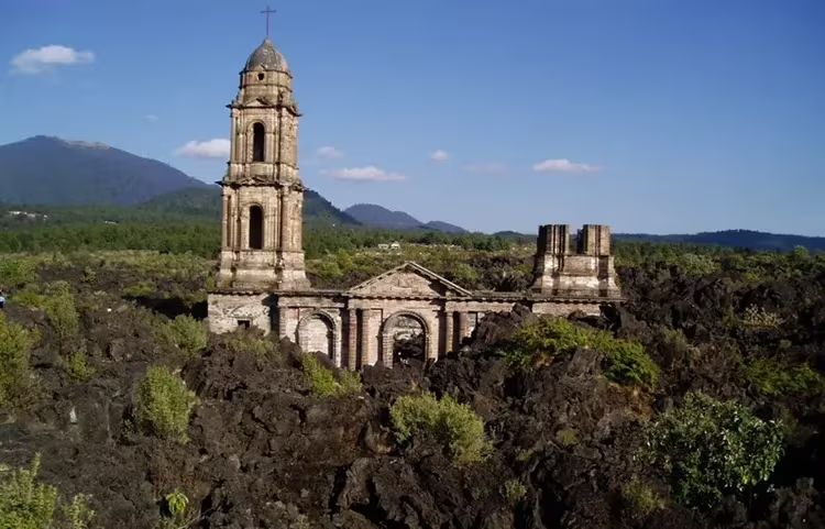
The inhabitants of the nearby villages, like no one else, understand that if this formidable neighbor had not warned them of the possible danger with his roar and warning shots, they would not have escaped the fate of the inhabitants of Pompeii. Lava flows flooded everything around, but the bell tower of the church still towers over this lifeless landscape.
Here every year on the birthday of the volcano a procession is made. People thank the supreme forces that they did not allow a single victim during the eruption.
Local residents and tourists observe here an improvement or deterioration in well-being. Scientists explain this by the appearance of an energy field at the site of the formation of a volcano. The forces emanating from the Earth can influence the human field. This adds mysticism to the unearthly landscape and attracts anomaly researchers from all over the world.
Guides and excursions
The best observation point from which amazing landscapes of the volcano, the field of solidified lava and the half-buried church are opened is in the nearest village of Angauan.
Here you can find a guide who will show you the way to the Paricutina crater.
The multitude of travel options makes it accessible to almost everyone. The most convenient way is to get to the foot by car, and after half an hour climbing the trail, to be at the top.
Local guides offer horseback riding for those who don't mind a ride.
The walking option is suitable for more hardy explorers.
How to get on your own
This natural monument is located in Mexico in the state of Michoacán. In the city of Uruapan, which is located 30 km from the volcano, there is an international airport. There, upon arrival, you can rent a car and comfortably travel around the country. Near the destination there are several villages where you can leave your car and get there either on foot or on horseback. The closest village to the volcano is Nuevo San Juan Parangaricutiro, 6 km away is the village of Angauan. It is best to rent a cross-country vehicle and get to the foot. On it you can see other sights of this interesting country.
Feel the pulse and breath of the planet!
Recommended reading Tour to the volcano – an extreme trip.