
Mount Kilimanjaro in Tanzania, Africa – photo, description, climbing routes, Kilimanjaro on the map
Kilimanjaro – this word, unusual for the Russian language, has become attractive for most Russians since childhood, and many, like Hemingway's heroes, have a dream to visit these wonderful places and, perhaps, even climb the Crown of Tanzania. That is what they call the highest mountain in Africa (literal translation from Swahili – sparkling mountain).
Country symbol
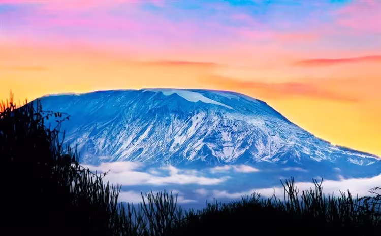
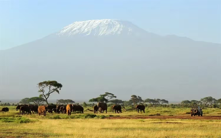
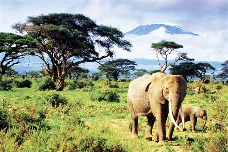
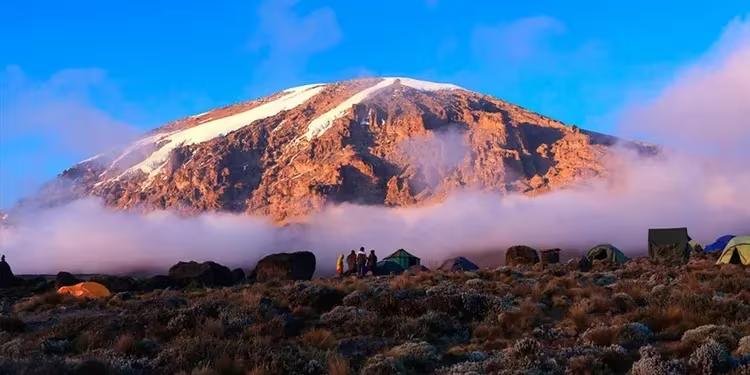
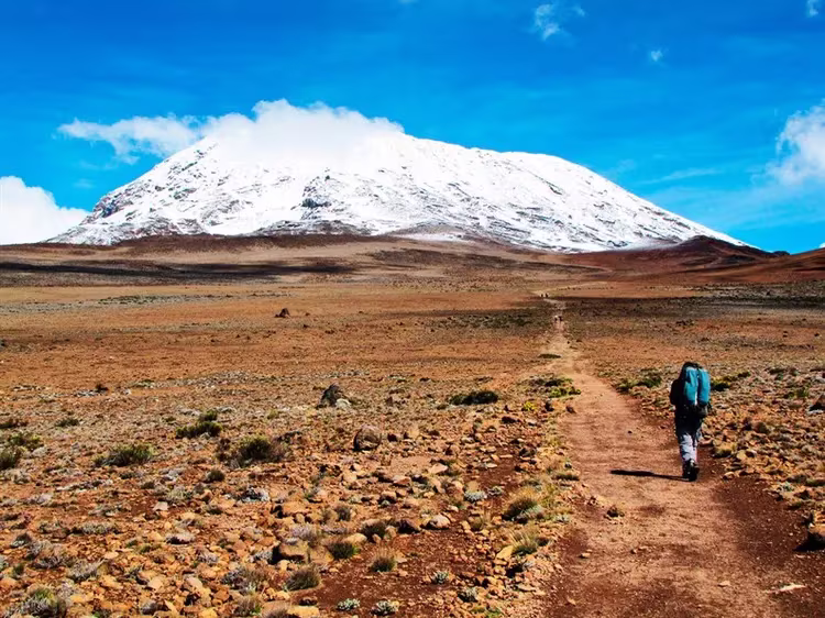
The snow-white top of Kilimanjaro, like the mountain itself – a symbol of the country, towering above the savannah, is visible from afar. Its height is 5895 m, and the diameter of the base is 60 km. In hot weather, the bluish hue of the base of the mountain merges with the surrounding landscape, and it seems that the upper part is hanging in the air. This feeling is enhanced if there is a slight cloud cover: clouds usually cover the lower part of the mountain, leaving only the snowy top for viewing.
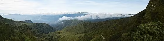
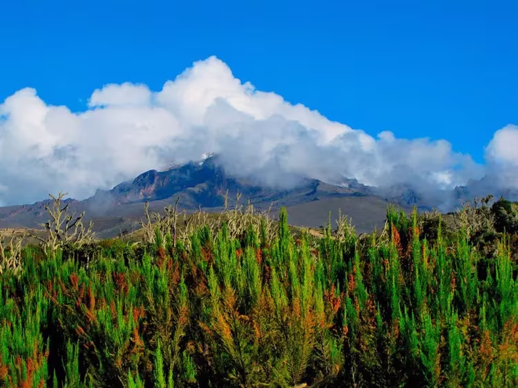
Mount Kilimanjaro is so huge that its own special climate forms at its foot. The wind, having stumbled upon such a large obstacle, dumps moisture particles in the form of rain or snow. Good soil irrigation is known to contribute to the diversity of the plant world. Therefore, the flora on Kilimanjaro is much richer than on the surrounding plain. Tropical plants grow in the lower part of the mountain (in particular, corn, coffee), further – up to a height of about 3000m – the mountain is covered with jungle, even higher – lichens and mosses.
Crown of Tanzania
Even in the Middle Ages, travelers used Kilimanjaro as a landmark, and the first written mention of this volcano (namely, a volcano with a flat top and a crater) dates back to the 13th century. Kilimanjaro was first described by Chinese sailors off the African coast. They talked about a white peak rising to the sky from the depths of the mainland.
However, medieval memories of a snowy mountain for a long time were perceived by compatriots of the pioneers as fiction: no one could believe that there could be an ice peak almost on the equator (3 degrees south latitude). Only in the 19th century – after the expedition undertaken by the Europeans in 1889 – it was marked on geographical maps.
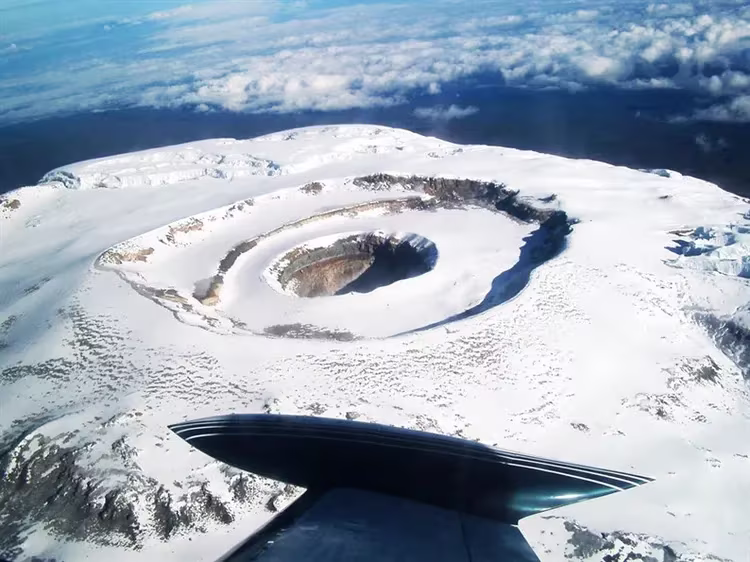
Now the territory near Mount Kilimanjaro has been declared a national park, the area of which is 7500 sq.m. This status was assigned to the land in 1961 after Tanzania became an independent country. Kilimanjaro National Park has been on the UNESCO list since 1987. By the way, Kilimanjaro is a mountain formed from three separate volcanoes. Over the long years of numerous eruptions, they seem to have stuck together into a single formation, but individual parts are distinguishable even now. The oldest Shira volcano is the western part of the main mountain. According to scientists, it was originally much higher, but, as they believe, it collapsed as a result of a particularly strong eruption. Now its height is 3810 m.
A younger volcano – Mawenzi – is adjacent to the base from the east and now looks like a peak with a height of 5334 m. The final view of Kilimanjaro was formed by the newest and highest volcano – Kibo. It was he who gave the peak a characteristic flat shape with eternal ice on the surface.
However, every year the snow mass decreases. A number of experts call the heating of the volcano the cause of this process, according to others, global warming is to blame. Be that as it may, they all admit that the snow cap of Kilimanjaro has become much smaller than it was in the last century, and they do not exclude that in 200 years it will completely disappear.
How to conquer Kilimanjaro
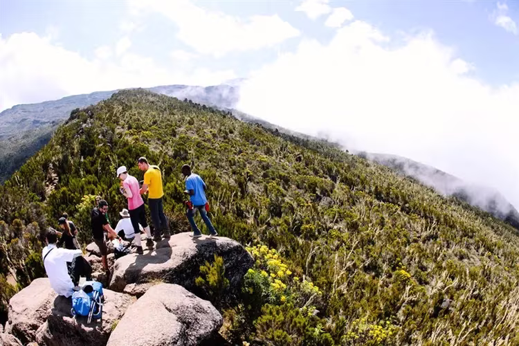
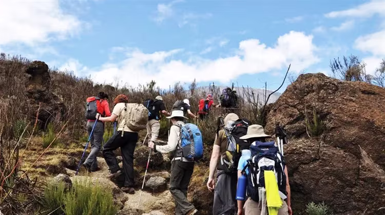
Thousands of tourists come to Tanzania every year to try to climb Africa's most famous peak. You can climb it on foot, which makes the mountain attractive not only for climbers, but also for ordinary mountain travelers. However, not everyone succeeds in this: during the ascent there are places (although not often) that are difficult to overcome: you have to rely on all the limbs at once.
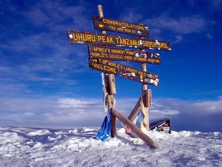
Mawenzi volcano is considered the most difficult to climb: to conquer this part of Kilimanjaro, climbing skills on rocks, ice and snow are required. It is not very difficult to climb to the highest point – Uhuru Peak (Kibo Volcano), but in this case it will take time to acclimatize. By the way, it is the height that is the main obstacle for the majority, because at a certain moment (someone earlier, some later) it becomes difficult for the conquerors to breathe, headaches and nausea appear. This is what tourists call the most difficult test, but that is why the trips are designed for several days.
Uhuru Peak was first climbed in 1889 by Hans Mayer of the first European expedition. The centenary of this event was celebrated in Tanzania on a grand scale. Surprisingly, the very first guide was present at the festival, who helped the first climbers. In 1989 he was 118 years old. Now about half of the travelers who started from below get to the top of Uhuru, two-thirds manage to reach a height of 5681 meters (Gilmand's height).
For less prepared people, local travel agencies have prepared very easy routes: Marangu, Rongai and Mashame.
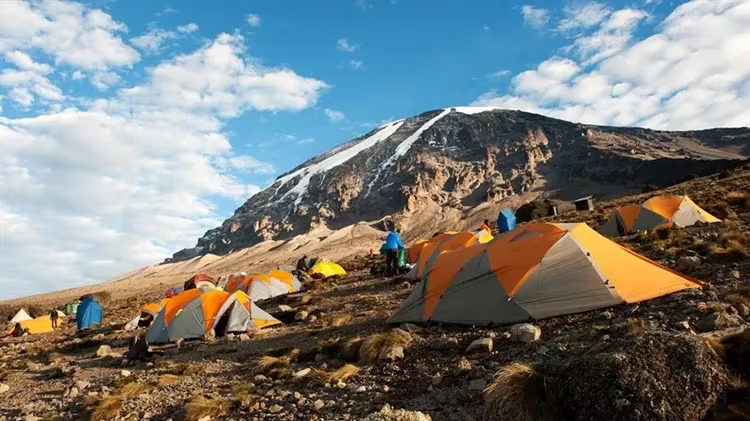
The oldest and most popular is the Marangu route (also called the “Coca-Cola route“). On this hike – the only one of them all – tourists do not need to take tents with them, since they already have places to stay along the way. These are 3 mountain huts (lodges), the first of which (Mandara) is located at an altitude of 2700 m, the second (Horombo) – at an altitude of 3700 m and the third (Kibo) – at an altitude of 4700 m. The huts are recreation facilities (Mandara is designed for 80 people, others smaller) and a dining area. Conditions are not particularly comfortable. The journey takes 5-6 days. The Mashame route is designed for 6-7 days, it is considered more difficult than Marangu, but is also accessible to ordinary people.
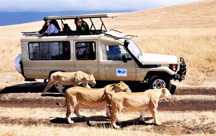
The Rongai route is currently the least known, but very interesting. It runs along the northern slope of Kilimanjaro, where the local flora and fauna are most widely represented. Here you can see many animals characteristic of this place. Takes 5-6 days.
Each route has its own characteristics and rules that must be strictly observed. For example, there are paths that you can only climb – going down is strictly prohibited. There are five such tracks on Kilimanjaro. Three trails can only be descended, and only one – Marangu – is used for both ascent and descent.
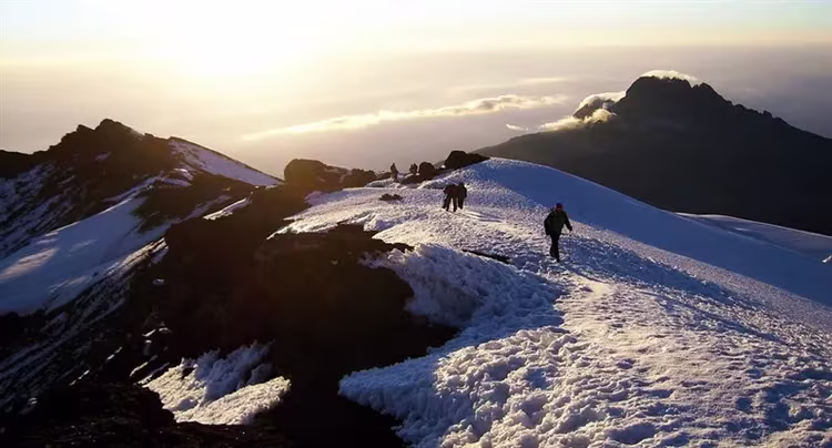
At around 4 km, the trails of all routes run into the so-called Kibo Ring (as the name implies, this trail encircles the entire mountain), from where the ascent begins directly to the very top and the crater of the Kibo volcano. At this point, you can also choose from three options: follow the Glacier Arrow Trail (or Western Gap Trail), the Barafu Trail, and another unnamed trail leading to Gilmand Height and the Volcano Crater.
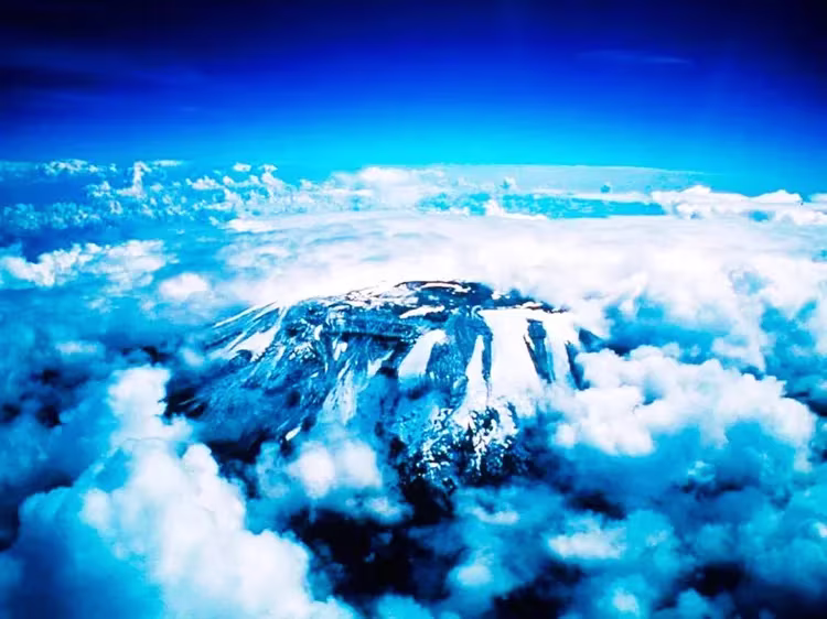
Here the tourists, finally, find themselves at the goal: they rise above the clouds, touch the eternal ice, look inside the volcano, which is still showing signs of activity (smoke and the characteristic smell of sulfur). At this moment, all those who have conquered Kilimanjaro are unanimous in their feelings: the difficulties of hiking are immediately forgotten, only delight from the surrounding beauty remains.

Which route to choose, local guides will tell you. It should be remembered that climbing Kilimanjaro without a guide is strictly prohibited. In the town of Moshi, closest to the volcano, there are a huge number of travel agencies offering their services. The cost of the trip depends on the number of people in the group, but on average it is about $1000 per person. Local residents are ready not only to accompany tourists on the way, but also to carry their things, as well as cook food – it all depends on the desire and financial capabilities of travelers.
Travel agencies are open all year round. Accordingly, you can go hiking at any time, but do not forget about the weather conditions: there is a rainy season in Tanzania. Many recognize that the best time to travel is July and August. At this time, as a rule, there are no tropical showers, the heat is easily tolerated. In principle, travelers will not be mistaken if they come here during the periods from August to October and from January to March. But even at this time, you need to remember that on Kilimanjaro you can find yourself both in the tropics and almost in polar conditions: if at the foot of the mountain the average annual temperature is +30 ° C, then at an altitude of 3000 m – only + 5… 15 ° C, and at night the thermometer can drop below zero. Thus, at the beginning of the journey it will be very convenient to wear shorts and a T-shirt, but at a height you will need completely different clothes. Do not forget about this when going on the road.
What else to do on Kilimanjaro?
For those who do not want to go on a multi-day mountain hike, one-day excursions to the mountain are offered: you don't have to climb very high, but you can get an idea of the “crown of Tanzania”. There are many other entertainments:
And yet, experienced travelers strongly recommend trying to master the ascent. Kilimanjaro is the only real mountain in the world that you can climb without experience, and then for a long time be proud of yourself and feel like a real climber.
If you want to continue your trip to Africa, then I recommend reading the Uganda travel guide. Or maybe you are interested in extreme tours? Then I recommend reading the life hack Climbing Mount Kinabalu.