
Appian Way in Rome – history, photo, description, map
The primitive people of the planet communicated with the help of whistles, drum sounds, smoke, fire, water. Much later, roads became a necessary means of communication for the ancient world. Postal messages, carriages with people rushed along them, trade developed. Cities grew nearby, life was born, forming a special role of roads in the economic and cultural development of each country.
Construction history
The need for a reliable, straight, like a spear of the militant Romans, the road was caused by the military goals of the empire. The Romans were the first among the Mediterranean states to solve the problem of introducing overland methods of trade. Merchants quickly appreciated the convenience of delivering goods not always by sea, rivers, but also quickly by land. There was a connection between Rome and the countries of Africa, Asia, European cities. The road was built on the basis of an order, with the active leadership of the censor Appius in 312 BC. e.
By this period, there was an old Latin road leading from Rome to Cala. The beginning of a new road was its addition. A distinctive feature of the “royal road” was the fact that it became the first paved road in Rome, made with the highest quality along its entire length. The road is named after the creator.
During the reign of the Roman Republic, a network of such roads appeared on the territory of the Apennine Peninsula. The total length of the Roman roads is about 300 thousand km. The construction of any road began with a carefully created infrastructure of the settlements through which it was planned to lead the road. These are sewerage, water supply, allocation of places for transport, passers-by.
In the future, sidewalks appeared. Outside the city, during the construction of roads, approved standards were used, for example, the width of a straight section of the road is at least 2.45 m, at bends 4.9 m. Two chariots drove around without problems at such points. It was the responsibility of the owners of the nearest site to fence off the road if there was no stone laying. In her absence, travelers could go, go wherever they want.
The road construction time has three main phases:
- 4th century BC e. A 195 km long section connected Rome and Capua for purposes important in the 30-year war with the Samnites. On the paved road, the speed of movement of troops, caravans with goods has become much higher.
- 3rd century BC e. The section of the road leading to Benevent greatly strengthened the position of Rome on all issues.
- Second part of the 2nd century BC. e. Having reached Brundisium, the road connected Rome with the Egnatius route. There was an important opportunity to trade, to deliver slaves.
In Byzantine times, many sections were renovated. She filled the original role. The events of the Middle Ages weakened the trading functions of the unique building. Much more often it was used by pilgrims and travelers. Gregory III made major changes to the original version of the road arrangement. By order, a new surface was laid on the road. In subsequent centuries, the royal road suffered from the barbaric destruction of monuments, the road.
Many ancient artifacts passed into private possession, were taken to other states. Especially, at the time of the birth of the “fashion” for the excavation of the remains of saints, martyrs, which were in demand by museums in different countries. By the way, permission to conduct excavations was given by Pope Pius VI in the 19th century. The road was restored by the end of the 18th century.
Description
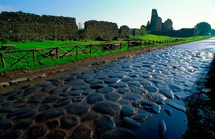
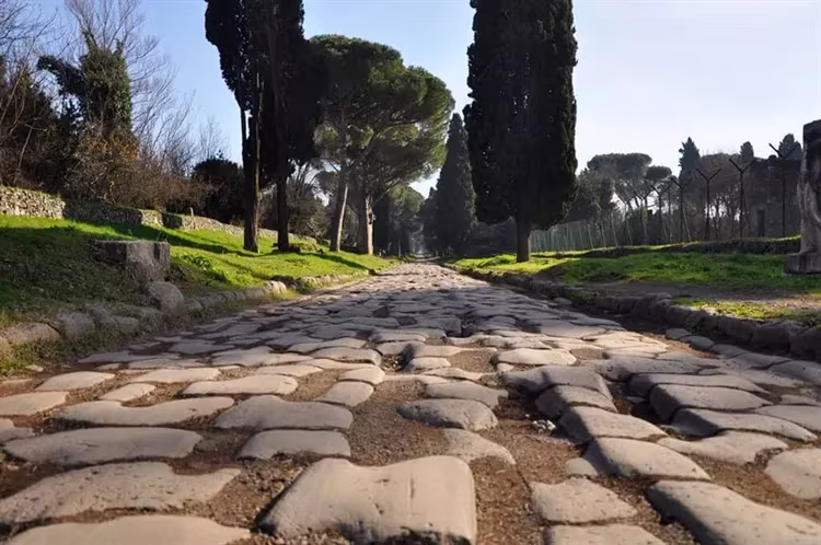
Surprise at the quality of the construction of the road does not decrease even now. It does not have the troubles of modern roads in the form of pits, potholes, cracks. Smooth, even slabs delight with their orderliness, strength, and eternity. The ancient secrets of technology consisted in the following stages of construction:
Convenient signs used by travelers were built along the entire Appian Way. These include the following road infrastructure elements:
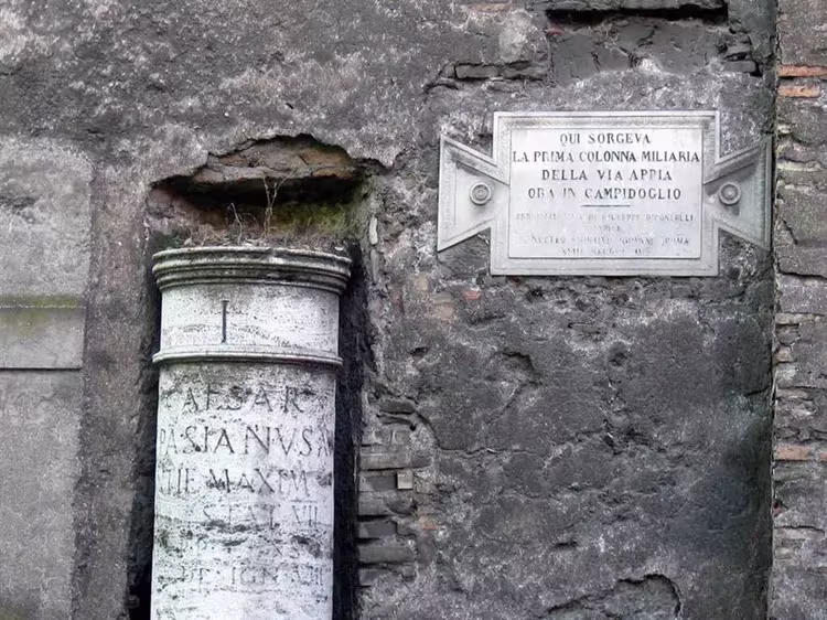
- A kind of marking in the form of a Roman mile (1478 m). At a certain distance, poles with tablets were installed indicating the time of the reign of the emperors, other important dates of the country, the path to the nearest settlement. Now the milestone of the first mile with the date of completion of the road construction has been preserved. By the way, the marks were made in the form of cylindrical columns with a height of 4 m, a thickness of 80 cm in diameter, and a weight of over 2 tons. They were mounted on powerful cubic bases fixed in the ground.
- Stations for changing horses, lodging for the night, and rest were located every 15 km. At the same time, three simple stations accounted for one with the possibility of overnight stay. To distinguish them, they were painted in a red tint. There were comfortable stables, a blacksmith, an inn, a tavern. Often a new city grew up near the stations. The laws of the hospitable population allowed travelers to settle in the homes of local residents. Along the road, special barns were built, warehouses for storing food supplied to Rome.
- Organization of postal, courier, security service. A well-established message system made it possible to deliver the required letters to any corner of the empire. Couriers could travel a distance of 75 km per day. The possibilities of other roads then did not exceed 45 km of daily travel. Horseback riding was used for fast delivery. At the same time, the courier had to wear a distinctive headdress. When traveling on a special chariot, the mail was in a box. Service as a courier at that time was characterized by the danger of attack by robbers. To prevent such a crime, the Romans built military, defensive structures along the road. Often they turned into fortresses, and the soldiers serving in them were engaged in the repair and maintenance of the road.
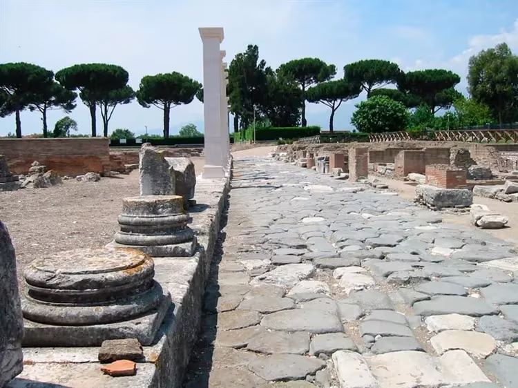
- The creation of places of worship, sacred monuments along the road is associated with the law, according to which it was forbidden to bury the dead along the perimeter of the city limits. Along the road there were columbariums, majestic tombs, necropolises, temples, mausoleums. Their main goal was to glorify the great personalities of the empire, the victory of the troops, the formation of spiritual nourishment for travelers. They had the opportunity to pray to the god of trade Mercury, Diana protecting the road, and other gods. Now many of them belong to the ancient sights of Italy, hosting a huge number of tourists from different countries. On one (Troyan's column) you can see the construction of the famous Appian Way.
sights
For a careful study of the sights of Italy, located on the sides of the Appian Way, you need a lot of time. Preliminary acquaintance, drawing up a plan for visiting them can be done along with excursions organized along specific miles of the road.
Attractions I mile:
- Tombs of Scipio, Geta, Priscilla.
- Kapensky gate, port of Appia or the gate of St. Sebastian.
- The first mile column.
- Columbaria Pomponius Gila, freedmen of Libya.
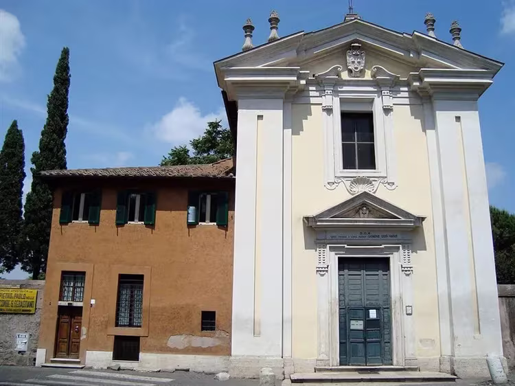
- Church of Domine Quo Vadis.
Attractions II mile:
- The pagan burial of the hypogeum of Vibia in the form of catacombs with ancient paintings.
- Tombs of Romulus, freedmen of the Volusian family.
- Catacombs of Saint Callistus, Vigny Randanini, Saint Sebastian.
- Circus Maxentius.
- Column of Pius IX.
Attractions other miles of the road:
- Tower of Capo di Bove.
- Heroic relief.
- Christian, Jewish catacombs, cemetery crypts of rich families, ruins of medieval fortresses, architectural structures of the Renaissance, Baroque type, interesting museums. Columbariums, unique underground structures of the hypogeum, catacombs, monumental tombs, modern country villas of Roman aristocrats.
Where is it located and how to get there
Now the Via Appia is the state highway Strada Statale 7 Via Appia, part of it is covered with asphalt. Plots with antique pavement, keeping the imprints of ancient chariots, are included in the regional park of Italy. The movement of any transport on weekends, holidays on the road is prohibited. There are routes of interesting excursions along it. They start in the center of Rome at Via Appia Antica 42 – 00179 Roma. The beginning of work, the cost of tickets for all places of visit is different. Full information can be obtained on the website, in any hotel. Bus number 118 runs along the old road.