













Geirangerfjord: cruise to the Seven Sisters waterfalls and Trollstigen in 2026
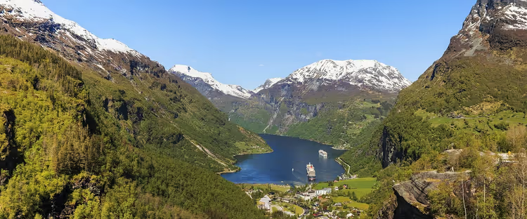
Geirangerfjord was inscribed on the UNESCO World Heritage List in 2005 (as of 09/2026, UNESCO list). It is 15 km long, and its slopes rise almost vertically out of the water. The village of Geiranger at the bottom is small, but in summer it gets very crowded.
Viewing the fjord from the shore is almost pointless. The best views open up from the water and from the high lookout points. Some roads close for the winter, and the hairpin road has been under repair for months after a rockfall.
Below you will find where to look for the waterfalls, how the Eagle Road works, what is going on with Trollstigen right now, and whether it is worth booking the ferry.
Ad: this article contains affiliate links, we earn a commission if you book through them, at no extra cost to you.
Geirangerfjord: a World Heritage site
💡 In short:
- The 15 km long fjord was added to the UNESCO list in 2005 (as of 09/2026, Wikipedia).
- The Seven Sisters, the Suitor and the Bridal Veil waterfalls are best viewed from the water, while the panorama is best taken from the lookout points.
- The Trollstigen road was reopened for the 2026 season after repairs (as of 09/2026, Fjord Norway).
- Check the ferry schedule on the official Fjord1 website.
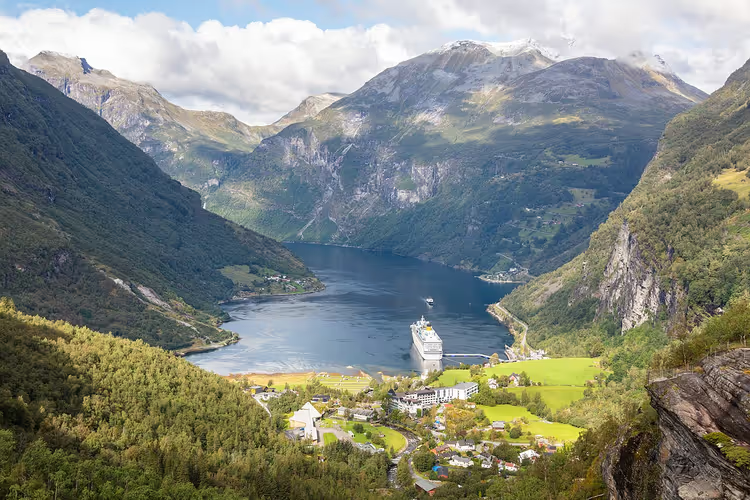
Geirangerfjord is a continuation of Storfjord, which locals call the Big Fjord. The fjord got its name from the village at its foot. It has few permanent residents, but in season cruise ships call here almost every day.
Check the ship schedule in advance. On days with two cruise ships, you will stand in line for the ferry and at the lookout point. Morning and late evening remain calm.
 © Diego Delso · CC BY-SAPhoto: Diego Delso, CC BY-SA (https://creativecommons.org/licenses/by-sa/4.0), Wikimedia Commons
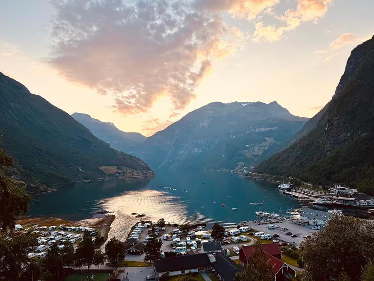
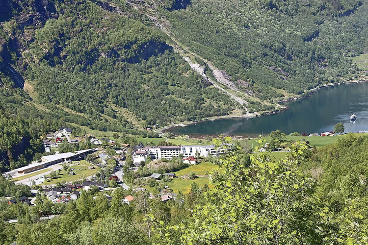
The village of Geiranger and the Geirangelva river
The Geirangelva river ends in the village of Geiranger. It flows into the fjord right by the pier. The place feels enclosed: cliffs rise on three sides, and the only way out is by water or along the hairpin road.
 © Cbliu · CC BY-SAPhoto: Cbliu, CC BY-SA (https://creativecommons.org/licenses/by-sa/4.0), Wikimedia Commons
The landscape was shaped by the last glacier. The ice carved a deep valley between the ridges, and after it retreated, water filled the depression.
Two to three hours is enough to walk around the village. Bring a rain jacket: it often drizzles here even in July. On the plus side, after rain the slopes look more contrasted and the waterfalls gain strength.
 © W. Bulach · CC BY-SAPhoto: W. Bulach, CC BY-SA (https://creativecommons.org/licenses/by-sa/4.0), Wikimedia Commons
Waterfalls: Seven Sisters, Suitor, and Bridal Veil
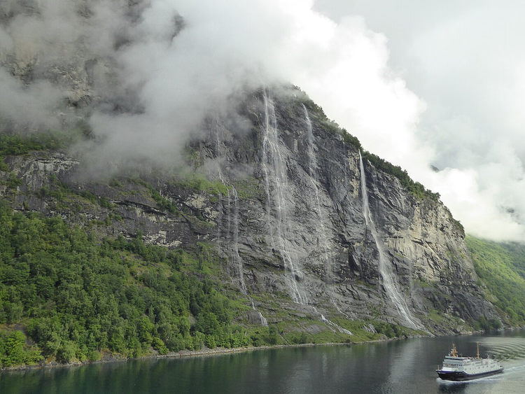
Three waterfalls frame the fjord and gave rise to local legends. The most famous one is called the Seven Sisters (De Syv Søstrene). Its waters plunge down in seven separate streams.
 © Millars · CC BY-SAPhoto: Millars, CC BY-SA (https://creativecommons.org/licenses/by-sa/4.0), Wikimedia Commons
The total height reaches 410 m, and the free fall of the tallest stream is 250 m (as of 09/2026, Wikipedia). In June and July the flow is at its strongest because the snow is melting. Take a tour in the first half of the day: the sun lights up the streams.
Across the fjord, you can see the Suitor (Friaren). It is lower and shaped like a bottle. The legend explains this simply: the suitor could not choose one of the sisters and found comfort in a bottle.
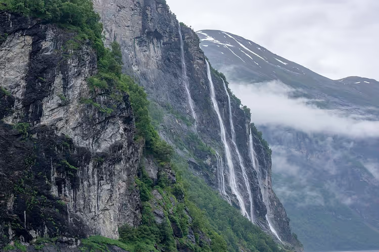
The third one is the Bridal Veil waterfall (Brudesløret). It lies west of the Seven Sisters. Its water does not fall vertically but slowly flows down the rock in a wide sheet.
Waterfall | Height | Distinguishing feature |
|---|---|---|
Seven Sisters (De Syv Søstrene) | up to 410 m, free fall 250 m (source) | seven separate streams |
Suitor (Friaren) | lower, exact height not stated | stands opposite the Seven Sisters, bottle-shaped |
Bridal Veil (Brudesløret) | flows down the rock rather than falling | wide sheet of water |
Knivsfla farm and abandoned mountain farms
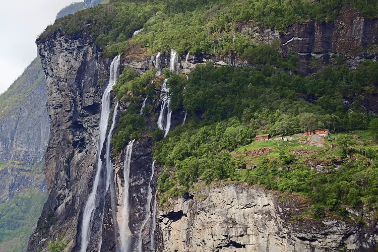
Next to the Seven Sisters stands the abandoned Knivsfla farm. Livestock used to be kept here on narrow ledges above the water. The buildings now stand empty.
There are dozens of such farms on the slopes. Many are abandoned, but some have been restored through the efforts of a local company. They are a reminder of how people lived here before roads appeared.
You cannot reach the upper farms without ladders and equipment. Do not climb wet rocks for a photo: the slope is unstable.
 © Jan V H Luthman · CC BY-SAPhoto: Jan V H Luthman, CC BY-SA (https://creativecommons.org/licenses/by-sa/4.0), Wikimedia Commons
Eagle Road and the Ørnesvingen viewpoint
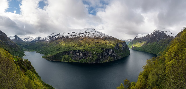
The Eagle Road (Ørnevegen) climbs up the slope from Geiranger. It is a section of Route 63 with eleven hairpin turns. The highest point lies at 620 m above sea level (as of 09/2026, Visit Geiranger).
 © DXR · CC BY-SAPhoto: DXR, CC BY-SA (https://creativecommons.org/licenses/by-sa/4.0), Wikimedia Commons
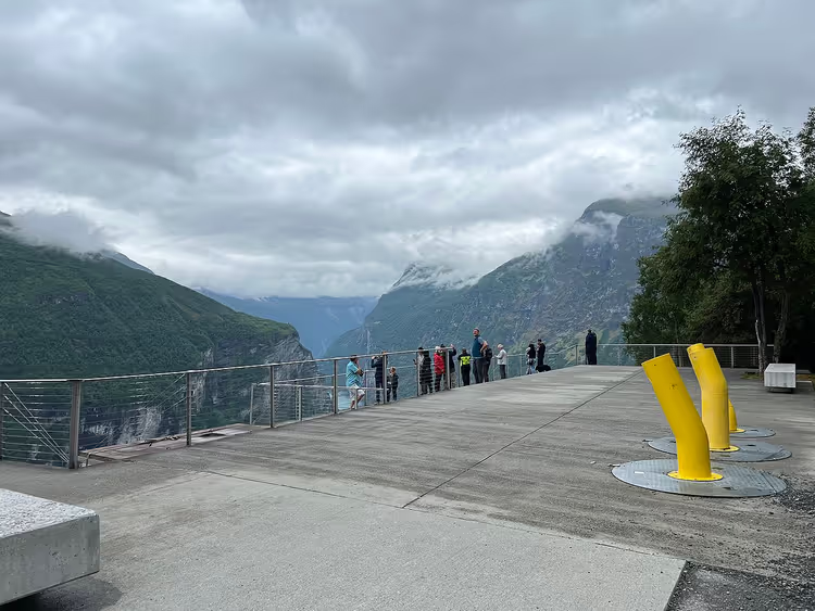
At the top turn stands the Ørnesvingen viewpoint. From there you can see the entire fjord, the village on the left, and the Seven Sisters waterfall on the right (Nasjonale turistveger). The viewpoint itself has its own small waterfall.
 © Lukas Beck · CC BYPhoto: Lukas Beck, CC BY (https://creativecommons.org/licenses/by/4.0), Wikimedia Commons
Arrive at opening time or in the evening. In the middle of the day, buses take up all the parking spaces. If you are driving, leave your car in the parking area and walk to the edge.
Troll Road: the Trollstigen hairpin road
The Trollstigen road is considered one of the most spectacular in Norway. It is part of the Geiranger-Trollstigen national tourist route (Nasjonale turistveger). Steep hairpin turns climb alongside waterfalls and rock walls.
The road's fate has changed over time. In 2024 it was closed after a series of rockfalls. It reopened in the summer of 2025 after rock stabilization work, and for the 2026 season it is open again (as of 09/2026, Fjord Norway).
Check the status before your trip. In the first weeks of the season the road is temporarily closed due to weather, and Statens vegvesen, the Norwegian road authority, provides current information.
Do not take the hairpin road in an RV unless you are confident in your brakes. It is better to walk part of the route or take a guided tour with a local driver behind the wheel.
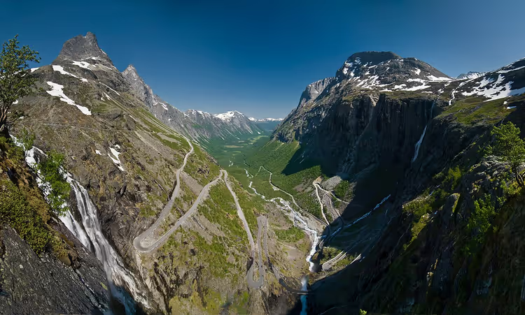 © Stefan Krause, Germany · CC BY-SAPhoto: Stefan Krause, Germany, CC BY-SA (https://creativecommons.org/licenses/by-sa/3.0), Wikimedia Commons
Ferry, boat and fjord cruise
The fjord truly opens up from the water. Fjord1 operates the ferry between Hellesylt and Geiranger (Fjord1). The crossing takes just under an hour and passes directly beneath the waterfalls.
In season, tickets are best booked in advance (according to Visit Geiranger). That way you will not be standing in line with cruise groups.
Get a spot on the open deck. It is windy under the cliffs, and you will need a warm layer even in July. Fjord tours are easy to compare in advance on GetYourGuide.
Besides the ferry, sightseeing boats and cruise ships also travel the fjord. For a romantic evening, Viking-style longship boats are available to rent: this format is chosen for marriage proposals. The only witness to your moment will be a sea eagle above the water.
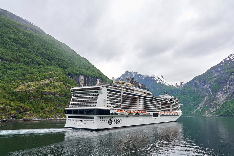 © Virtual-Pano · CC BY-SAPhoto: Virtual-Pano, CC BY-SA (https://creativecommons.org/licenses/by-sa/4.0), Wikimedia Commons
Anglers also have plenty to do here. You can cast a line in the river or from the shore near the village. Check the permit requirements locally, as rules change by season.
Tours and tickets in Geiranger
Guided tours, skip-the-line tickets and activities — most offers can be cancelled free of charge.
See offers on GetYourGuideThe widget loads once you give your consent.
⁉️🤔 Frequently asked questions
How much time do you need for Geirangerfjord?
One full day is enough for the village, a short boat trip and the climb to the viewpoints. If you also plan to do Trollstigen, allow two days: the hairpin road takes half a day, and the drive there and back takes up the rest.
When is the best time to visit Geirangerfjord?
The peak waterfall flow comes in June and July, when the snow melts. That is also when there are the most tourists. May and September offer a calmer pace, but some tours run on a reduced schedule.
How do you get to Geirangerfjord?
From Ålesund there are two routes. The first leads to the Fjord1 ferry from Hellesylt: it travels along the fjord directly beneath the waterfalls. The second goes via Eidsdal, from where the Eagle Road descends to the village with eleven hairpin turns. In winter some roads are closed, so check the status in advance.
Is the Trollstigen road open?
For the 2026 season it is open again: the road reopened after rock stabilization work. Before your trip, check the status with Statens vegvesen, because mountain weather changes plans quickly.
Can you see the Seven Sisters waterfall from the shore?
From the shore you can only see fragments: the cliffs block the streams. The Seven Sisters, the Suitor and the Bridal Veil waterfalls are fully visible only from the water. Take a ferry or boat trip and head up to the open deck.
In short: what to book
If you are going for the waterfalls, take a fjord cruise on a ferry or boat. For panoramas, plan the Eagle Road in the morning and leave Trollstigen for the second day. For a relaxed evening, a Viking-style longship boat works well.
- For the waterfalls: a fjord cruise beneath the Seven Sisters.
- For the panoramas: the Eagle Road and the Ørnesvingen viewpoint.
- For the route: the Trollstigen hairpin bends in the 2026 season.
Compare fjord tours on GetYourGuide and pick a time that fits your trip.

A small editorial team writing guides for independent travel. We travel ourselves, but we haven’t been everywhere, so we check prices, opening hours and how to get there against official sources.