




Bay of Kotor: towns, panoramas and season for a trip
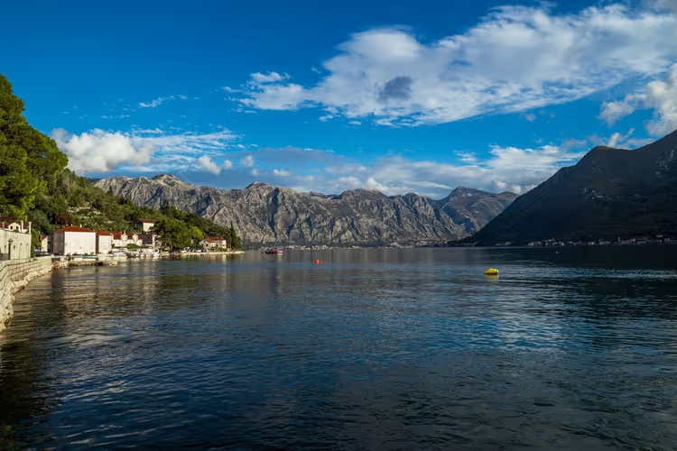
Kotor, Perast and Herceg Novi sit along the shores of a bay often called the southernmost fjord in Europe. Travelers come here for the mountains, the water between them, and the old stone towns right at the water's edge. The Bay of Kotor cuts into the mainland for several dozen kilometers and gathers towns with very different characters along its shores.
We put together a practical trip guide: what to see in Kotor and Perast, where the best panoramas open up from, when to go, and how to get there from Tivat Airport. We rely on data from the national tourism office and open sources, with no outdated prices.
Ad: this article contains affiliate links, we earn a commission if you book through them, at no extra cost to you.
Geography and shape of the bay
💡 In short:
- The Bay of Kotor lies in the southwest of Montenegro, near the border with Croatia.
- Main stops: Kotor with the Fortress of St. John, Perast with Our Lady of the Rocks island, Herceg Novi, and the Lovcen panoramas.
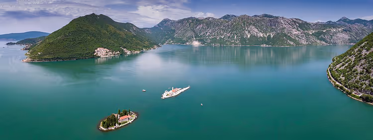
The bay consists of several basins connected by straits and feels more like a system of inland seas. The water area cuts into the mainland for roughly 30 kilometers, and at its narrowest point the width is no more than 300 meters. In places the depth exceeds 40 meters (according to the Montenegro tourism office).
 © Chensiyuan · CC BY-SAPhoto: Chensiyuan, CC BY-SA (https://creativecommons.org/licenses/by-sa/4.0), Wikimedia Commons
Cliffs and mountain ridges come almost right up to the water. That is why the bay is compared to Norwegian fjords, although scholars debate the exact term. The narrow passages shelter the water from wind, and cruise ships move calmly through the bay.
The high shores create their own microclimate. It is warmer by the water than in the mountains, and the protected coves warm up faster than the open sea. Because of the terrain, the roads around the bay are winding, and short distances on the map take more time than you expect.
History: from the Illyrians to Montenegro
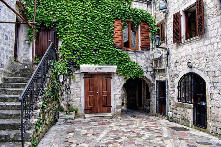
The first settlements on the shores of the bay were founded by the Illyrians. Over two millennia, Romans, Greeks, Slavs, Venetians, Ottomans and Austrians all left their mark here (according to the country's tourism organization). Each left a trace in the architecture and faith of the coastal towns.
 © Jocelyn Erskine-Kellie from London, UK · CC BY-SAPhoto: Jocelyn Erskine-Kellie from London, UK, CC BY-SA (https://creativecommons.org/licenses/by-sa/2.0), Wikimedia Commons
The bay held particular importance for Austria-Hungary. The bay served as a naval base and the southeastern frontier of the Habsburg Empire, which is why hundreds of fortifications were built in the surrounding area. You can still see some of these fortifications today on the slopes above the water.
After World War I the region became part of Yugoslavia, and after its breakup it became part of independent Montenegro. The old quarters of the towns survived all the changes of power almost unchanged, and you will notice it in the facades.
Resorts along the bay
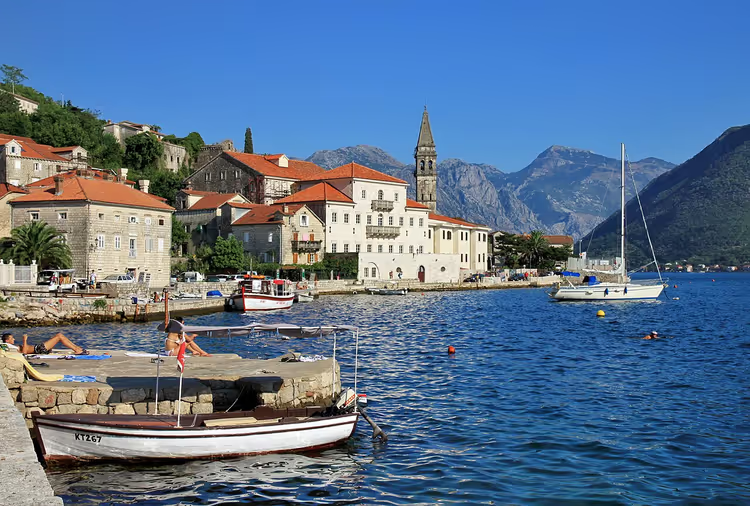
Small Montenegrin towns stand one after another along the shore of the bay. Travelers most often choose Kotor, Perast, Tivat, Herceg Novi and Risan: each has its own character and its own waterfront.
 © Marcin Konsek · CC BY-SAPhoto: Marcin Konsek, CC BY-SA (https://creativecommons.org/licenses/by-sa/4.0), Wikimedia Commons
Town | Known for | Who it's for |
|---|---|---|
Kotor | UNESCO-protected old town, fortress above it | History and walking |
Perast | Baroque palaces, Our Lady of the Rocks island | Views and boat trips |
Tivat | Airport, beaches of the Tivat side | Arrival and beach time |
Herceg Novi | Savina Monastery, stairways of the old center | Long, relaxed stays |
Risan | Quiet town at the foot of the mountains | Peace and nature |
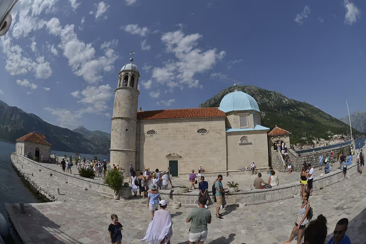
Perast is interesting for its baroque palaces and two small islands across from it. One of them, Our Lady of the Rocks, was built up on rocks by sailors' hands. Boats go there from the Perast pier, and it is one of the most recognizable spots in the bay.
Herceg Novi stretches from the sea up the slopes and is known for the stairways of its old center. Nearby is Igalo, a center of medical tourism with mud treatments and mineral water. The Tivat side has more beaches and hotels, and Tivat itself is convenient because of its proximity to the airport.
Many travelers head to the Blue Cave. The sea carved two entrances into the rock, where boats with tourists enter. You can swim in the aquamarine water of the grotto. Swim here only from a boat, as the shores near the cave are steep.
What to see in the towns of the bay
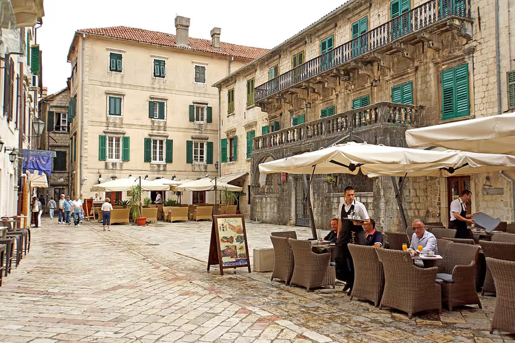
Start with Kotor: it is the main hub of the bay. The Old Town is a UNESCO World Heritage Site, and its cobbled streets are easy to explore on foot (according to the official tourist office). Over its history, the city has served as both a port and a fortress.
 © Dennis G. Jarvis · CC BY-SAPhoto: Dennis G. Jarvis, CC BY-SA (https://creativecommons.org/licenses/by-sa/2.0), Wikimedia Commons
Among Kotor's architecture, the Cathedral of Saint Tryphon stands out. It was consecrated in 1166. Its facade is supported by two bell towers connected by an arch (according to the national tourism office). Nearby are the Orthodox Church of Saint Nicholas, the small Church of Saint Luke, and a clock tower.
Above the city rises the Fortress of Saint John. From its walls you can see how the bay loops around Kotor. In the evening the fortifications are lit up, and the climb is worth it even if you are not a fan of heights.
Herceg Novi is also worth a visit: it is the second most important town on the bay. It is home to the Orthodox Savina Monastery, whose oldest buildings date back to the 11th century. Besides the monastery, you will find a Venetian bastion and a Turkish fortress above the water.
Further into the bay lies Risan, and along the shore stretch promenades with piers. Set aside one day for a walk along the water, and you will see how the coastline changes between the towns.
Viewpoints above the bay
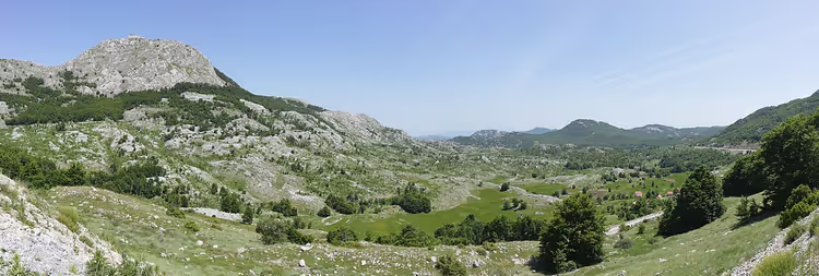
The best panoramas open up from above. Most of the viewpoints are in Lovcen National Park, at an altitude of more than 1,600 meters above sea level. A mountain road with 25 hairpin turns leads to them, and it is better not to drive it in the midday heat.
 © Ingo Mehling · CC BY-SAPhoto: Ingo Mehling, CC BY-SA (https://creativecommons.org/licenses/by-sa/4.0), Wikimedia Commons
The second popular spot is the top of the Fortress of Saint John directly above Kotor. The fortification stands at about 300 meters, and the climb up the paved trail takes over an hour (according to the guide to Kotor's walls). Bring water and set out in the morning: during the day the steps get scorching hot in the sun.
If you are driving, allow time for the road with stops. The views change at every turn, and you will want to get out at each one. Head back down before dark, because the hairpin road has no lighting.
Tours of the Bay of Kotor
The bay is easy to explore with a guide. Boat tours cover several spots in one trip: Perast, Our Lady of the Rocks island, and the Blue Cave. By speedboat, these distances go faster than along the mountain hairpin road.
 © Miomir Magdevski · CC BY-SAPhoto: Miomir Magdevski, CC BY-SA (https://creativecommons.org/licenses/by-sa/4.0), Wikimedia Commons
Walking tours of Kotor and Herceg Novi suit those who want to understand the history. A guide will point out Venetian winged lions on the facades and explain how the city endured changes of power. Programs usually cover Kotor, Perast, Herceg Novi, and Risan.
Compare offers in advance so you do not waste your time at the pier in high season. See bay tours on GetYourGuide.
Tours and tickets in Kotor
Guided tours, skip-the-line tickets and activities — most offers can be cancelled free of charge.
See offers on GetYourGuideThe widget loads once you give your consent.
Where it is and how to get there
The Bay of Kotor lies in southwestern Montenegro, near the border with Croatia. The nearest airport is in Tivat, about 10 kilometers from Kotor, and the drive from the terminal to the waterfront usually takes 15 to 20 minutes (according to the Tivat to Kotor transfer guide).
Buses run from Budva to Kotor, and the trip takes about an hour. The towns are roughly 20 kilometers apart along the coastal road, and in high season it can get congested. If you are driving, allow extra time for traffic.
The bay itself is easy to get around by boat or by the local ferry across the narrow strait. The crossing saves you the detour around the bay, runs year-round, and costs less than the extra kilometers along the hairpin road.
Where to stay and what to choose
Accommodation is easiest to choose by town. In Kotor you stay inside the Old Town or near the waterfront, and everything important is within walking distance. Tivat works well for arrivals and short trips, while Herceg Novi and Igalo are a good fit if you want a long, quiet vacation.
Prices depend on the season: in August they are higher than in May or October. Find hotels in Kotor on Trip.com.
Best time to visit
The swimming season on the coast usually runs from May to October. In summer the air warms up to +26, and the water in sheltered bays up to +25 (according to the Montenegro tourism office). The mild Mediterranean climate makes walks comfortable if you stay along the water.
The tourist peak falls in August. During this time, cities host festivals and carnivals, but lines and prices are also at their highest. If you want a quiet vacation, choose June or September.
Bay of Kotor on the map
On the map, the bay looks like a loop: two wide sections connected by a narrow strait. That makes it easier to understand why driving around the bay takes longer than crossing it.
⁉️🤔 Frequently asked questions
How many days do you need for the Bay of Kotor?
For Kotor, Perast, and one viewpoint, two full days are enough. St. John's Fortress takes a morning, and a boat tour to the island and the Blue Cave takes another half day. Add a day for Herceg Novi and Igalo if you want to relax without rushing.
When is the best time to go to the Bay of Kotor?
The swimming season runs from May to October, with the peak in August. For a quiet trip, choose June or September: the water is already warm, and there are fewer people and less heat. In winter the towns are open, but you won't be able to swim.
How do you get to the Bay of Kotor?
The fastest way is through Tivat Airport, which is about 10 kilometers from Kotor. Buses run from Budva, and the trip takes about an hour. Around the bay, it's convenient to travel by boat or on the local ferry across the narrow strait.
Can you swim in the bay?
Yes, you can swim almost everywhere, but the water in sheltered bays is calmer than in the open sea. In summer it warms up to +25. There are sandy and pebble beaches, and at the Blue Cave you can get into the water right from the boat.
Is it worth climbing St. John's Fortress?
The climb takes over an hour up steps and a paved trail, but the view of the bay makes it worthwhile. Go in the morning before it gets hot, and bring water. If it's hard for you, climb at least halfway: the panorama of the old town opens up from there too.
In short: what to book
If you have two days and a base in Kotor: the climb to St. John's Fortress plus a walk through the old town. If you want to see the bay from the water: a boat tour to Perast and the Blue Cave. If you're going for panoramas: the viewpoints of Lovćen National Park. If you're planning a longer vacation: Herceg Novi or Igalo.
For your trip, choose June or September, because August is peak season. Book accommodation in advance. Choose a bay tour on GetYourGuide.

A small editorial team writing guides for independent travel. We travel ourselves, but we haven’t been everywhere, so we check prices, opening hours and how to get there against official sources.