














 © Rich Niewiroski Jr. · CC BYPhoto: Rich Niewiroski Jr., CC BY (https://creativecommons.org/licenses/by/2.5), Wikimedia Commons
How the Golden Gate Bridge was built and how much it costs to cross
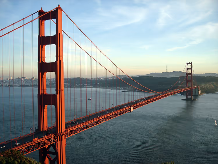
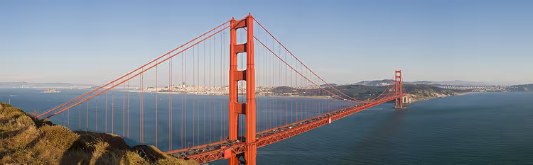
The Golden Gate Bridge spans the strait at the entrance to San Francisco Bay. It is visible from the ocean, from the city's hills, and from the air. It is one of the most recognizable structures in the world, and tourists come to see it from all over California.
Before your trip, you need three things: whether there is a toll, where to leave your car, and where the best view is. The toll for a passenger car is just over 10 dollars (as of 09/2026, official website), and pedestrians cross for free.
Ad: this article contains affiliate links, we earn a commission if you book through them, at no extra cost to you.
Golden Gate Bridge: key info for tourists
💡 In short:
- Walk or take a bike: crossing is free for them, and the sidewalks are open during the day.
- By car, you pay only in the southbound direction, toward the city, and only cashless.
- Come early in the morning or toward evening: during the day the bridge is often covered in fog, and the sidewalk gets crowded.
- Toll and visiting hours: 09/2026, verified on the official bridge website.
The bridge connects San Francisco with Marin County and carries six vehicle lanes and two sidewalks. Until 1964, its main span was the longest suspension span in the world. Today, in America, only the Verrazzano-Narrows Bridge in New York surpasses it in this measure.
The bridge's fame came not only from its scale. The orange color of the structure was chosen by architect Irving Morrow so that it would stand out against the gray fog and water. You will notice this shade from far away, even on the approach to the city.
Drivers are not handed a ticket: the bill arrives later based on the license plate number.
How the bridge was built
The idea of spanning the strait with a bridge appeared long before construction began. It had more opponents than supporters, and the project's main advocate was engineer Joseph Strauss.
 © Bogdan Oporowski · CC BY-SAPhoto: Bogdan Oporowski, CC BY-SA (https://creativecommons.org/licenses/by-sa/3.0), Wikimedia Commons
Strauss's first proposal called for a bridge on piers, and city authorities rejected it. Then Leon Moisseiff, the designer of the Manhattan Bridge in New York, was brought in. He proposed a suspension design, which became the basis.
Charles Ellis was responsible for the calculations, and Irving Morrow led the architectural design. It was Morrow who insisted on the orange paint that became the bridge's calling card.
Among the critics were the military. US Navy generals feared that the bridge would obstruct ships heading to the Pacific Ocean and would become a convenient target for sabotage. Before construction, ferries crossed the strait, and railroad companies that lost their monopoly also objected.
The main challenge was the Great Depression. To keep work going, US authorities issued bonds and partially built the bridge with that money.
The bridge took four years to build, from 1933 to 1937. Hundreds of thousands of people attended the opening on May 27, 1937. The next day, cars began crossing the bridge, and anyone can still walk on the sidewalk today.
The metal giant in numbers
The structure was designed for strong winds and constant load. The total length of the bridge with approaches is 2,737 m, the suspended section stretches for 1,966 m, and the main span between the towers is 1,280 m. The clearance above the water is 67 m, and the tower height is 227 m.
The bridge owes its strength not to massiveness but to the work of the cables. They carry the entire load and allow the span to move slightly in the wind. That is why in a storm you may notice the deck swaying slightly.
Crossing, toll, and parking
The bridge is tolled in only one direction. When you enter San Francisco from the north, you pay; in the opposite direction, crossing is free. Cash is not accepted on the bridge; payment is processed by license plate number.
Payment method for 2-axle vehicles (rates from July 1, 2026, as of 09/2026, toll rates page) | Rate |
|---|---|
FasTrak (transponder) | $10.25 |
One-time payment or license plate account | $10.50 |
Pay by invoice | $11.25 |
Trip with three or more passengers (carpool) | $8.25 |
Rent a car with toll payment already set up, otherwise the bill will arrive later with a rental company surcharge.
Pedestrians and cyclists pay nothing, and this is the easiest way to see the bridge up close. You just need to get to the south entrance and step onto the sidewalk.
Parking is available on both sides. At the south entrance it is paid and more spacious; at the north entrance there are fewer spots. On weekends, lots fill up early in the morning, so plan your arrival in advance.
What else to see nearby
The bridge itself can be photographed from dozens of spots. Three viewpoints on the north side, in the Marin Headlands, offer different views, and each is worth allowing an hour for. The fourth stop, a pavilion with exhibits, is at the south entrance.
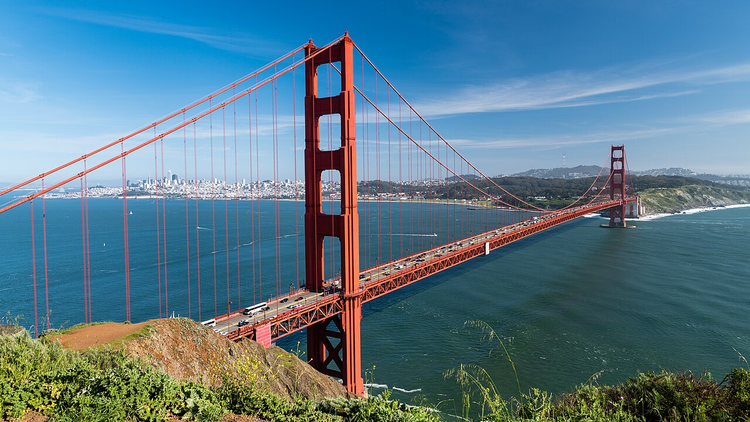
Battery Spencer with a view from above
Battery Spencer stands high above the water and is considered the best viewpoint for the bridge. The battery was built back in 1897 to defend the harbor (as of 09/2026, National Park Service). From the overlook above the cliff, you can see the span heading into the city, with fog hanging over the water.
 © Christoph Strässler · CC BY-SAPhoto: Christoph Strässler, CC BY-SA (https://creativecommons.org/licenses/by-sa/2.0), Wikimedia Commons
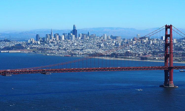
The Transamerica Pyramid angle
Through the eucalyptus grove near the north anchorage of the bridge, a popular shot is visible. The spire of the Transamerica Pyramid skyscraper rises exactly in the gap between the anchorage and the span. This composition is shot from one turn of the road in the Marin Headlands, and the best light here is early in the morning.
 © Lightandtruth · CC BY-SAPhoto: Lightandtruth, CC BY-SA (https://creativecommons.org/licenses/by-sa/4.0), Wikimedia Commons
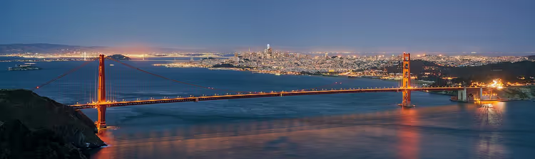
Hawk Hill and the strait panorama
From the top of Hawk Hill, a panorama opens up of the strait, Point Bonita with its lighthouse, and the Pacific Ocean. Photographers love this spot: from here the entire bridge is visible together with the city in the background. The ascent follows the winding Conzelman Road.
 © Daniel L. Lu (user:dllu) Camera location 37° 49′ 39.52″ N, 122° 29′ 56.17″ W View this and other nearby images on: OpenS · CC BY-SAPhoto: Daniel L. Lu (user:dllu) Camera location 37° 49′ 39.52″ N, 122° 29′ 56.17″ W View this and other nearby images on: OpenS, CC BY-SA (https://creativecommons.org/licenses/by-sa/4.0), Wikimedia Commons
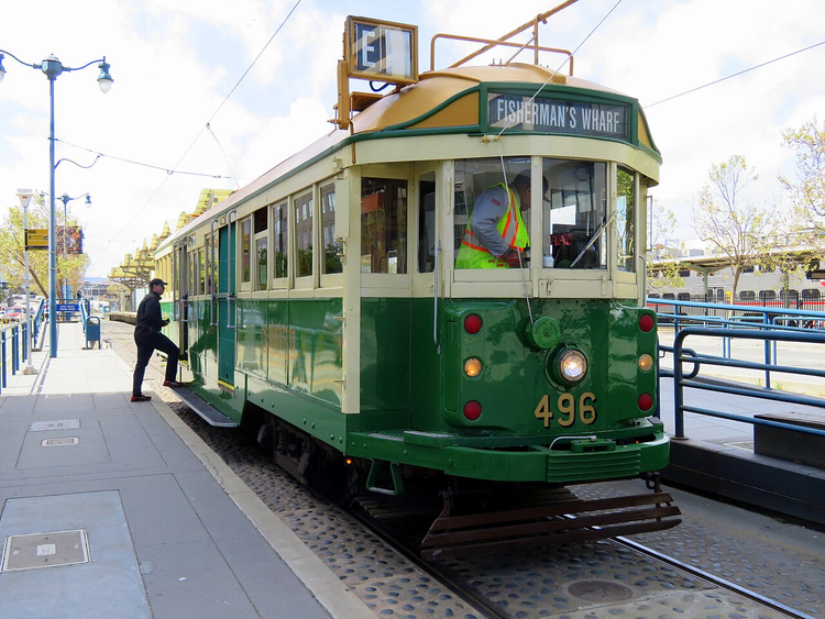
Bridge exhibit pavilion
Near the south entrance, a pavilion with engineering exhibits is open. It displays a scaled-down model of the anchorage and a section of the main cable nearly a meter thick. Inside the cable are thousands of thin wires, and they hold the entire structure.
 © Pi.1415926535 · CC BY-SAPhoto: Pi.1415926535, CC BY-SA (https://creativecommons.org/licenses/by-sa/3.0), Wikimedia Commons
Getting to the northern viewpoints without a car or bike is difficult. Public transit only goes to the south entrance, so many people rent a bike in the city and ride across the bridge to the north.
Tours and tickets in San Francisco
Guided tours, skip-the-line tickets and activities — most offers can be cancelled free of charge.
See offers on GetYourGuideThe widget loads once you give your consent.
Golden Gate Bridge on the map
Below, the bridge is marked on the map. It lies on US Route 101 between San Francisco and Marin County, so it is convenient to use as a landmark when planning your route.
⁉️🤔 Frequently asked questions
Can you walk across the bridge?
Yes, the sidewalks are free and open during the day; only drivers pay. Keep in mind that it is always windy on the bridge and usually colder than in the city, so bring a jacket with a hood. A full crossing in one direction takes about an hour.
How much does it cost to cross the bridge?
For a two-axle passenger car, it is $10.25 with FasTrak, $10.50 with one-time payment, and $11.25 by invoice (as of 09/2026, bridge website). You pay only when heading toward San Francisco; in the opposite direction, crossing is free.
When should you go to avoid the fog?
The best windows are morning before 10:00 and evening after 18:00, when the fog has either not yet risen or has already cleared. In summer the bridge is covered especially often; in autumn there are more clear days. In winter there are fewer tourists, but rain is more frequent.
Is there parking at the bridge?
Yes, there are lots on both sides; parking at the south entrance is paid. The south entrance has more spaces; the north entrance, near Battery Spencer, has only about a dozen. On weekends they fill up early in the morning, so arrive early or on a weekday.
How to get to the bridge without a car?
From downtown San Francisco, city buses go to the south entrance, and some routes stop right at the bridge. The second option is a bike: a separate path leads across the bridge. Airport transfers should be booked in advance.
In short: what to book
- If you have one day in the city: walk to the south entrance and step onto the sidewalk.
- If you are coming for photos: get there at dawn and shoot from Battery Spencer.
- If you are with children: choose the south entrance, where there is a flat area and more parking.
- If you are driving: rent a car with bridge toll payment included, otherwise the bill will arrive later with a surcharge.
Guided tours of the bridge and Marin Headlands should be booked in advance; on weekends spots run out quickly: see tours on GetYourGuide

A small editorial team writing guides for independent travel. We travel ourselves, but we haven’t been everywhere, so we check prices, opening hours and how to get there against official sources.