













Athabasca Glacier, Maligne Canyon and waterfall: route through Jasper Park
Jasper is open to visitors year-round.
The 2024 fire swept through the Athabasca River valley, and some trails, campgrounds, and roads are still being restored. Before you head out, check the official list of open sites (as of 09/2026). In 2026, visitors are allowed further than the year before.
The park covers about 11,000 km² in the Rocky Mountains of Alberta. The Athabasca Glacier and Athabasca Falls sit along the Icefields Parkway. Maligne Canyon and Medicine Lake lie along Maligne Road. Two or three days is enough to see the highlights, and the drives between them are short.
Ad: this article contains affiliate links, we earn a commission if you book through them, at no extra cost to you.
The park's main goal: protecting nature
💡 In short:
- Plan at least two days: the sights are spread across dozens of kilometers.
- Bring warm clothes: it is noticeably colder on the glacier than in the valley.
- Book your campground in advance: spots fill up fast in summer.
- Prices and hours: 09/2026, verified on the official website
It started as a forest park. The area received that status in 1907, and in 1930 Jasper gained national park status. It was named after fur trader Jasper Hawes, who lived here in the 19th century. Around 11,000 km² of mountains, glaciers, lakes, and coniferous forests are under protection.
The main goal is nature conservation. Scientists count animals and restore rare species year-round. There are zones where you travel only on foot: vehicles with exhaust emissions are banned there.
The rules are simple. Do not feed the animals, do not leave the trails, and pack out your trash. If you want to continue your route through the Rocky Mountains, check out our guide to Banff National Park. Banff is about 290 km from Jasper along the Icefields Parkway (as the map shows).
When to visit Jasper
Season | What happens | What to keep in mind |
|---|---|---|
June-August | all services operate, campgrounds are full | book your spot in advance |
September-October | fewer people, larches turn yellow | cold nights, some roads close |
November-March | skiing at Marmot Basin, northern lights | winter tires required |
April-May | snow melts, sites open one by one | trails are wet |
 © Joli Rumi · CC BY-SAPhoto: Joli Rumi, CC BY-SA (https://creativecommons.org/licenses/by-sa/4.0), Wikimedia Commons
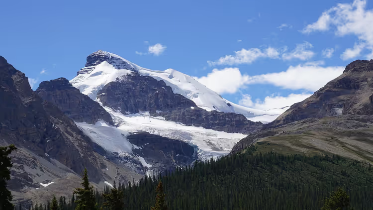
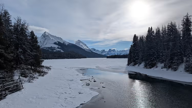
In winter, climbers train in the park: the rock faces are challenging, and snow lingers until April. In summer, those same slopes are accessible to you on foot. Bring footwear for any weather. It changes twice in a single day.
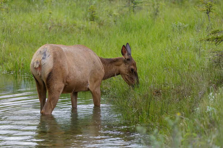
In summer, elk feed along the roads. They are not afraid of cars, so slow down. Do not get out of the car to feed them. Shooting from the window gives you good shots and keeps the animals safe.
The park looks different from the water. On the lakes you can rent a kayak, canoe, or raft. The turquoise color comes from rock flour carried down by the glaciers.
Fishing is allowed with a license: $15 per day or $51.25 per year (as of 09/2026, Parks Canada rates). Anglers catch trout from shore and from boats, but only in designated waters. Spend the morning on the water. Leave the second half of the day for the drive.
Five top sights in the park
The main points lie along the Icefields Parkway and Maligne Road. If you are short on time, pick from these five.
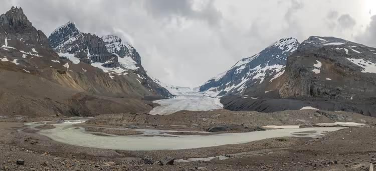
Athabasca Glacier
 © Ethan Sahagun · CC BYPhoto: Ethan Sahagun, CC BY (https://creativecommons.org/licenses/by/4.0), Wikimedia Commons
The glacier's tongue is visible from the highway, but the ice itself is far from the road. A trail leads from the parking lot to the glacier. It is one of the most accessible glaciers in the Rocky Mountains, and it has retreated noticeably over the past century. Crevasses are covered with snow, so stepping onto the ice without a guide is prohibited.
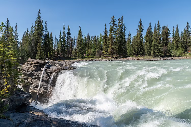
Athabasca River and Falls
The river crosses the entire park and plunges into a gorge as a 23-meter waterfall. You can hear the roar from the parking lot. A path leads to the viewpoints. Do not climb over the barriers: the rocks near the water are slippery even in dry weather.
 © Hansueli Krapf · CC BY-SAPhoto: Hansueli Krapf, CC BY-SA (https://creativecommons.org/licenses/by-sa/4.0), Wikimedia Commons
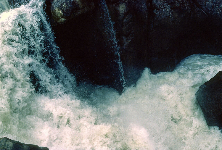
Maligne Canyon
Over millennia, the Maligne River has cut through the limestone. Where the walls narrow to two meters, the flow turns into a stream. Fossils over 300 million years old are found in the rock. A walk across the bridges above the water easily fits into half a day.
 © David Wipf · CC BYPhoto: David Wipf, CC BY (https://creativecommons.org/licenses/by/2.0), Wikimedia Commons
Maligne Road was reopened after the 2024 fire on October 11, 2024 (as of 09/2026, Parks Canada closures page). Some points along it open later. Check the status before you head out.
Medicine Lake
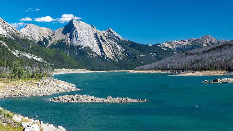
The lake looks ordinary, but by fall the water disappears. It drains underground through subterranean channels. The level drops so much that you can see the bottom right from the shore. There is trout in the lake, and you can fish without a boat.
 © Christoph Strässler from Oberdorf BL, Schweiz · CC BY-SAPhoto: Christoph Strässler from Oberdorf BL, Schweiz, CC BY-SA (https://creativecommons.org/licenses/by-sa/4.0), Wikimedia Commons
Rock paintings and ancient campsites
The park has preserved sites with rock paintings and traces of ancient campsites. Before Europeans arrived, Indigenous peoples lived in the Athabasca Valley. They hunted here and buried their ancestors. These sites are not to be touched by hand, and stones are not to be moved.
Jasper flora and fauna
 © Thomas Fuhrmann · CC BY-SAPhoto: Thomas Fuhrmann, CC BY-SA (https://creativecommons.org/licenses/by-sa/4.0), Wikimedia Commons
The park is home to elk, grizzly bears, and Canada lynx. Grizzlies and lynx avoid people. Photograph them from a safe distance with good optics. If an animal changes its behavior because of you, you are standing too close.
Flying squirrels glide between trees. Red squirrels also live in the park. There are about 200 bird species here, and in the morning you hear them right from your tent. The forest is mostly coniferous: fir, larch, spruce, and juniper.
Douglas fir also grows in the park. Trails in the forest get washed out by rain, so stay on the marked route.
Tickets and hours
Park entry is counted by day. Starting September 8, 2026, regular rates apply again, and the free Canada Strong Pass program ended on September 7 (as of 09/2026, Jasper National Park price list).
Who | Price per day |
|---|---|
Adult (18-64) | $12.25 |
Senior (65 and older) | $10.75 |
Youth under 17 | free |
Family or group in one vehicle | $24.50 |
Discovery Pass annual, adult | $83.50 |
The annual Discovery Pass works in all national parks in Canada, so it pays off on a long trip across the country. Camping starts at $19.50 per site without a fire pit, the option with electricity starts at $40.00, and a ready oTENTik is $147.50 (as of 09/2026, same source).
Some areas remain closed after the 2024 fire. The list is updated on the Parks Canada page. Check it the day before you leave: the status changes throughout the season.
Tours and tickets in Jasper
Guided tours, skip-the-line tickets and activities — most offers can be cancelled free of charge.
See offers on GetYourGuideThe widget loads once you give your consent.
How to get to Jasper
 © Ethan Sahagun · CC BYPhoto: Ethan Sahagun, CC BY (https://creativecommons.org/licenses/by/4.0), Wikimedia Commons
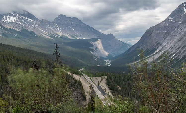
The drive to the park takes almost a full day. The views along the way are worth the time.
From Calgary you take Highway 93, the Icefields Parkway: about 410 km (on the map). Along the way there are viewpoints, Athabasca Falls, and the glacier. From Edmonton, Highway 16 (Yellowhead) leads there, about 360 km (on the map). It is convenient to pick up a car at the Calgary airport.
Car rental on DiscoverCars helps you compare rental options in advance.
It is also doable without a car. The VIA Rail train stops in the town of Jasper, with trains running from Edmonton and Vancouver. The station sits in the Athabasca River valley, with gas stations, cafes, and hotels nearby.
Jasper National Park on the map
The map shows how the town, Athabasca Glacier, the falls, and Maligne Canyon are connected.
Jasper National Park
Places on the map
- Jasper The park's base town, VIA Rail station, hotels and cafés
- Athabasca Glacier One of the most accessible glaciers in the Rockies, its toe reaches the highway
- Athabasca Falls A 23-metre waterfall, viewpoints by the parking lot
- Maligne Canyon Limestone canyon with bridges over the water, 300-million-year-old fossils
- Medicine Lake A lake with underground drainage, water level drops sharply by autumn
Cell service in the park is not available everywhere, so save the map in advance. If you want to continue your route through Canada, check out Château Frontenac in Quebec City and Thousand Islands National Park.
⁉️🤔 Frequently asked questions
How much does it cost to enter Jasper?
An adult day pass costs $12.25, seniors pay $10.75, and visitors under 17 get in free (as of 09/2026, national parks fee schedule). A family or group in one vehicle pays $24.50 per day. An annual Discovery Pass is worth it if you're visiting several parks across the country.
How many days do you need for the park?
Plan for at least two days. You can cover the town of Jasper, Athabasca Falls, and Maligne Canyon on the first day. On the second and third days, add the Athabasca Glacier, Medicine Lake, and the viewpoints along the Icefields Parkway. The route is easy to build without long backtracking.
What's closed after the 2024 fire?
The fire swept through the Athabasca Valley, and recovery is ongoing. Some trails and campgrounds are closed, while other areas reopened in 2025 and 2026 (as of 09/2026, Parks Canada page). Maligne Road was back in service on October 11, 2024. Check the official list of open sites before you head out.
Can you see a bear or a deer?
Elk stand by the roadside in summer, while grizzly bears and lynx keep away from roads. Take photos from a safe distance, don't feed the animals, and don't get out of your car to approach them. If an animal changes its behavior, you're too close. Back off and give it space.
How do you get to the park without a car?
The VIA Rail train stops in the town of Jasper. The station sits in the Athabasca River valley, close to hotels and cafes. Trains run from Edmonton and Vancouver. Getting around inside the park without a car is difficult, so plan your days around the town.
In short: what's worth booking
If you have one day: the town of Jasper, Athabasca Falls, and Maligne Canyon.
If you have two or three days: add the Athabasca Glacier, Medicine Lake, and the drive along the Icefields Parkway.
If you're going in winter: check road conditions and use winter tires.
Lodging in the town of Jasper gets booked up fast, so it's best to reserve your place in advance on Trip.com. It's also cheaper to book a car before you fly: compare rentals on DiscoverCars. Start with your pass and your first day in town, so you can explore the rest of the park at a relaxed pace.

A small editorial team writing guides for independent travel. We travel ourselves, but we haven’t been everywhere, so we check prices, opening hours and how to get there against official sources.