
















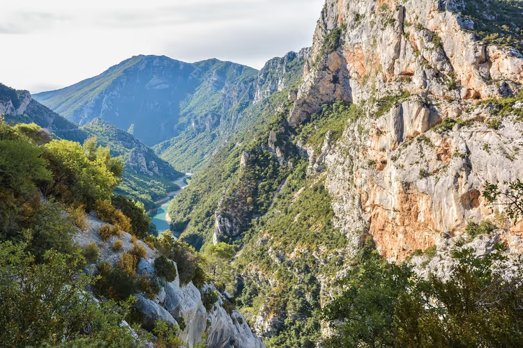
Verdon Gorge: canyon route, trails and Lake Sainte-Croix
The Verdon Gorge lies on the border of Var and Alpes-de-Haute-Provence, about two hours by car from Nice airport (on the map). It is one of the deepest canyons in Europe: 25 km long and up to 700 meters deep (Wikipedia, Gorges du Verdon).
The challenge is not finding the place, but the logistics. Viewpoints, trails, and boat docks are scattered along both rims, with dozens of kilometers of switchbacks between them. In one day you will see the canyon from the road. In two, you will have time to get down to the water and hike a couple of sections.
Below we have put together the practical side: where the gorge is, how it formed, how to drive the cliff roads, where to hike, and where to rent a boat. Plus Lake Sainte-Croix and the lavender on the Valensole plateau, which are almost always added to the route.
Ad: this article contains affiliate links, we earn a commission if you book through them, at no extra cost to you.
Where the Verdon Gorge is located
💡 In short:
- The canyon runs between the Carajuan narrows and Lake Sainte-Croix (Wikipedia article about the canyon).
- By car, allow a full day for the roads along both rims and the descent to Pont du Galetas.
- Access, roads, and junctions: 09/2026, according to the Verdon tourist office.
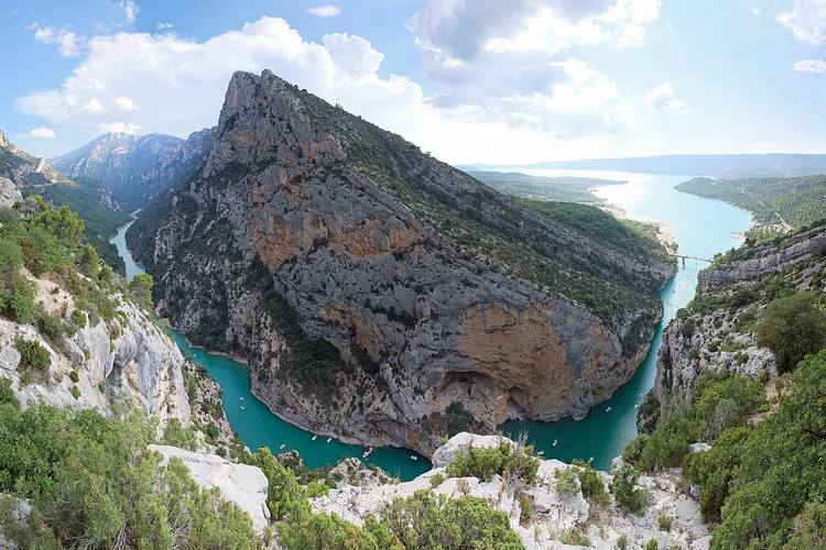
The Verdon River starts at the Col d'Allos in the Alps and runs 166 km before flowing into the Durance (Wikipedia data on the canyon). The canyon occupies the middle section of the river: from the Carajuan narrows to the Pont du Galetas bridge, where the Verdon empties into Lake Sainte-Croix. The rims are sometimes 200 meters apart, sometimes a kilometer and a half.
 © kallerna · CC BY-SAPhoto: kallerna, CC BY-SA (https://creativecommons.org/licenses/by-sa/4.0), Wikimedia Commons
The gorge cuts across two departments. The south rim belongs to Var, the north rim to Alpes-de-Haute-Provence. The river level drops from 630 meters at the start of the canyon to 510 meters at the lake, while the depth varies from 250 to 700 meters (gorge description on Wikipedia).
The two most convenient places to stay are as follows. La Palud-sur-Verdon sits on the north rim, close to the Route des Crêtes viewpoints. Moustiers-Sainte-Marie works as a base near the lake: from the village to Pont du Galetas is about 10 km on the map. On the south shore, Aiguines is another option.
Both options require a car. Buses along the canyon are rare, so you will depend on tours and transfers (Verdon tourist office section).
How the Verdon Canyon formed
The rocks began forming about 200-250 million years ago. At that time, Provence lay at the bottom of a warm, shallow sea, and layers of limestone were deposited from the shells of marine organisms (canyon geology on Wikipedia). Later the Alps rose, and the river began cutting through this mass.
Water finished the job. The Verdon washed away the limestone over millennia, creating grottoes and caves in the walls. Two places are worth knowing by name. Imbut, where the river disappears under a pile of rocks. And Styx, a mini-canyon within the canyon.
The first full expedition was led by Édouard-Alfred Martel in 1905. He also introduced the word "canyon" in reference to the Verdon, and the most famous hiking route, Sentier Martel, was named after him (Martel trail on Wikipedia).
 © qwesy qwesy · CC BYPhoto: qwesy qwesy, CC BY (https://creativecommons.org/licenses/by/3.0), Wikimedia Commons
Why you should come here by car
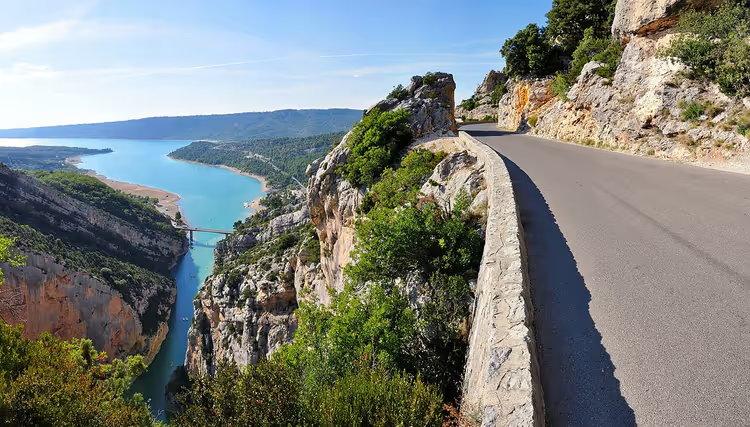
The roads along both rims let you see the canyon for free. The D952 runs along the north side, the D71 and Corniche Sublime along the south, with parking areas and guardrails at the viewpoints (corniche routes on Wikipedia).
The main route for drivers is called Route des Crêtes. It's a loop around La Palud-sur-Verdon: it climbs onto the plateau, passes a series of lookout points, and returns to the village. Allow half a day. You'll be stopping at every panorama.
 © Tobi 87 · CC BY-SAPhoto: Tobi 87, CC BY-SA (https://creativecommons.org/licenses/by-sa/3.0), Wikimedia Commons
Two spots are worth noting in advance. Belvédère du Tilleul gives you a view of the entire Verdon meander, and Point Sublime hangs over the village of Rougon. Another stop along the way is the lookout at Pont du Galetas: from there you can see the turquoise river flowing into the lake.
The catch with a car is just one thing: narrow switchbacks, in places without guardrails, and the driver is tempted to look down rather than at the road. You need mountain driving experience behind the wheel.
Hiking trails, climbing, and water
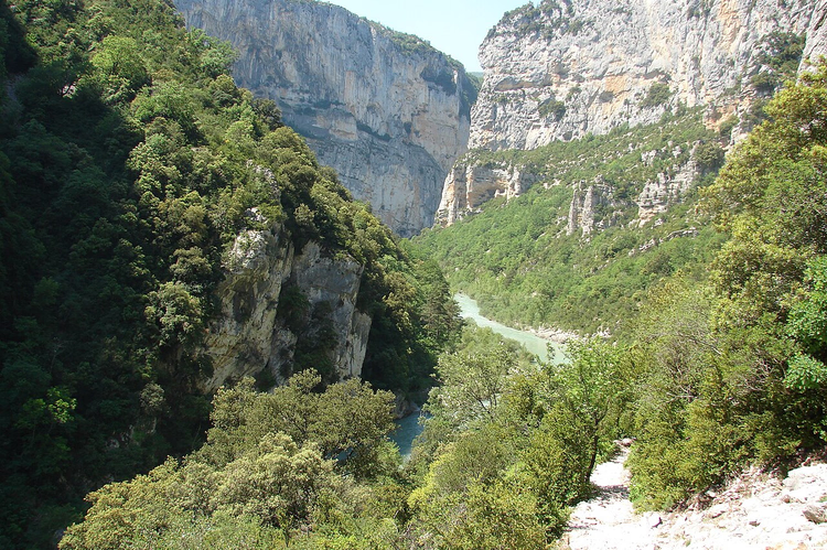
On foot, the gorge opens up differently. Dozens of trails run along the riverbanks, enter natural caves, and climb to the rim summits. A day hike takes up to 5-6 hours, and you'll need water, shoes with good tread, and a headlamp (trails and routes from the tourist office).
The most famous route is called Sentier Blanc-Martel. It follows the river for a full day, with tunnels and ladders in the cliffs. The trail was built by the Touring club de France around 1928-1930 (hiking trails on Wikipedia), and today it's hiked from Chalet de la Maline to Point Sublime.
For climbers, the canyon has long been a classic. Walls up to 700 meters high are equipped with multi-pitch routes, and sectors exist on both rims (climbing in the gorge on Wikipedia).
On the water, the options are broader. At Pont du Galetas, you'll find rentals for canoes, kayaks, and boats with electric motors. You go up from the lake to the entrance of the gorge as far as the yellow buoys; beyond that, the way is closed to private boats (Verdon Canoë rental). Only experienced groups with a licensed guide travel the full length of the canyon.
 © avu-edm · CC BYPhoto: avu-edm, CC BY (https://creativecommons.org/licenses/by/3.0), Wikimedia Commons
Ideas for tours, canyoning, and rafting are easy to gather in advance: tours and rentals on GetYourGuide.
Tours and tickets
Guided tours, skip-the-line tickets and activities — most offers can be cancelled free of charge.
See offers on GetYourGuideThe widget loads once you give your consent.
Fossils, lavender, and Lake Sainte-Croix
The cliffs are cut at an angle in places, and shells of ancient mollusks are found in the limestone fragments. This entire area is part of the Haute-Provence geological reserve, where fossils lie almost underfoot (the reserve on the tourist office website).
 © Carsten Steger · CC BY-SAPhoto: Carsten Steger, CC BY-SA (https://creativecommons.org/licenses/by-sa/4.0), Wikimedia Commons
On the other side of the canyon begins the Valensole plateau, the main lavender region of Provence (Wikipedia, Lac de Sainte-Croix). Lavender blooms roughly from late June to mid-July, with exact timing depending on the year. The fields are private, so you should stick to roads and cultivated edges.
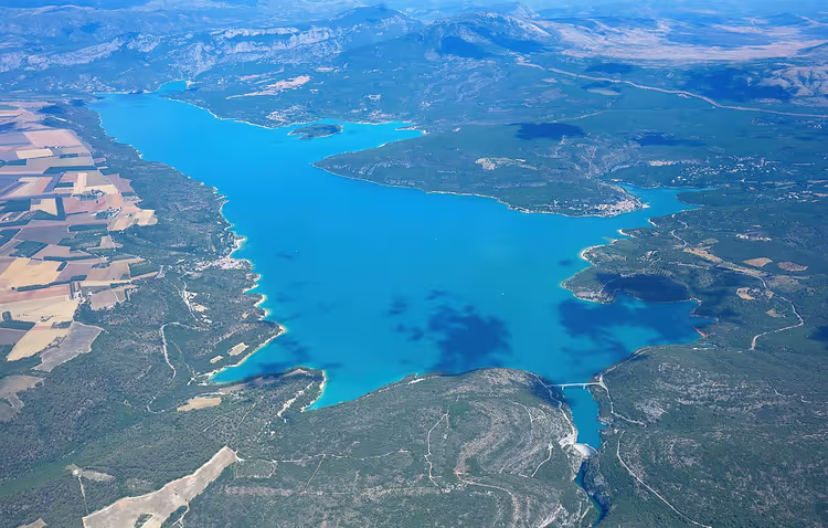
Lake Sainte-Croix appeared in 1973, when a dam was built on the Verdon (Wikipedia, Barrage de Sainte-Croix). The reservoir covers about 22 km² and remains one of the largest artificial bodies of water in France. The old town of Salles-sur-Verdon went underwater, and the village was rebuilt above the new shoreline (the flooded village on Wikipedia).
People swim here, rent boats, and camp in campgrounds by the water (campgrounds near the gorge on the tourist office website). In summer the water is turquoise from the limestone sediment carried by the Verdon.
There is no need to linger at the lake. Rent a boat for an hour or two, go along the canyon entrance, and come back. Limestone walls rise above you, and silence hangs over the water.
Verdon Gorge on the map
The canyon runs east to west between the Carajuan pass and Lake Sainte-Croix. The map below shows where the roads run along the rims and where the villages of La Palud-sur-Verdon, Moustiers-Sainte-Marie, and Aiguines are located. Open it in full size if you are planning a driving route: you will see the switchbacks and junctions in advance.
⁉️🤔 Frequently asked questions
How many days do you need for the Verdon Gorge?
One day is enough to see it from the road: Route des Crêtes, Point Sublime, and a couple of viewpoints. A second day is worth adding for the descent to the water and Lake Sainte-Croix. The hiking route through the canyon takes a full day, and you won't complete it without staying nearby overnight.
When is the best time to visit?
Late spring and September are ideal: mild weather and uncrowded viewpoints. July and August bring heat and heavy traffic on the winding roads. For lavender, choose late June or early July, and swimming in the lake is more comfortable from June through September.
Can you kayak through the canyon?
Independent paddling is only possible at the entrance to the gorge. You rent a boat at Pont du Galetas and can only go as far as the buoys. The full canyon is traversed by experienced groups with a licensed guide, most often as part of a rafting trip.
Is there an entrance fee for the gorge?
There is no separate entrance fee: the canyon and viewpoints are open around the clock. What you pay for are services, meaning boat or kayak rental, rafting, canyoning, and guided tours. Verdon Regional Nature Park asks visitors to stay on marked trails.
Where should you stay near the gorge?
La Palud-sur-Verdon is closest to the viewpoints. Moustiers-Sainte-Marie and Aiguines sit by the lake. A hotel in the village is convenient for evening panoramas, a campsite near Sainte-Croix costs less, and available nights in summer run out quickly.
How to get there without a car?
From Nice, the Chemins de fer de Provence train runs to Digne-les-Bains. From the station you still need a taxi or a transfer to reach the canyon. Buses along the gorge are almost nonexistent, so many people take a day tour from Nice or book a transfer from Nice Airport.
In short: what to book
If you have one day, get a car and see the canyon from Route des Crêtes. If you have two or three days, add the descent to Lake Sainte-Croix and the village of Moustiers-Sainte-Marie. If you're traveling in July or August, look for accommodation early: the villages have limited options.
It's easiest to rent a car in Nice (see car rental options) and stay in La Palud-sur-Verdon or Moustiers-Sainte-Marie (find a hotel near the gorge). Plan your route in advance so you can fit in both the viewpoints and the water.

A small editorial team writing guides for independent travel. We travel ourselves, but we haven’t been everywhere, so we check prices, opening hours and how to get there against official sources.