
















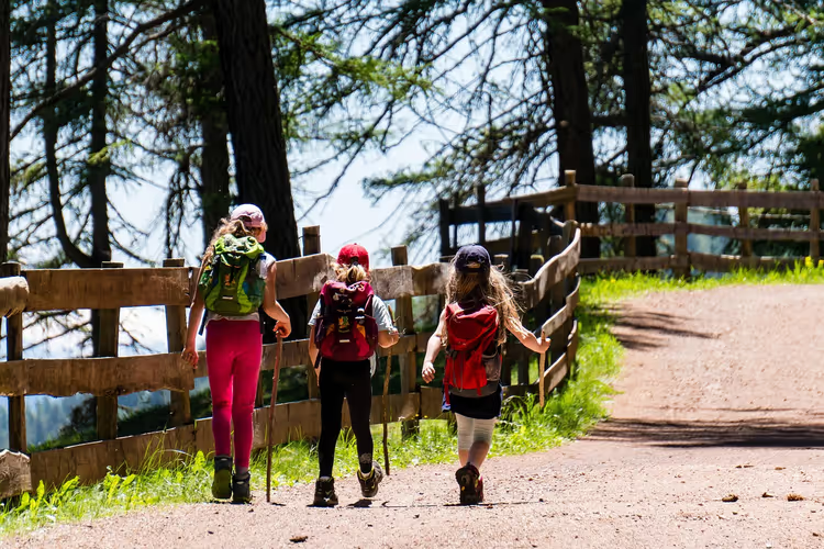
Hiking in Portugal: 5 routes from Douro to the Atlantic
Portugal is marked for hiking better than most European countries. The color of the lines on posts shows the direction and type of trail. Yellow and red markings indicate short PR routes. White and red markings indicate long GR routes.
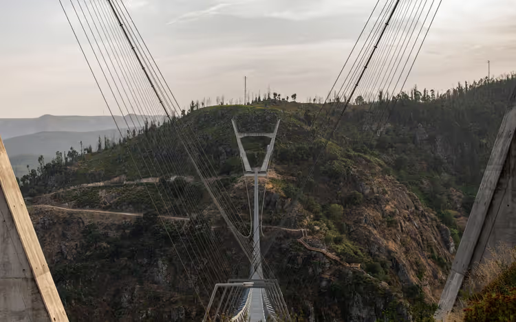
The 516 Arouca Bridge is 516 meters long and hangs 175 meters above the Paiva River (as of 09/2026, 516 Arouca bridge website). Nearby, 8 kilometers of wooden walkways stretch out, and they are worth walking at least once.
Below are five routes: from the Douro vineyards to the Atlantic cliffs. For each, I give the length, difficulty, and how to get there. I will also show where to get ready-made tracks and how to buy tickets in advance.
Ad: this article contains affiliate links, we earn a commission if you book through them, at no extra cost to you.
Where to find hiking tracks
💡 In short:
- Get ready-made tracks from Wikiloc, AllTrails, and Komoot, and save maps for offline use.
- Download the track at home and bring a power bank: in the mountains, signal drops out, and navigation drains your phone quickly.
Portugal has a huge number of marked trails, and without an app it is easy to get lost on them. Here are the services locals use.
- AllTrails (all routes) shows length, elevation gain, and reviews for each trail. Filters help you pick a walk for a couple of hours or a full day.
- Komoot (planner) builds a route from your starting point. You set the length and difficulty, and the service suggests options.
- Portugal Trails (website) was created by the country's tourism board. Hiking and cycling routes are collected here by region.
- Natural.PT (nature reserves) describes protected areas: trails, infrastructure, and local traditions.
- Wikiloc holds a huge database of track recordings from around the world. Find the route you need on the map and download the file for your navigator.
 © Kolforn · CC BYPhoto: Kolforn, CC BY (https://creativecommons.org/licenses/by/3.0), Wikimedia Commons
Offline maps come in handy in the mountains, where signal drops out. Download the track at home and bring a power bank: navigation drains your phone quickly.
Additional maps are published by municipal websites. At the entrance to a natural park, there is usually a board with a map and route numbers.
1. Paiva walkways and the 516 Arouca bridge
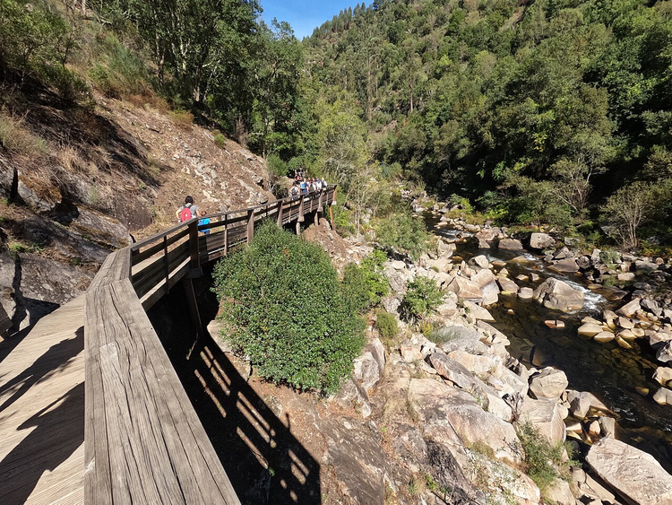 © Joseolgon · CC BY-SAPhoto: Joseolgon, CC BY-SA (https://creativecommons.org/licenses/by-sa/4.0), Wikimedia Commons
Passadiços do Paiva stretches for 8 kilometers along the left bank of the Paiva River, between the villages of Areinho and Espiunca (as of 09/2026, official website). The walkways run right above the water and in places rise several meters high.
The 516 Arouca bridge hangs over the gorge, the longest pedestrian suspension bridge in the country (as of 09/2026, official 516 Arouca website). The metal deck sways underfoot, while the river rushes below and waterfalls cascade down.
Important: the ticket costs €12 and gives access to both the bridge and the Paiva Walkways (as of 09/2026, ticket page). It is sold online only, there are no ticket offices on site. Buy in advance, because weekend slots sell out.
The trail is linear. From Espiunca back to the start in Areinho, you can take a taxi or walk the same distance back. Paiva Walkways tours on GetYourGuide solve the logistics issue.
2. The port wine trail in the Douro Valley
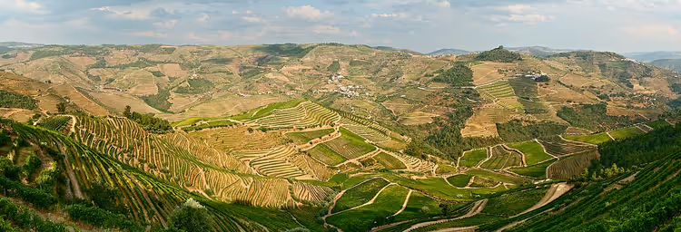 © François Philipp from Darmstadt, Germany · CC BYPhoto: François Philipp from Darmstadt, Germany, CC BY (https://creativecommons.org/licenses/by/2.0), Wikimedia Commons
The Douro River valley with its vineyard terraces offers one of Portugal's most recognizable landscapes. The marked "Port wine Trail" (PR2 Trilho do Vinho do Porto) runs through here.
The loop route starts and ends in the village of Samodães near Lamego. It is about 8 kilometers long, with roughly one kilometer running right along the Douro riverbank (according to Komoot, 09/2026).
The descent starts right from the church, and the climb awaits you at the end of the route. Bring water and do not plan the walk at midday: the open terraces get hot.
If you want to stay overnight near the vineyards, hotels in the Douro Valley on Trip.com work well as a base for a couple of days.
3. The schist villages of Lousã
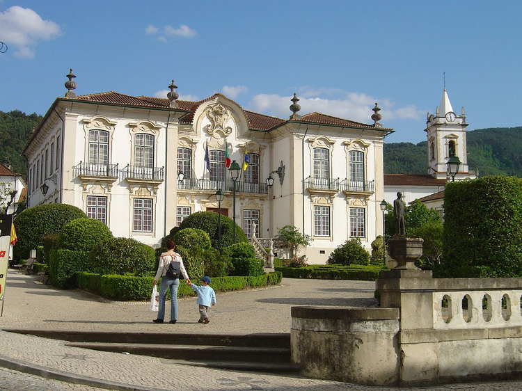 © Vitor Oliveira from Torres Vedras, PORTUGAL · CC BYPhoto: Vitor Oliveira from Torres Vedras, PORTUGAL, CC BY (https://creativecommons.org/licenses/by/2.0), Wikimedia Commons
The Lousã mountain range is covered with dense forests, and schist villages hide among the trees. Locals call them Aldeias do Xisto.
Around 50 hiking and 10 cycling routes run through the Lousã mountains, plus there are trails for climbing and canoeing (as of 09/2026, Aldeias do Xisto).
Walk between the villages of Comareira, Aigra Nova, Aigra Velha, and Pena. The houses are built from schist, the streets are cobbled, and signposts will lead you to the right trails. There are almost no cafes here, but you can rent a house and enjoy the quiet.
4. The hobbit road on Açor Mountain
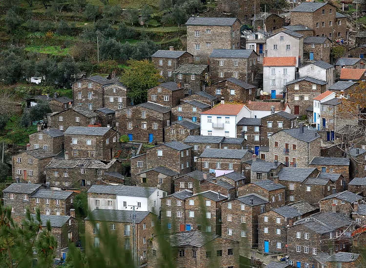 © Rui Daniel Ferreira · CC BY-SAPhoto: Rui Daniel Ferreira, CC BY-SA (https://creativecommons.org/licenses/by-sa/3.0), Wikimedia Commons
The Hobbit Road trail starts in the village of Piódão on Mount Açor. The slate village itself deserves a separate hour: cobbled streets, stone houses, and a river pool.
The forest path leads to Foz d'Égua beach by the river. The length is about 6 kilometers (according to AllTrails, 09/2026). At the water, climb the steps to the suspension bridge and then to the slate shrine.
The trail is a loop, so you don't need to return the same way. With exploring the village, the walk takes longer than the map shows, so plan your energy accordingly.
5. Porto Covo coves on the Atlantic
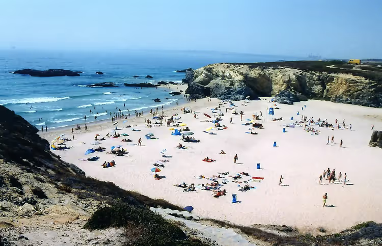 © Filipe Rocha,user:sacavem (pt) http://pt.wikipedia.org/wiki/Usu%C3%A1rio:Sacavem · CC BY-SAPhoto: Filipe Rocha,user:sacavem (pt) http://pt.wikipedia.org/wiki/Usu%C3%A1rio:Sacavem, CC BY-SA (https://creativecommons.org/licenses/by-sa/2.5), Wikimedia Commons
After the mountains, you'll want to head down to the ocean, and the southwest of the country is perfect for that. The coves near the town of Porto Covo are part of the Rota Vicentina network.
The coastal Fishermen's Trail stretches 226.5 kilometers from Porto Covo to Lagos, and its individual sections range from 7 to 20 kilometers (as of 09/2026, official Rota Vicentina website). The entire route is divided into 13 day stages.
Wear trekking boots: the trail runs over rocks, and flip-flops are dangerous here. Bring a windbreaker, because it's often windy on the cliffs.
A transfer to Porto Covo will help if you're traveling without a car.
Tours and tickets in Portugal
Guided tours, skip-the-line tickets and activities — most offers can be cancelled free of charge.
See offers on GetYourGuideThe widget loads once you give your consent.
⁉️🤔 Frequently asked questions
Do I need a car for these routes?
For most starting points, public transport isn't suitable. The 516 Arouca bridge and Paiva Walkways boardwalks are easiest to reach from Porto by car or as part of a tour. Renting a car gives you flexibility, since you can see several trails in a day.
How much does the 516 Arouca bridge cost?
The ticket costs €12 and includes the walk across both the bridge and the Paiva Walkways boardwalks (as of 09/2026, schedule and tickets).
When is the best time to go hiking in Portugal?
Spring and autumn are the most comfortable: from April to June and from September to October. In summer, the south is hot from early morning, while the north gets rain. In winter, the coast often sees rain, but the trails are almost empty.
Can I do these trails with children?
The Paiva Walkways boardwalks and the Hobbit Road are suitable for school-age children. The distances are short, but the trails run over rocks and steps. Bring comfortable shoes and extra water. The 516 Arouca bridge may scare children because of the height.
Where can I download trail maps for offline use?
In AllTrails, Komoot, and Wikiloc, maps can be saved to your phone and work without internet. Download the trail at home and check that the app opens it offline.
In short: what to book
Hiking in Portugal is easy to organize by region: the north with the 516 Arouca bridge, the Douro Valley, and the Alentejo coast. Getting between them by car is easy.
- If you're short on time: go for the Paiva Walkways boardwalks and the suspension bridge.
- If you love wine and views: choose the Port Wine Trail in the Douro Valley.
- If you want the ocean: plan a section of the Fishermen's Trail near Porto Covo.
Book accommodation and tickets in advance: in high season, bridge slots and coastal hotels sell out quickly.

A small editorial team writing guides for independent travel. We travel ourselves, but we haven’t been everywhere, so we check prices, opening hours and how to get there against official sources.