
















Lake Powell: how much entry costs and when to go
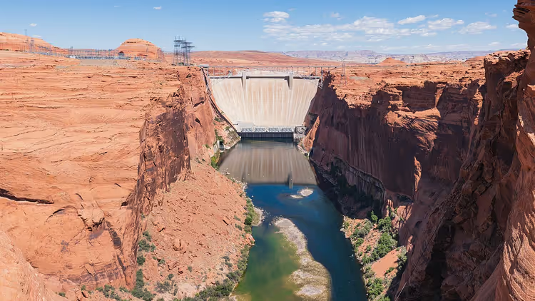
Lake Powell was created by people. Glen Canyon Dam blocked the Colorado River in 1966, and the water gradually flooded the canyons (as of 09/2026, Glen Canyon Dam).
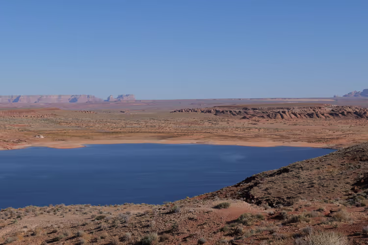
Today it is the second-largest reservoir in the United States: turquoise water, red rocks, and almost no buildings on the shore.
If you want fewer crowds and mild weather, plan your visit for spring or fall.
Ad: this article contains affiliate links, we earn a commission if you book through them, at no extra cost to you.
Lake Powell: the second-largest reservoir in the US
💡 In short:
- The lake lies on the border of Arizona and Utah; the nearest town is Page.
- The park is open 24 hours a day, and entry is paid.
- The best season to visit: spring and fall.
- Prices and hours of operation: 09/2026, verified on the prices and rules page.
History of Glen Canyon Dam
Builders worked on the river for ten years: the dam was started in 1956, and the last concrete was placed in 1966 (as of 09/2026, construction timeline). The structure, 710 feet tall, or about 216 meters, holds back water in a narrow canyon.
 © Christian David · CC BY-SAPhoto: Christian David, CC BY-SA (https://creativecommons.org/licenses/by-sa/4.0), Wikimedia Commons
The lake was named after John Wesley Powell. In 1869 he traveled down the Colorado River through the Grand Canyon and mapped the river's course (as of 09/2026, Glen Canyon park page). Powell's expedition was considered one of the riskiest of the 19th century.
Military engineer Joseph Ives traveled a similar route ten years before him, and wrote in his diary that this river would forever remain untouched and unfit for people.
The dam changed the entire region. It supplies water and electricity to Arizona, Utah, Colorado, and New Mexico (as of 09/2026, Colorado River project). Some cliff dwellings and rare plants were submerged, and striped bass appeared in the lake, bred specifically for fishing.
Lake Powell in numbers
Keep the reservoir's key figures in front of you so your plans match the water level.
Parameter | Value |
|---|---|
Reservoir length | 186 miles, about 300 km |
Surface area | 161,390 acres |
Full capacity | 25.16 million acre-feet |
Dam height | 710 feet, about 216 m |
Hydropower capacity | 8 generators, about 1.02 GW |
As of 09/2026: article about the dam.
The water rose over the years, so the shoreline changed within a single generation. Today the lake level is not constant: from late April it rises and stays high until early July, then usually drops by fall. This determines where you can boat and where you can dock.
 © W. Bulach · CC BY-SAPhoto: W. Bulach, CC BY-SA (https://creativecommons.org/licenses/by-sa/4.0), Wikimedia Commons
Four rivers feed the lake: the Colorado, the San Juan, the Dirty Devil, and the Escalante. The shoreline is so deeply indented that bays and narrow channels extend for miles from the main channel, which is why the lake looks like a tree with branches on a map.
The canyon walls are made of Navajo sandstone (as of 09/2026, dam data). The rock absorbs water easily and crumbles, so the banks slowly change shape, and the depth near the dam reaches 176 meters.
The dam supplies power to the entire southwestern part of the country. The hydroelectric plant has eight generators with a total capacity of about 1.02 gigawatts (as of 09/2026, hydroelectric plant data). Farms and cities in four states receive this electricity.
The controversy around the project has not ended to this day: construction changed the balance of the Colorado River. At the same time, the dam gave the region new roads, water, and jobs.
The protected area covers more than 1.25 million acres (as of 09/2026, park description). Water occupies only a small part of this land; the rest consists of desert plateaus and canyons.
What to see on the lake and nearby
The main impressions here are tied to the water: the silence, the red arches, and the proximity of national parks keep bringing people back.
 © Thomas Wolf , www.foto-tw.de · CC BY-SAPhoto: Thomas Wolf , www.foto-tw.de, CC BY-SA (https://creativecommons.org/licenses/by-sa/3.0), Wikimedia Commons
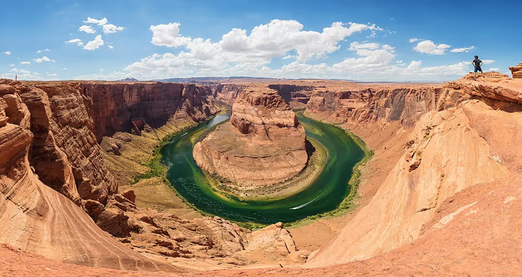
The first thing worth seeing is Horseshoe Bend. The Colorado River makes a turn of almost 270 degrees here, and the cliff under your feet drops 1,000 feet (as of 09/2026, US National Park Service). The overlook is near the town of Page, and you can walk to it from the parking lot.
The second symbol of the park is Rainbow Bridge. The national monument is managed by Glen Canyon National Recreation Area. You usually reach the arch by water, but you can also hike there on trails across Navajo lands with a permit (as of 09/2026, national monument). For the Navajo, this is a sacred place, so keep quiet and do not leave trash. Overnight stays at the arch are prohibited (as of 09/2026, park rules).
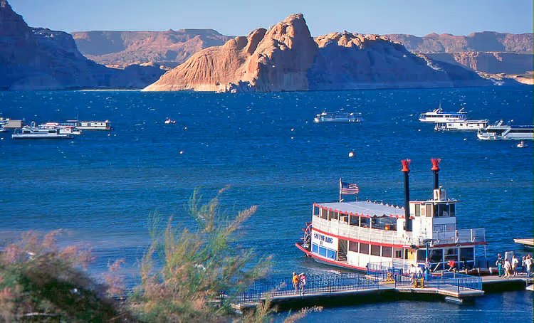
Infrastructure is concentrated in a few spots: there are marinas, campgrounds, restaurants, and visitor centers along the shore. There are almost no large buildings, so the view of the cliffs remains open.
There are also several time zones here, since the lake lies across both Arizona and Utah. Check the time on your devices before the trip.
People get around the lake mostly by boat. You can rent a kayak or a motorboat, take a canyon tour, or raft down the river below the dam. Most of the shoreline is accessible only from the water, so choose your format in advance.
Tickets and hours
Entry to the area is paid, and cash is not accepted here: payment is by card only (as of 09/2026, US National Park Service).
Who | Cost | Validity |
|---|---|---|
Passenger car | $30 | 7 days |
Motorcycle | $25 | 7 days |
Pedestrian or cyclist | $15 | single entry |
As of 09/2026: park pricing page. An annual pass costs $55, and a single America the Beautiful pass for non-US residents will run you $250. If you are driving, one pass covers everyone in the vehicle.
The park is open 24/7, with no weekend or seasonal closures (as of 09/2026, hours of operation page). Visitor center and marina schedules vary, so check them before you head out.
The season makes a big difference in comfort. In summer the air heats up above 40 °C, in winter nights can drop to -16 °C, and annual precipitation is under 15 cm (as of 09/2026, park weather page). The mildest conditions are in April-May and September-October: spring can bring strong winds, but fall has fewer tourists.
You can stay overnight at a campground or in Page. Camping is limited to 14 consecutive days and 30 days per season (as of 09/2026, park regulations). The nearest hotels and stores are in Page, a few minutes' drive from Wahweap Marina.
Book a boat or tour in advance.
Tours and tickets in Lake Powell
Guided tours, skip-the-line tickets and activities — most offers can be cancelled free of charge.
See offers on GetYourGuideThe widget loads once you give your consent.
Lake Powell on the map
⁉️🤔 Frequently asked questions
How much does it cost to enter Lake Powell?
A passenger car costs $30, and the pass is valid for 7 days. A motorcycle costs $25, and a pedestrian or cyclist pays $15 (as of 09/2026, national recreation area fees). The $55 annual pass pays for itself after a few visits.
When is the best time to visit Lake Powell?
Mild weather lasts from April through May and September through October. Spring can bring strong winds, so it is best not to plan long crossings in the first few days. Fall also has fewer tourists.
Is one day enough for Lake Powell?
One day is enough for Horseshoe Bend and a short boat trip. The canyons stretch for dozens of miles, so longer routes take a full day (as of 09/2026, park guide). If you want to see Rainbow Bridge, plan a full day and take a boat tour.
Can you swim and fish in the lake?
Yes, swimming, fishing, and water sports are allowed here. The water in the canyons is colder than it looks from a boat, so check the depth near the shore. A motorized vessel requires a separate permit, which can be obtained on site or online (as of 09/2026, entry rules).
How to get to Rainbow Bridge?
The easiest way is by water. The arch stands far from roads, so take a boat tour or go on your own boat from Wahweap Marina. Another option: hiking trails through Navajo lands, which require a permit. Overnight stays nearby are prohibited; camping is done in other areas of the park (as of 09/2026, overnight rules).
In short: what to book
If you are going for one day, book Horseshoe Bend and a short walk along the lake. For a week, plan the standard entry and choose a campground or hotel in Page in advance.
For trips on the water, book a boat and tours ahead of time. In July and August there are almost no spots left, so pick a date before your vacation starts. Lake Powell tours and walks on GetYourGuide.

A small editorial team writing guides for independent travel. We travel ourselves, but we haven’t been everywhere, so we check prices, opening hours and how to get there against official sources.