
















Saxon Switzerland: 10 routes from 1 to 7 hours
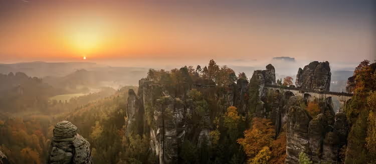
Saxon Switzerland starts right at the Elbe, less than an hour from Dresden. Sandstone towers rise directly above the river. You can go for an hour, or you can spend a whole day on the stairs and bridges of the national park.
The ten routes below follow ridges, gorges, and plateaus between Bad Schandau, Rathen, and Schöna. At some starting points parking is free, at others you pay. Almost every trailhead is served by a bus or S-Bahn.
The main thing that changed by September 2026: after the storm on July 31, forests and trails in the Rathen area were closed. Schwedenlöcher and the upper part of Amselgrund have reopened, and the status of the remaining sections is checked weekly (according to the regional tourist office, 09/2026). Check this list before every outing.
Ad: this article contains affiliate links, we earn a commission if you book through them, at no extra cost to you.
Saxon Switzerland: how the local trails work
💡 In short:
- Ten routes: from a one-hour walk to a full-day 12 km hike.
- Each route starts at a Wanderparkplatz or a bus stop.
- Stairs, bridges, and short rocky passages are almost everywhere.
- Parking and open trails: 09/2026, verified on the regional tourist office website.
 © Bybbisch94, Christian Gebhardt · CC BY-SAPhoto: Bybbisch94, Christian Gebhardt, CC BY-SA (https://creativecommons.org/licenses/by-sa/4.0), Wikimedia Commons
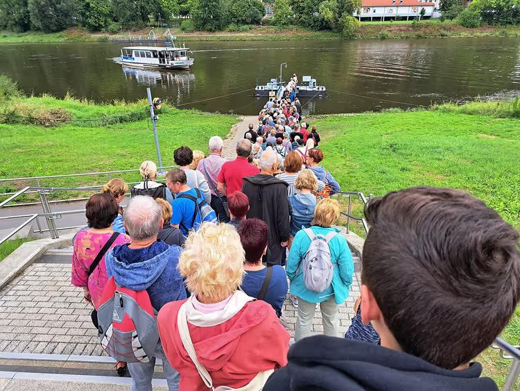
The region revolves around the Elbe, and almost every trail leads either to a plateau or to a viewpoint above the water. The most famous multi-day route here is called the Malerweg. It runs in stages through the entire Elbe Sandstone area, and you can hike one day of it without planning the whole route.
The western trails are calmer and less crowded. Schrammsteine and Bastei can get packed in summer. Plan your outing for the morning: early in the day the viewpoints are still empty and the parking lots are free.
Before heading out, open the national park's Wegeservice. It lists closed sections, and the list is updated quickly (according to the national park Wegeservice). Almost every Wanderparkplatz has a bus stop, and in season the parking lots fill up fast (according to the national park's getting there page).
1. Kuhstall and Himmelsleiter: the gate in the Neuer Wildenstein rock
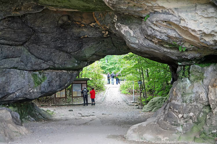
The second-largest rock gate in the Elbe Sandstone area is called Kuhstall. It cuts through the Neuer Wildenstein rock, and through it you get a view of the valley.
 © W. Bulach · CC BY-SAPhoto: W. Bulach, CC BY-SA (https://creativecommons.org/licenses/by-sa/4.0), Wikimedia Commons
The trail here starts at Lichtenhainer Wasserfall or at Beuthenfall. Part of the route follows a wide forest road, so the start works well for families with children.
The climb to the gate takes you up steps and ladders. There are a lot of them, but each step is short, and you tire less here than on a long ridge climb.
At the top there is a Gasthaus. Grab a coffee and rest before the second section.
Next comes the Himmelsleiter. A long ladder climbs through a narrow crevice to another viewpoint.
Want more of a challenge? Head to Schneiderloch. You have to crawl into the low cave, and then a narrow gap begins with a few steps. Leave your backpack outside.
Route: about 5 km loop.
Time: about 1.5 hours without long stops.
Profile: steps, ladders, a crawling section in Schneiderloch.
Start: Beuthenfall parking lot, daily rate.
The catch: the Schneiderloch section is tight, and you won't fit through with a large backpack.
As of: the regional route catalog, 09/2026.
Combine both approaches into a loop. That way you'll see the gate, the ladder, and return by a different path. Who it's for: families and anyone who wants a short outing with a viewpoint.
2. Arnstein: a short climb without the crowds
Want to get away from the crowds on the Malerweg? Then choose Arnstein. Almost nobody climbs up here.
You start at the free Wanderparkplatz on Ottendorfer Straße. From the parking lot to the summit is not far at all, but this short stretch has steps in a crevice, bridges, and easy rocky passages.
The climb takes longer than you expect if you stop to take photos. Allow extra time and bring water.
At the top there is a wide view. You'll also find the remains of Arnstein Castle, also called Ottendorfer Raubschloss. Nearby stands a stone water cistern. Who it's for: those who want quiet on a short route.
Route: about 1.1 km out and back.
Time: about an hour including stops.
Profile: steps in a crevice, bridges, easy rocky sections.
Start: free Wanderparkplatz on Ottendorfer Straße.
The catch: with photo stops, the climb takes longer than you expect.
As of: the official trail list, 09/2026.
3. Lilienstein: plateau, bridges, and a view of the Elbe
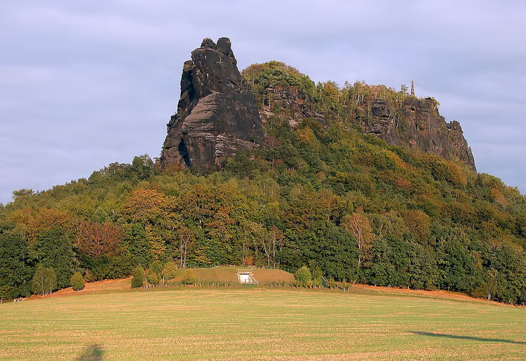
Lilienstein is considered the symbol of Saxon Switzerland. The plateau rises above the Elbe, and almost everyone visiting the region for the first time climbs up here.
 © Jörg Blobelt · CC BY-SAPhoto: Jörg Blobelt, CC BY-SA (https://creativecommons.org/licenses/by-sa/4.0), Wikimedia Commons
The southern ascent goes through shady forest. On a hot day this is a big plus: the sun only reaches you on the rocks. The trail winds between boulders and flowers.
Then the famous steps and bridges begin, the ones that make Elbe sandstone recognizable. The climb is steady, without long gentle sections. About half an hour, and you're on the plateau.
Up on the plateau, several viewpoints await, and from them you see the whole region. The strongest view opens to the west. Bridges, stairs, and one short ladder lead to it.
From the western edge of the plateau you see the Elbe and the towns on its banks. The viewpoint is narrow, so on weekends expect a line for a good shot. Between viewpoints you cross short bridges over crevices.
Stay to the right of the southern ascent, and in a couple of minutes you'll come to the Gaststätte and other viewpoints. These views require no climbing, and that's the convenience of the plateau. From the eastern edge you look along the Elbe to Bad Schandau and further into the Elbe sandstone.
You can descend via the northern route. It's longer, but it takes a different path, so you don't repeat the ascent. Who it's for: those who want a panorama after a short climb.
Route: about 3.5 km as a loop.
Time: about 2 hours including viewpoints.
Profile: southern ascent about 1 km and half an hour, northern descent about 1.6 km and 45 minutes.
Start: parking on Liliensteinstraße, day rate.
The catch: the western viewpoint is reached by a short ladder above a drop; if you're afraid of heights, this is an unpleasant section.
As of: the region's hiking page, 09/2026.
The descent follows the northern side of the plateau, and on this path you meet almost no one. If you still have energy, walk to the viewpoint above the Elbe. From there the river is visible over a long stretch.
4. Zirkelstein: a 360-degree panorama
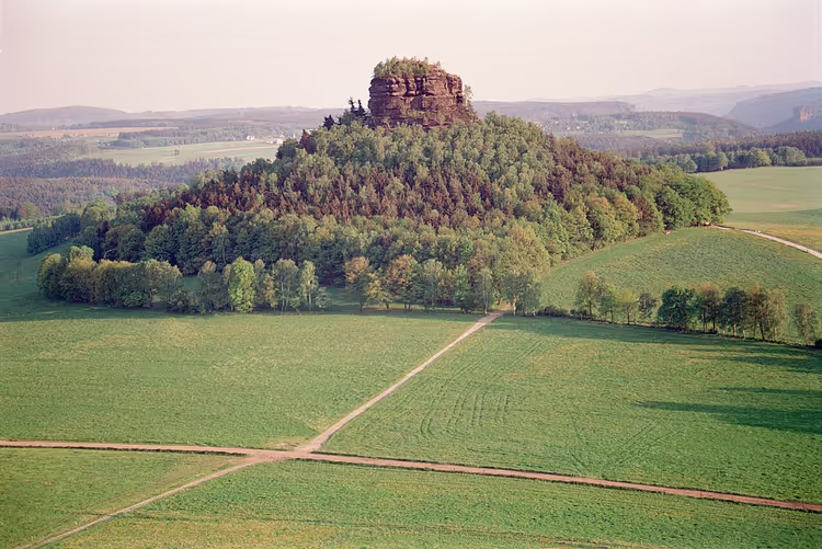
Zirkelstein stands near Schöna and promises a full view in all directions. Careful: from this summit you'll want to take photos for a long time.
 © Olaf1541 · CC BYPhoto: Olaf1541, CC BY (https://creativecommons.org/licenses/by/2.5), Wikimedia Commons
You leave the car at the free Wanderparkplatz at the southern exit of Schöna. From the parking area you can already see the summit, so getting lost is unlikely. Bus 252 goes to the village, stop at Dorfplatz.
First you walk along the edge of the village, then along the wide gravel street Am Zirkelstein. The ascent goes through shady forest, and on the eastern side steps and stairs begin.
From the summit you'll see Lilienstein, Schrammsteine, and the neighboring Kaiserkrone in one direction, while in the other direction the big mountains of Czech Switzerland stretch away. Among them is Hoher Schneeberg, the highest mountain in the Elbe sandstone.
Route: about 2 km out and back, 75 meters of elevation gain.
Time: about an hour.
Profile: easy, steps only in the last few meters.
Start: free parking at the southern exit of Schöna or bus 252.
Who it's for: those who want maximum views for a short walk.
As of: the tourist office directory, 09/2026.
5. Gohrisch: climbing stairs to the weather vane
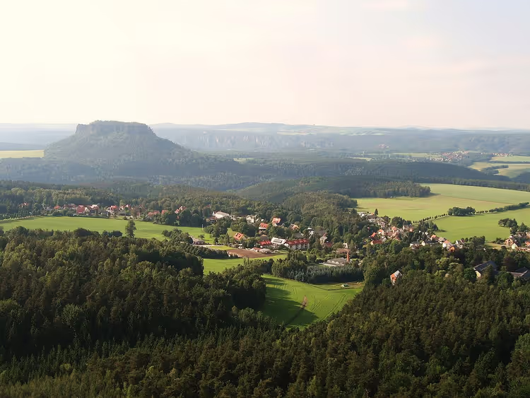
Gohrisch is a plateau south of the village of the same name. The summit is visible from the road, so you'll find the start without a map.
 © Dirk Schmidt (Celsius auf Wikivoyage) · CC BY-SAPhoto: Dirk Schmidt (Celsius auf Wikivoyage), CC BY-SA (https://creativecommons.org/licenses/by-sa/3.0), Wikimedia Commons
The climb starts from the Wanderparkplatz and goes through the forest. Along the way you pass the Specksteinstollen, an adit where bats hibernate.
Before the final section there's a convenient spot for a break. After that the climb follows steps and ladders, sometimes through narrow crevices.
At the top, Pavillonaussicht welcomes you. It's worth walking further across the plateau to the western edge: there's a weather vane there, and another wide view over Elbe Sandstone opens up from that point.
Route: about 2 km loop.
Time: about an hour.
Profile: moderate, steps and short ladders.
Start: Wanderparkplatz on the road south of Gohrisch, first hour of parking free with a Parkscheibe.
As of: the region's official website, 09/2026.
You descend via the western route and return to the car along the Muselweg. This path is longer, but it gives you a proper loop. If you're traveling on vacation with a rental car, compare rental prices in Dresden in advance.
6. Papststein: sunset over the Elbe and an inn at the top
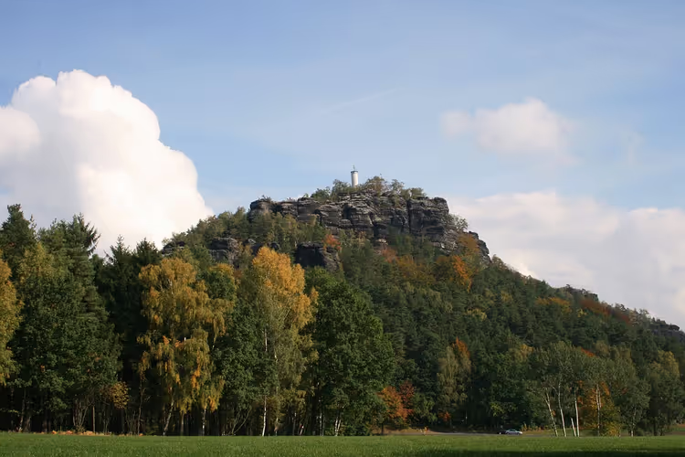
Papststein sits right next to Gohrisch, and they share the same starting point. The difference is that the climb up Papststein follows a lit trail.
 © Spitzhofer · CC BYPhoto: Spitzhofer, CC BY (https://creativecommons.org/licenses/by/3.0), Wikimedia Commons
You cross the road and ascend a wide path with steps. The lamps here weren't installed by accident: a Berggaststätte operates at the top, so guests stay until dark.
The first viewpoint over the rocks is called Hunskirchenblick. Beyond it, new ladders and new viewpoints begin. To the northwest you see Gohrisch, to the south the village of Papstdorf with its church.
From the inn you can walk a bit to the east. More viewpoints and whimsical rock walls await you there. The descent passes the Kleine and Große Hunskirche.
Route: about 2 km loop.
Time: about an hour, longer at sunset.
Profile: easy climb, lit trail to the top.
Start: the same Wanderparkplatz south of Gohrisch.
The catch: the descent past the Hunskirche is partly overgrown and can be slippery after rain.
As of: the Saxon Switzerland tourist office, 09/2026.
7. Felsenlabyrinth: a maze between Königstein and Bielatal
The Felsenlabyrinth between Königstein and Bielatal is a favorite with families. Kids breeze through the maze, adults struggle in places.
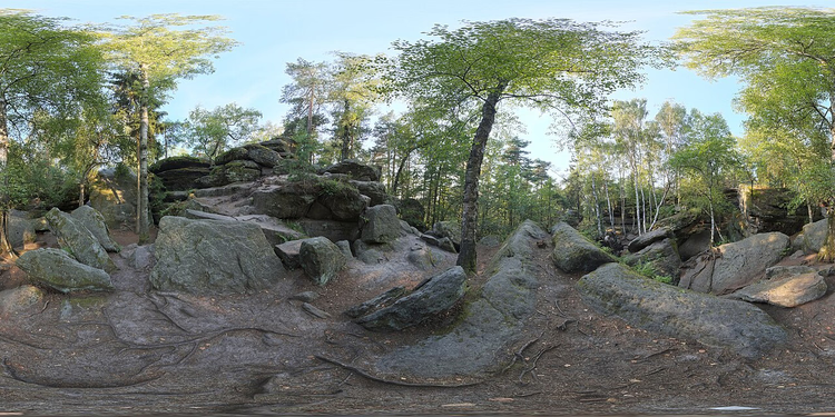
You find the entrance by following the green dot from the parking lot. The walk in is very short, which is convenient with children. Beyond that, the route is marked with numbers, so getting lost inside is unlikely.
The gaps between the rocks are narrow in places, and that's part of the game. Not for: anyone who feels uncomfortable in tight passages or is carrying a large backpack.
Route: marked loop, enter via the green trail marking.
Time: from half an hour to an hour if the kids lead the way.
Profile: easy, but tight in places.
Start: parking lot at the maze, entrance a few hundred meters away.
The catch: in adult size, some crevices are awkward, and you'll have to take off your backpack.
As of: the region's hiking catalog, 09/2026.
8. Bastei and Schwedenlöcher: the region's signature view
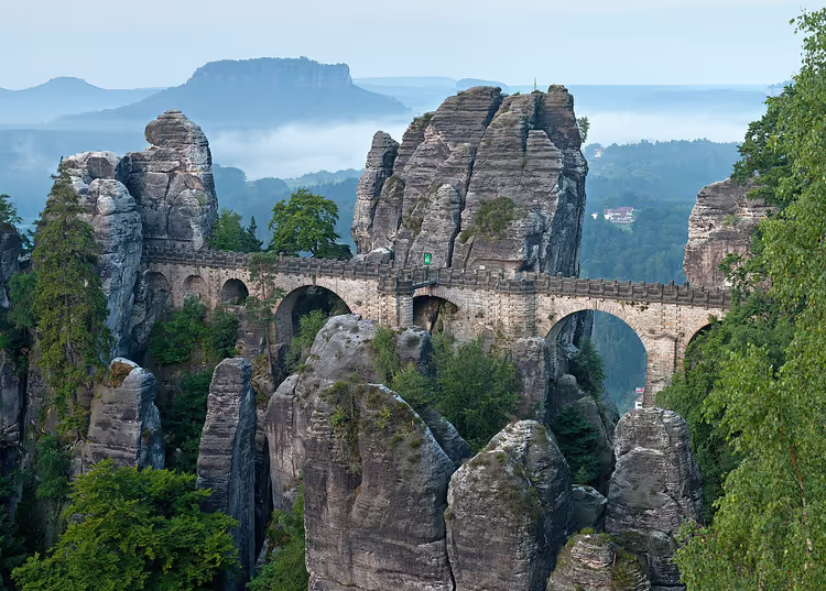
Everyone knows Bastei with its Basteibrücke. There are noticeably more people here than on other trails, and the view is still worth it.
 © Thomas Wolf , www.foto-tw.de · CC BY-SAPhoto: Thomas Wolf , www.foto-tw.de, CC BY-SA (https://creativecommons.org/licenses/by-sa/3.0/de/deed.en), Wikimedia Commons
The best plan: combine Bastei with a loop. To the north lie the Schwedenlöcher: a descent through a narrow gorge with high walls. It's cool here in summer, making it the best section in hot weather.
At the bottom you walk through the Amselgrund, and then Amselsee begins. In the spa town of Rathen you can take a short break before the climb up to Bastei.
At the top, one viewpoint follows another. The stone bridge, the rock castle Felsenburg Neurathen, and the view over the Elbe all come in a single climb. Check the trail status after storms in the region's current notices: the Basteiweg from Rathen is already open.
Route: about 5 km loop.
Time: 1.5 to 2 hours.
Profile: the descent through the Schwedenlöcher is harder than the climb, steps are slippery after rain.
Start: Berghotel Bastei parking lot or the climb from Rathen.
The catch: Bastei is crowded in summer, come early in the morning.
Who it's for: anyone who wants to see the region's signature view in a single outing.
As of: the tourist office website, 09/2026.
9. Schrammsteine: a loop through the Große Schrammtor
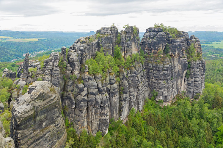
The Schrammsteine with the Große Schrammtor and its viewpoint round out the list of the region's signature views. The start here is convenient: parking right at the trails.
 © J.-H. Janßen · CC BY-SAPhoto: J.-H. Janßen, CC BY-SA (https://creativecommons.org/licenses/by-sa/4.0), Wikimedia Commons
You walk through Lattengrund and gain elevation the whole way. The trail winds through forest and a gorge with high walls. At the end of the climb, a view opens up over Schrammsteine and neighboring Falkenstein.
Next you follow Obrigensteig along the rocks to Wildschützensteig. This is where steps, ladders, and short rocky climbs begin. At the top, turn left toward Schrammsteinaussicht.
The convenient way down is the Mittelwinkel descent, which has more ladders. Then you return to the car along a wide trail on the north side of the rocks.
Route: about 6 km loop.
Time: about 2.5 hours.
Profile: moderate, steps and ladders on both climbs.
Start: Wanderparkplatz on Zahnsgrund, Schrammsteinbaude stop.
As of: the region's route list, 09/2026.
10. Carolafelsen, kleines prebischtor and affensteine
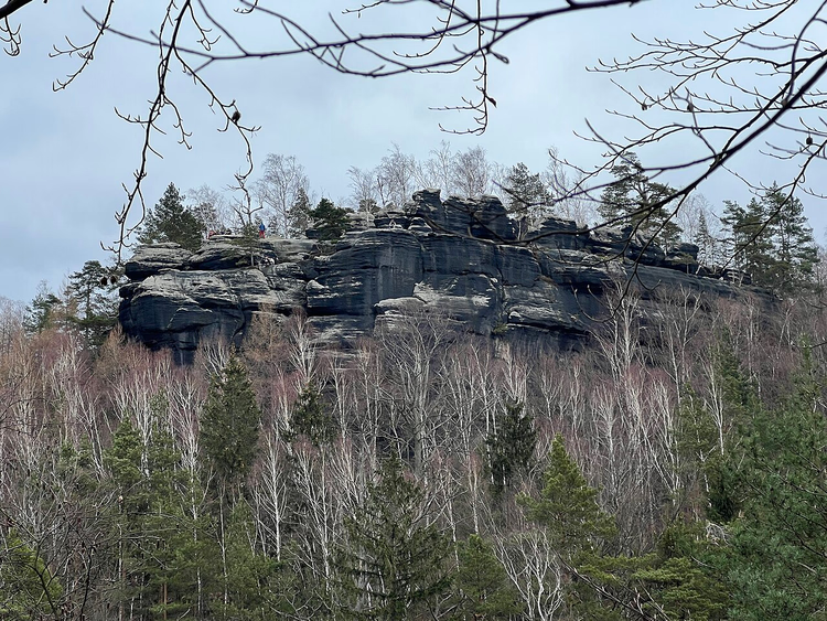
If you have a full day, continue from Schrammsteinaussicht along the Malerweg. This adds Kleines Prebischtor, Carolafelsen, and Affensteine to the loop.
 © Lukas Beck · CC BYPhoto: Lukas Beck, CC BY (https://creativecommons.org/licenses/by/4.0), Wikimedia Commons
First the Malerweg follows Gratweg: up and down, with steps and ladders. At Breite Kluft there are comfortable rocks for a break and a panorama over the whole region.
Next the climb follows Zurückesteig. For Carolafelsen, it's worth leaving the Malerweg for ten minutes each way. The view from there opens over the entire Elbe Sandstone Mountains.
Then you return to the Malerweg and walk past Kleines Prebischtor to Domerker. The descent at Domkanzel requires hands, but it leads to a viewpoint overlooking Affensteine.
After that the trail gets quieter, and you'll hardly see any tour groups here. You walk along the edge of the plateau, with the towers of Affensteine always visible above the trees.
Next comes Sandlochweg, and the forest here is full of giant trees. The last stretch to Beuthenfall follows a wide trail and no longer takes much effort.
Route: about 12 km from Zahnsgrund to Beuthenfall.
Time: about 7 hours with breaks and photos.
Profile: moderate, a long day with elevation gain on Gratweg.
Start: Wanderparkplatz on Zahnsgrund, finish at Beuthenfall, you can take a bus back from Bad Schandau.
The catch: this is a full-day route, you won't manage it in under seven hours with breaks.
As of: the official trail catalog, 09/2026.
For an overnight stay, Bad Schandau is the most convenient base. Bridges cross the Elbe, so trails on both banks are close by. Both the town center and apartments outside town work well as a base for a week: check hotel prices in Bad Schandau on Trip.com.
If you want guided tours and kayaks on the Elbe, take a look at the selection below.
Tours and tickets
Guided tours, skip-the-line tickets and activities — most offers can be cancelled free of charge.
See offers on GetYourGuideThe widget loads once you give your consent.
⁉️🤔 Frequently asked questions
Which route should I start with in Saxon Switzerland?
Start with Kuhstall and Himmelsleiter: about 5 km, a short climb, and an inn at the top. The second option is Lilienstein, where you get a panorama after half an hour of climbing. Both routes give you a sense of how the steps and bridges work here, so after them you can head more confidently to Schrammsteine or spend a full day on the Malerweg.
How much does parking near the trails and entry to Bastei cost?
The Wanderparkplatz on Ottendorfer Straße and in Schöna are free; Lilienstein and Beuthenfall charge a daily rate. Entry to Bastei itself is free, only the rock museum Felsenburg Neurathen is paid (according to current reports from the tourist office, 09/2026). Check parking rates on site, they change by season.
Are Schwedenlöcher and Amselgrund open in 2026?
Yes. After the storm on July 31, 2026, the descent into Schwedenlöcher, the upper part of Amselgrund, and Gansweg were reopened, and Basteiweg from Rathen across the bridge is also open. Some sections around Rathen remain closed, so check current regional updates before heading out. The list is updated almost every week.
Can I do these routes without a car?
Yes, some routes are reachable by public transport. Bus 252 goes to Schöna with a stop at Dorfplatz, a bus goes to Schrammsteine with a stop at Schrammsteinbaude, and the S-Bahn runs to Rathen and Bad Schandau. Almost every Wanderparkplatz has a bus stop nearby (according to national park transport information).
Where should I stay to hike every day?
Bad Schandau is a convenient base for reaching both banks of the Elbe: bridges connect the sides of the river, so Bastei, Schrammsteine, and Lilienstein fit into one weekly plan. The villages around Gohrisch work well if you have a car and want quiet. Book accommodation early: options get snapped up quickly in summer and September.
In short: what's worth booking
If you have one free day, go for Lilienstein or Schrammsteine: both trails offer a panorama and fit into half a day. With kids, plan for Felsenlabyrinth and Kuhstall, where the climbs are short and Kuhstall has an inn at the top. For quiet, head to Arnstein and Zirkelstein. For the most famous view, go to Bastei early in the morning, before the buses bring in groups. Save the combination of Schrammsteine, Carolafelsen, and Affensteine for a long day.
Without a car, Bad Schandau is the most convenient place to stay: buses and the S-Bahn run to the trails, and you can book train tickets to Bad Schandau on Trip.com in advance.

A small editorial team writing guides for independent travel. We travel ourselves, but we haven’t been everywhere, so we check prices, opening hours and how to get there against official sources.