
















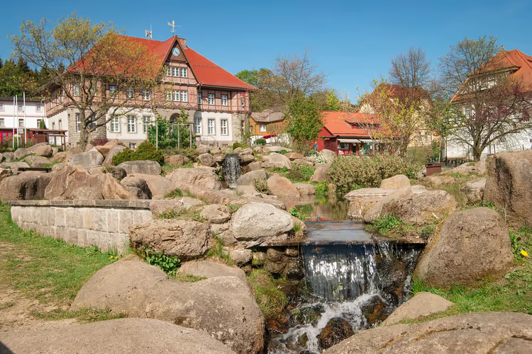
Spring hiking in Germany: 15 routes from the Eifel to the Allgäu
Germany wakes up from winter fast. In March, almonds and crocuses are already blooming in the southwest, while the Allgäu still has snow on the same days. You have a rare chance to stretch spring over several weeks: start in the southwest and finish in the Alps.
We've put together 15 hiking routes where spring is at its most visible. From six million wild daffodils in the Eifel (according to Eifelsteig) to the panoramas of the Swabian Jura. For each route we give the length, walking time and the best month.
Spring routes: our picks
💡 In short:
- Spring season in Germany runs from March to May. The southwest blooms first, the north and the mountains last.
- Bring hiking boots and a rain jacket: trails are wet in spring, and the weather can change within an hour.
- Long-distance routes like Albsteig or Urwaldsteig are best done in stages, not in one go.
- Blooming seasons and route data: checked on 12.09.2026 on the official Eifelsteig website.
Here are all 15 routes in one list:
Route | Region | When to go | Highlight |
|---|---|---|---|
1. Zwieselberg | Allgäu | April, May | Alpine panorama and lakes |
2. Narzissenroute | Eifel | April | largest daffodil field |
3. Krokusweg | Black Forest | March | wild crocuses |
4. Schachblumen-Tour | Spessart | late April | rare fritillaries |
5. Mandelpfad | Palatinate | from March | almond blossom |
6. Kaiserstuhlpfad | Breisgau | late March | cherry trees and warmth |
7. Hegau-Vulkane | Hegau | April, May | volcanoes and orchids |
8. Albsteig, stage 11 | Swabian Jura | April, May | castle and cave |
9. Saar-Hunsrück-Steig | Hunsrück | April, May | wild nature |
10. Altmühltal-Panoramaweg | Altmühl Valley | from March | heathland and small towns |
11. Plöner See | Holstein Switzerland | May | lakes and rapeseed |
12. Urwaldsteig | Kassel | early May | beech forests |
13. Kahler Asten | Sauerland | March, May | circular panorama |
14. Eppinger Linienweg | Kraichgau | April, May | history and ramparts |
15. Saale-Horizontale | Thuringia | April, May | beer garden above Jena |
1. Zwieselberg in the Allgäu
The circular trail starts in Rieden and runs 20 km (per the map) through yellow dandelion fields to the summit of Zwieselberg at 1055 m (per the map). From the top you get an Alpine panorama, with views of Forggensee and the entire mountain chain. The return route leads via Koppenkreuz to the eastern shore of Hopfensee and over moraine hills back to Rieden. A shorter option starts in Roßhaupten: 10 km and about 3 hours (per the map).
- Who it's for: if you want the first big panorama of the season.
- The catch: the full 20 km in one go isn't for everyone, take the option from Roßhaupten.
2. Daffodil trail in the Eifel
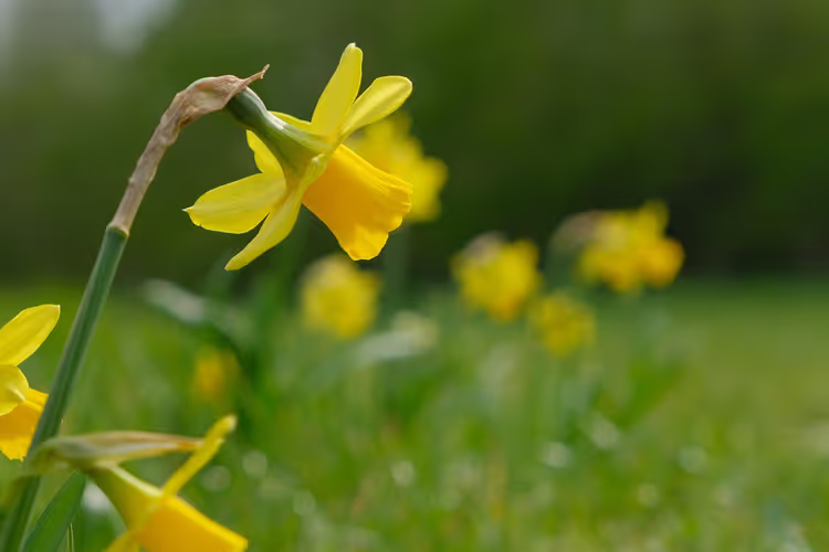
Every April, millions of yellow daffodils bloom in the meadows of the Perlenbachtal valley between Monschau and Hellenthal, the largest wild field in Germany (according to the trail website). The circular Narzissenroute trail, 12 km long (per the map), starts in the village of Höfen and takes about three hours. The trail connects to the local path network, so the bloom is easy to include in a multi-day hike along the Eifelsteig.
- Who it's for: for those who want to see the bloom at its largest scale.
- The catch: peak bloom lasts about three weeks, so check the date in advance.
3. Crocus trail in the Black Forest
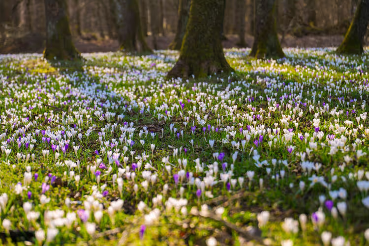
In March, wild crocuses bloom around Bad Teinach-Zavelstein, the largest field in southern Germany. The short Krokusweg trail takes one to two hours and is entirely dedicated to this bloom. The longer Augenblickrunde at 15 km (per the map) adds the Wolfsschlucht gorge and viewpoints with views as far as the Swabian Jura.
- Who it's for: for a leisurely walk with a camera.
- The catch: Zavelstein is very popular in March, so on weekends arrive in the morning or come on a weekday.
4. Fritillaries in the Spessart
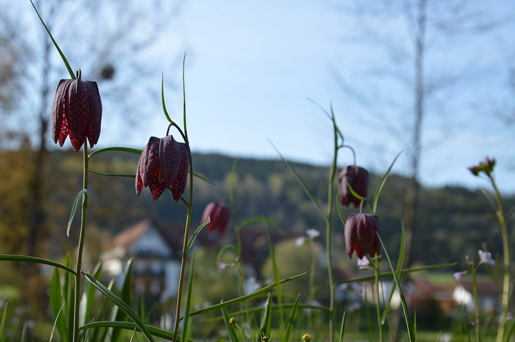
The Sinn river flows through the Spessart between Wildflecken and Gemünden, past untouched meadows and forests. In late April and early May, these floodplains are covered with rare fritillaries, with their purple-and-white checkered pattern on the petals. You can see them on a walk along the riverbed from Burgsinn to Mittelsinn. If you have time, add a loop through Fellen and Richtberg: that gives you a 19 km route (per the map).
 © Christoph Muench aus dem Zauberwald · CC BY-SAPhoto: Christoph Muench aus dem Zauberwald, CC BY-SA (https://creativecommons.org/licenses/by-sa/4.0), Wikimedia Commons
- Who it's for: for a quiet day without crowds.
- The catch: the bloom window is short, late April and the first ten days of May.
5. Almond trail in the Palatinate
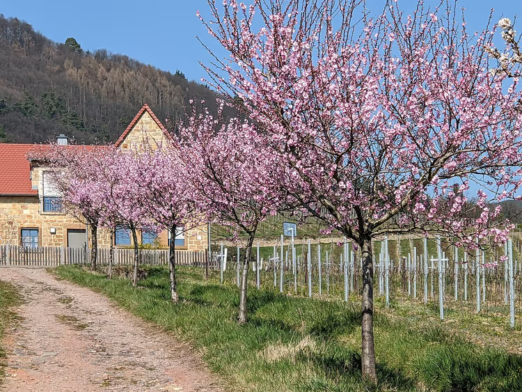
From early March, pink clouds of almond blossom hang over the vineyards of the Palatinate. The region's warm climate was already known to the Romans, and they were probably the ones who planted the first trees here. The Mandelpfad route runs 77 km (per the map) between Bad Dürkheim and Schweigen-Rechtenbach, linking viewpoints, avenues and wine villages. At local wineries you can try almond liqueur, almond bread and even almond salami.
 © Gerd Eichmann · CC BY-SAPhoto: Gerd Eichmann, CC BY-SA (https://creativecommons.org/licenses/by-sa/4.0), Wikimedia Commons
- Who it's for: for those who combine hiking with tasting.
- The catch: 77 km can't be done in one day, so pick your section in advance.
6. Kaiserstuhl in Breisgau
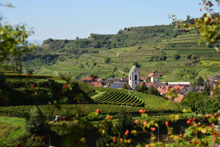
Breisgau near Freiburg ranks at the top of Germany's sunny-day statistics every year. The best target for an early start is the Kaiserstuhl, a low mountain range 20 km (on the map) northwest of the city. While snow still lies in the Black Forest and the Vosges, the first spring flowers already appear here. The Kaiserstuhlpfad trail runs 22 km (on the map) from Endingen to Ihringen across the entire range and takes about six and a half hours. In late March and April the route is especially beautiful during cherry blossom season.
- Who it's for: those who want to start the season earlier than everyone else.
- The catch: 22 km and six and a half hours require good fitness.
7. Hegau volcanoes and orchids
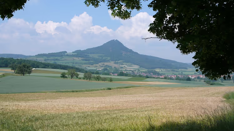
North of Lake Constance rise the cones of the extinct Hegau volcanoes. On one of them, Hohentwiel Fortress has stood since the early Middle Ages, with the ruins of Hohenkrähen and Mägdeberg nearby. From the summits you can see much of Lake Constance and the Alps. The loop around Hohentwiel is 3.5 km (on the map) and takes 1.5 hours; the route to Hohenkrähen and Mägdeberg runs 9 km (on the map) with 430 m of elevation gain. In spring, orchids bloom on the warm southern slopes near Immendingen, with information boards along the nature trail.
 © Prekario · CC BY-SAPhoto: Prekario, CC BY-SA (http://creativecommons.org/licenses/by-sa/3.0/), Wikimedia Commons
- Who it's for: those who want to combine lake views and botany.
- The catch: 430 m of elevation gain over 9 km puts noticeable strain on a beginner.
8. Lichtenstein castle and the Swabian Alb
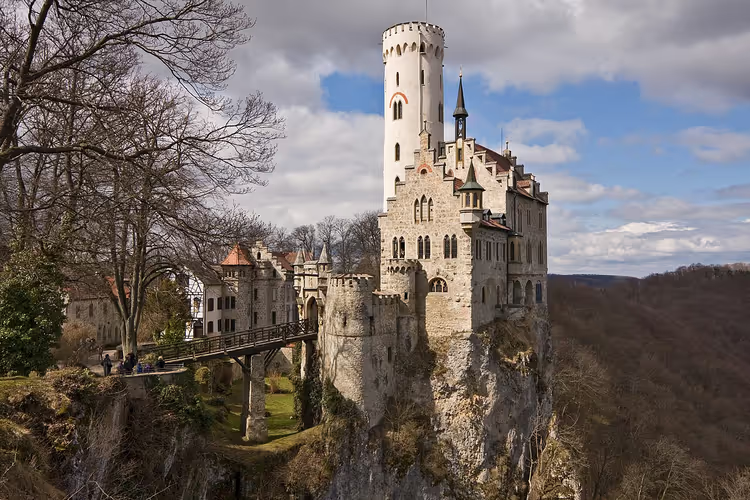
The Albsteig trail stretches 350 km (on the map) along the edge of the Swabian Alb. Stage eleven connects two attractions in one go. From Stahlecker Hof near St. Johann you walk six hours and 20 km (on the map) to Genkingen, passing the ruins of Stahleck and Greifenstein. Just 100 m (on the map) from Lichtenstein Castle stands the Alte Forsthaus, the most colorful stop on the route: it serves Swabian dishes and homemade pies. The second part of the route leads to Nebelhöhle Cave with its stalactites. If you're short on time, take the 9 km (on the map) loop from the castle.
 © -donald- · CC BY-SAPhoto: -donald-, CC BY-SA (https://creativecommons.org/licenses/by-sa/3.0), Wikimedia Commons
- Who it's for: those who want to combine a hike with a castle and a cave.
- The catch: the full 20 km stage is designed for a full day.
9. Hunsrück-Hochwald National Park
Germany's youngest national park protects the old forests, rocky valleys, and bogs of the Hunsrück. Wild cats, deer, owls, and bats live here undisturbed. Stages nine and ten of the 410 km (on the map) Saar-Hunsrück-Steig trail pass through the park. The section from Nonnweiler to Morbach requires good fitness and crosses the Erbeskopf, the highest point in Rhineland-Palatinate. There are also short walks, and west of the park the Saarschleife river loop awaits.
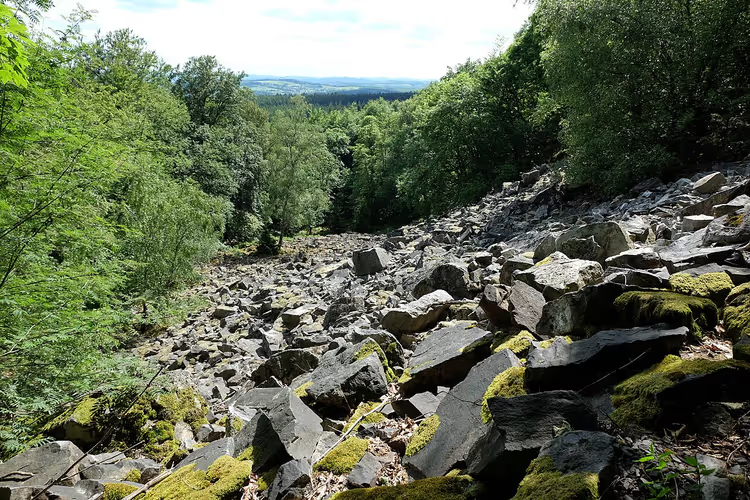 © Jbndr · CC BY-SAPhoto: Jbndr, CC BY-SA (https://creativecommons.org/licenses/by-sa/3.0), Wikimedia Commons
- Who it's for: lovers of quiet and wild nature.
- The catch: the long section is designed for experienced hikers.
10. Altmühltal valley
From March, pasqueflower (Küchenschelle) adds purple patches to the juniper heaths of the Altmühltal. The 200 km (on the map) Altmühltal-Panoramaweg is designed for two weeks and runs from Gunzenhausen along the Altmühl river and the canal to Kelheim. Along the way you pass through old towns, past castles, and to Weltenburg Abbey on the Danube. If you only have one day, walk the section from Walting to Kipfenberg across the sunny Gungoldinger Wacholderheide heath.
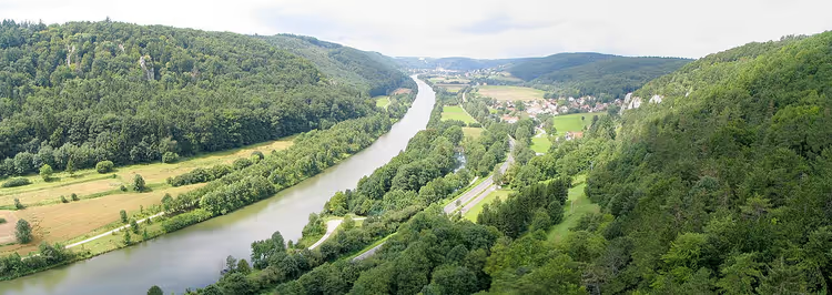 © Pahu · CC BY-SAPhoto: Pahu, CC BY-SA (http://creativecommons.org/licenses/by-sa/3.0/), Wikimedia Commons
- Who it's for: those who like long routes with history.
- The catch: 200 km requires vacation time; on a weekend, take just one stage.
11. Holstein Switzerland lakes
Between Kiel and Lübeck lie the hills and lakes of Holstein Switzerland. The region's largest lake, Plöner See, stretches for seven kilometers (on the map), and here you can spot white-tailed eagles. The best month to visit: May, when rapeseed fields blaze yellow under blue skies. The best base for overnight stays: Nehmten on the southwestern shore. From the Sepel area starts the region's best loop: along Plöner See, to Stocksee, and back, 16 km (on the map) in total and about four hours. You can rent a canoe and paddle across the lake.
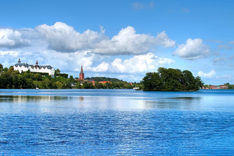 © Sören Jalas · CC BY-SAPhoto: Sören Jalas, CC BY-SA (https://creativecommons.org/licenses/by-sa/3.0), Wikimedia Commons
- Who it's for: leisurely walks by the water.
- The catch: peak rapeseed bloom lasts only through May.
12. Urwaldsteig at Edersee
Germany's beech forests are on the UNESCO World Heritage list, and they survive in only a few places. One of them: Kellerwald-Edersee National Park, 40 km (on the map) southwest of Kassel. Here beeches live out their natural cycle without human intervention. The best time to visit: early May, when the forest stands in fresh green. The Urwaldsteig trail runs along the southern shore of Edersee for 30 km (on the map) and constantly offers additional loops: in spring, the Ringelsberg and Bloßenberg sections are recommended. With four free days you can complete the entire 70 km (on the map) Urwaldsteig, including the northern shore.
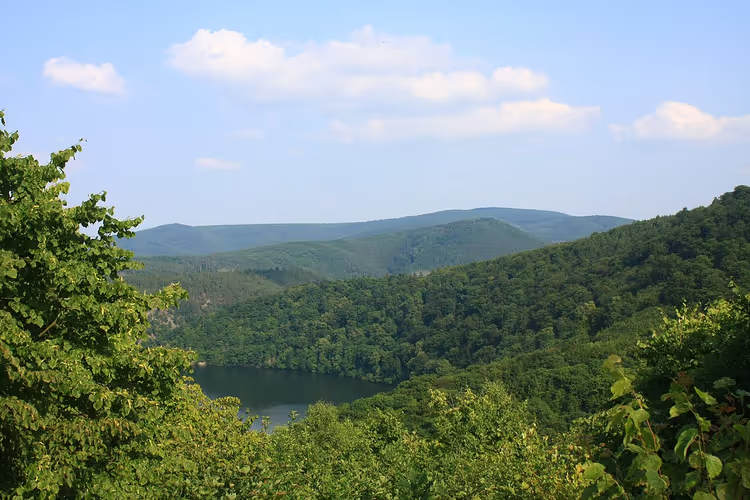 © Antiope05411 · CC BY-SAPhoto: Antiope05411, CC BY-SA (https://creativecommons.org/licenses/by-sa/3.0), Wikimedia Commons
- Who it's for: those who want to see a true old-growth forest.
- The catch: the full 70 km requires at least four days.
13. Kahler Asten in the Sauerland
This 15 km (on the map) trail leads high uphill. At 841 m (on the map), Kahler Asten is considered the most famous mountain in North Rhine-Westphalia. On the heath-covered plateau, a 360-degree panorama of the entire region awaits. In late winter and early spring it is especially beautiful here: sun and fog in the valleys. The descent from the Lenne spring into the valley also offers views of the "roof of Westphalia" and quiet trails along streams. Sports enthusiasts will enjoy the 10 km (on the map) Kahler Asten-Trail, a running route with steep climbs between Winterberg and the mountain.
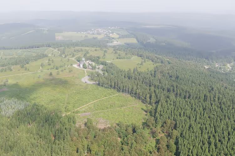 © Teta · CC BY-SAPhoto: Teta, CC BY-SA (https://creativecommons.org/licenses/by-sa/3.0), Wikimedia Commons
- Who it's for: those willing to climb for a panoramic view.
- The catch: the Kahler Asten-Trail running route is only for trained runners.
14. Eppinger Linienweg in stages
The 40 km (on the map) Eppinger Linienweg has earned the German quality seal "Wanderbares Deutschland." You walk along ramparts and ditches that Margrave Ludwig Wilhelm von Baden-Baden built in the late 17th century against the French. Large sculptures by Hinrich Zürn explain the historical background. The signage gets you to Mühlacker without a map. It is best to hike the route in three stages.
- Who it's for: those who like history and level trails.
- The catch: 40 km cannot be done in one day; plan three stages.
15. Saale-Horizontale: green hills of Thuringia
At the Fuchsturmgaststätte beer garden on Jena's city hill, the air smells of roast venison with Thuringian dumplings. They serve home-style regional cuisine and vegetarian dishes such as gnocchi with sugar snap peas. Literary readings also take place here, and if you don't make it back down to the valley, stay in one of the three guest rooms. You can climb up from Jenaprießnitz (3 km, on the map) or from the Steinkreuz parking lot (2 km, on the map). The more scenic option is the Saale-Horizontale loop around Jena: 70 km (on the map) in four stages. On one of the stages, a terrace with a view over the city and the Saale valley awaits.
- Who it's for: those who want to finish a hike with lunch and a view.
- The catch: the climb from the Steinkreuz parking lot goes two kilometers (on the map) uphill.
⁉️🤔 Frequently asked questions
When does the season for spring hikes begin in Germany?
The season opens earliest in the southwest: in the Palatinate, almond trees bloom as early as the beginning of March. Next come the Black Forest and Breisgau with cherries in late March. In the Allgäu and on the ridges, snow melts later, so hiking there is realistic from April to May. Plan your trip by region, not by calendar.
Where is the most blooming in spring?
Germany's largest wild daffodil field lies in the Eifel, in the Perlenbachtal valley between Monschau and Hellenthal: in April, millions of yellow flowers bloom there. Equally spectacular are the crocuses in the Black Forest near Bad Teinach-Zavelstein and the blooming almond trees on the Mandelpfad in the Palatinate. Start in the southwest, where spring arrives two to three weeks earlier.
Do I need special boots for these routes?
Yes, trekking boots with good tread will work for most routes. In spring, trails are wet after snowmelt, and on heaths like Gungoldinger Wacholderheide the clay is slippery. Sneakers are enough only for short walks on level paths, such as the Krokusweg or around Plöner See.
Can I hike these routes with children?
Short routes work well: the loop around Hohentwiel is 3.5 km (on the map), and the Krokusweg takes one to two hours. Long stages of 20 km or more, such as on the Albsteig or Zwieselberg, are better left to adults. For families, the lakes at Plöner See are convenient, where you can alternate walking with canoeing.
What should I do if the weather turns bad?
In Germany, spring weather can change within an hour, so bring a rain jacket. If a trail gets muddy, switch to short town walks around the Altmühltal or strolls near Plöner See. Mountains like Kahler Asten are better postponed in fog, since a panorama without a view loses its point.
In short: what to book
You don't have to pay for the trails themselves in Germany. Money goes to lodging, parking, and entry to individual sites such as Nebelhöhle cave or Hohentwiel fortress. You don't need to book the trail itself, but accommodation near popular spots fills up early. In the Black Forest and at Plöner See, look for weekend lodging as early as March, and in the Eifel check bloom dates on the trail website.
The selection matrix looks like this:
- If you have one free day: Krokusweg in the Black Forest or the loop around Hohentwiel.
- If you're going in April for the blooms: Narzissenroute in the Eifel.
- If you want panoramas: Zwieselberg in the Allgäu or Kahler Asten.
- If you have a week of vacation: Urwaldsteig or several stages of the Altmühltal-Panoramaweg.
- If you want quiet: Hunsrück-Hochwald National Park.
Before your trip, check current bloom dates and trail markings on official park websites, for example on the Eifelsteig website.

A small editorial team writing guides for independent travel. We travel ourselves, but we haven’t been everywhere, so we check prices, opening hours and how to get there against official sources.