
















Thor's Well in Oregon: high tide hour, safety and the road to Cape Perpetua
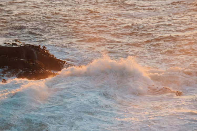
The ocean drains into a hole in a basalt slab and returns as a fountain.
That is what Thor's Well looks like at Cape Perpetua in Oregon. There is no ticket booth or railing here, and no admission fee for the sinkhole. But some parking areas in the Cape Perpetua zone operate with a paid day-use pass. The sinkhole works year-round, and the cape's viewing platforms are open from dawn to dusk. To see the fountain rather than a flat puddle, you need the right tide hour and a car.
Ad: this article contains affiliate links, we earn a commission if you book through them, at no extra cost to you.
Where Thor's Well is located
💡 In short:
- Thor's Well sits at Cape Perpetua, about 5 km south of Yachats on Highway 101.
- The visitor center is open from 10 to 4, Tuesday through Sunday in winter, daily in summer.
- Visitor center hours and shore access: as of 09/2026, verified on the official website
 © Joe Mabel · CC BY-SAPhoto: Joe Mabel, CC BY-SA (https://creativecommons.org/licenses/by-sa/4.0), Wikimedia Commons
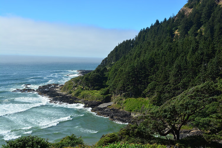
Cape Perpetua juts into the Pacific Ocean between Yachats and Florence. It is in Lincoln County on Oregon's central coast. Thor's Well lies in the northern part of the cape, on a flat basalt slab right at the water's edge. Two parking areas lead to it from Highway 101: a small one at Cook's Chasm and a larger one at the Cape Perpetua visitor center.
If you are driving from the south, look for Cape Perpetua Scenic Area signs. From the north, it is easier to turn toward the visitor center at 2400 Highway 101, Yachats (as of 09/2026, US Forest Service). From the visitor center parking lot to the well is about 1 km along a trail that follows the cliffs. The trails are open year-round, even when the building itself is closed.
Gateway to the underworld
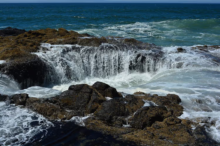
Thor's Well has a deceptive appearance. The slab looks solid until the tide covers it, and then a round mouth opens in the middle of the smooth basalt. That is why the place has been nicknamed the "Gateway to the Underworld" and "the hole the Pacific Ocean drains into." The sinkhole has no official name: Thor's Well is a nickname invented by photographers and guidebooks.
The mystique around the place has lasted longer than it should. Geologists described the mechanism long ago: it is the collapsed roof of a sea cave in the basalt slab. Water enters the sinkhole from below, through a channel from the ocean, rather than draining into a bottomless pit. There is no bottom in the usual sense, just a narrow passage into the surf. So tricks with a rope and a weight "to the bottom" prove nothing.
Next to Thor's Well on the same slab are three other well-known spots. Spouting Horn is a narrow crack from which water shoots out in a jet. Cook's Chasm is a long fracture in the rock, with a trail running along it. Devil's Churn is a large inlet at the cape where the sea rolls in with a roar. If you have half a day, walk to all four spots: they are within a kilometer of each other.
How Thor's Well works
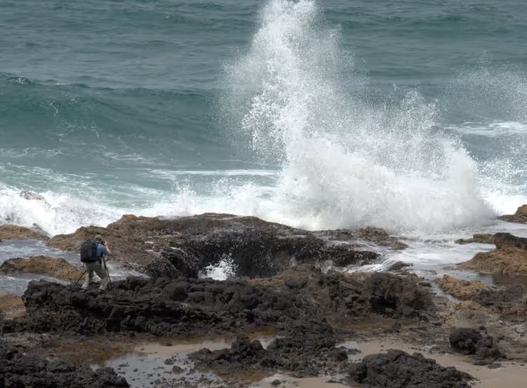
The sinkhole works simply. As the water rises, the channel fills, and the flow surges inward with a roar. As it recedes, the water drains back out, and the remainder shoots upward under pressure. The spray column rises several meters, higher in a storm. The sound is low, like a pipe, and can be heard from the parking lot.
 © John Fowler from Placitas, NM, USA · CC BYPhoto: John Fowler from Placitas, NM, USA, CC BY (https://creativecommons.org/licenses/by/2.0), Wikimedia Commons
To catch the peak, arrive early. Experienced observers recommend getting to the shore an hour before high tide and staying an hour after. The window is short: at low tide the sinkhole barely works, and you will see only wet rocks. The second rule: check the wave forecast, not just the water level.
The tide here changes twice a day; check the exact time on the NOAA forecast for the Yachats station. The difference between high and low water in this area reaches several meters. That is why the sinkhole looks different on every visit. In summer the tide is gentler. In winter the water arrives with force, and that is when the fountain is highest.
A dangerous spot on the shore
Thor's Well appears on lists of dangerous spots along the Oregon coast, and that is no exaggeration. The rocks near the sinkhole are almost always wet, and waves arrive in sets. Calm minutes are followed by a surge higher than the rest. These waves are called sneaker waves, and they have swept people into the ocean all along the western coast of the US.
The rules are simple. Do not approach the very edge of the sinkhole. Do not turn your back to the water, not even for a second for a photo. Hold children by the hand and do not leave them on the rocks near the edge. The rocks only seem dry until the next set of waves.
In winter, spray flies a dozen meters, and gear near the water falls into the ocean every season. Tripods, phones, backpacks: anything you set down near the edge risks being carried off by a wave. If you need a shot from above, go up to the cape's viewing platform. From there the sinkhole is fully visible and without risk.
Should you believe the legends
Thor's Well has a beautiful legend about a warrior in love, jealousy, and the god Thor turning blood into lava. That is folklore invented after the name. The Oregon coast has no connection to Norse mythology: Vikings never reached this far, their farthest camps remained in eastern Canada.
The real story is shorter. The sinkhole was carved out of the basalt by waves over thousands of years, and the name Thor's Well was cemented by guidebooks for dramatic effect. So do not look for traces of an ancient cult here. What you are seeing is geology, not a shrine, and that does not make the place any less fascinating.
The legend is still useful: it explains why people come to the sinkhole for the feeling, not just for photographs.
How to get there and when to visit
The easiest way is by car on Highway 101. There are no direct buses to the cape. From Yachats it is about 5 km south, from Newport about 40 km, from Florence about 50 km in the other direction. The road runs along the ocean, and the turnoffs to the slab are marked with signs.
If you fly through Portland, allow about 2.5 hours for the drive. Through Eugene it is about 1.5 hours. A rental car is more convenient: there are many stops along the shore, and buses along the coast run infrequently. You can compare rental options on DiscoverCars.
Come at high tide and with time to spare. The Cook's Chasm parking area has few spaces, and in summer it fills up by noon. Bring a windbreaker: the slab is always windier than in town. Fog rolls in suddenly and blocks the view within a couple of minutes. Check your day against the tide forecast in advance, not on the spot.
The best months for the show are late fall and winter, when storms approach the shore. In summer the tide is calmer, but the trails are dry and visibility is far. In any season, bring water: there is no cafe at the cape, and the nearest food options are in Yachats.
 © Joe Mabel · CC BY-SAPhoto: Joe Mabel, CC BY-SA (https://creativecommons.org/licenses/by-sa/4.0), Wikimedia Commons
Where to stay nearby
The most convenient places to spend the night are Yachats, Newport, or Florence. From Yachats it is a 10-minute drive to the cape, Newport has more hotels and an aquarium, and Florence is quieter and cheaper. If your route continues south, it makes more sense to base yourself in Florence. You can browse options on the Oregon coast on Trip.com.
Tours and tickets in Oregon
Guided tours, skip-the-line tickets and activities — most offers can be cancelled free of charge.
See offers on GetYourGuideThe widget loads once you give your consent.
⁉️🤔 Frequently asked questions
When is the best time to see Thor's Well?
Come at high tide: an hour before the water peaks and an hour after. Check the exact time on the NOAA forecast for the Yachats station. At low tide the sinkhole barely works, and in a storm the fountain is higher, but the shore becomes more dangerous.
Is there a ticket or entrance fee?
There is no separate ticket for the sinkhole, and no fee to view it. The trails and viewing platforms are open from dawn to dusk. For parking in the Cape Perpetua area, check the Forest Service website: some areas operate with a day-use pass.
Can you approach the very edge of the sinkhole?
No. The rocks are slippery, and waves arrive in sets. Stay back from the edge and keep children close. For a shot from above, there is a viewing platform on the cape.
How much time should you allow for the cape?
At least two hours: that is how long the window around high tide lasts. Add time for the walk from the parking lot and exploring the slab. If you want to visit Spouting Horn, Cook's Chasm, and Devil's Churn, set aside half a day.
What to see near Thor's Well?
At Cape Perpetua there is a viewing platform overlooking the coast, a visitor center with maps, and a trail to an old conifer forest. You can eat and stay overnight in Yachats, and Newport has an aquarium and a harbor nearby.
In short: what to book
The main thing for a trip to Thor's Well is not a reservation, but the tide time. Plan your day around high water, take a car, and do not leave parking until midday.
If you have one day: start from Yachats in the morning, catch the tide, and leave before the fog. If you are driving the entire coast: allow two nights so you can catch both the tide and the sunset, and avoid rushing on a wet highway.
Comparing rental cars is easier on DiscoverCars, and for hotels along the coast, check Trip.com.

A small editorial team writing guides for independent travel. We travel ourselves, but we haven’t been everywhere, so we check prices, opening hours and how to get there against official sources.