
















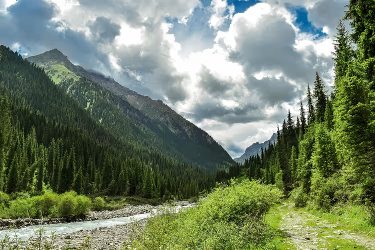
Tian Shan: 7 unique places for climbing and trekking
Tian Shan translates from Chinese as "heavenly mountains." The ranges of this system stretch across five countries: China, Kazakhstan, Kyrgyzstan, Tajikistan, and Uzbekistan. Here, glaciers, seven-thousanders, and a warm lake where people swim from June through August all sit side by side.
We picked seven places worth traveling to the mountains for. For each one, you'll find the elevation, the time needed for the ascent, and how to get there. Some spots are only accessible to mountaineers, while others can be done in a single day.
The entire system is divided into the Northern, Eastern, Southwestern, Inner, and Central Tian Shan. Let's start with the highest peak.
Ad: this article contains affiliate links. We earn a commission if you book through them, at no extra cost to you.
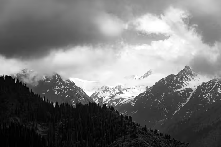
1. Peak Pobeda
💡 In short:
- Seven spots are spread across three countries: Kyrgyzstan, Kazakhstan, and Uzbekistan.
- The highest peak rises to 7,439 m; for beginners, Mount Patandazbashi at 1,823 m is a good fit.
- Route access and elevation data: as of 09/2026, verified on the Kyrgyzstan tourism portal.
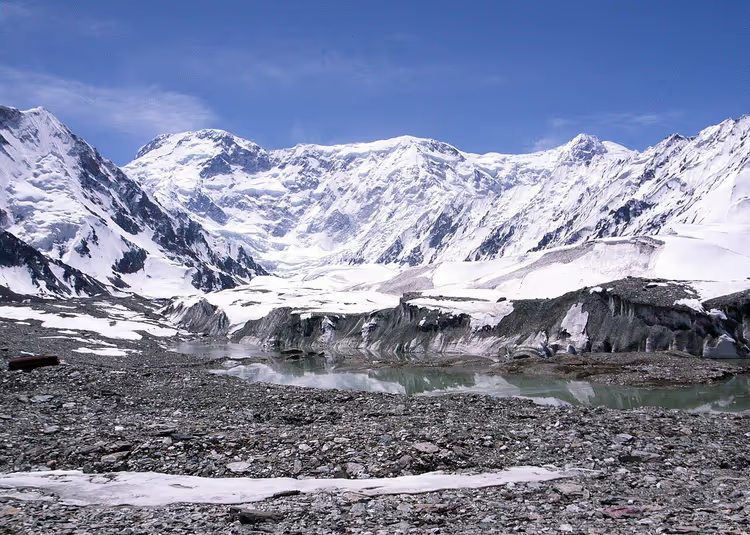
Peak Pobeda rises to 7,439 m and remains the highest point of the Tian Shan and Kyrgyzstan. It sits on the border between Kyrgyzstan and China's Xinjiang Uyghur Autonomous Region. The weather here is harsh: summit attempts get called off due to wind even in July. Without high-altitude experience, people don't go for this peak.
The route starts in Bishkek or with a transfer from Kazakhstan. From there, you travel to the village of Karkara on the Kazakh side, and then a helicopter drops you at the South Inylchek base camp at 4,000 m.
Plan on 30-40 days for acclimatization and the ascent, with 20-25 days spent adjusting to the altitude and 10-15 on the summit push itself. The peak is technically a seven-thousander, but in difficulty it's compared to eight-thousanders.
The climb goes in stages. After base camp, you spend nights at 4,200, 4,600, 5,300, 5,800, 6,400, and 6,918 m. Each camp is higher than the previous one and requires a day for adaptation.
Get your gear together in advance. You'll need a backpack of at least 80 liters, a sleeping bag rated to minus 30, a high-altitude tent, and boots with crampons. Bring carabiners, ice axes, harnesses, 10 rock pitons, 2 self-belays, 7 gas canisters, and a helmet.
 © Chen Zhao · CC BYPhoto: Chen Zhao, CC BY (https://creativecommons.org/licenses/by/2.0), Wikimedia Commons
2. Khan Tengri Peak
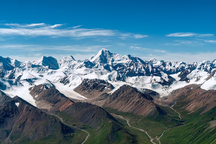
Khan Tengri rises to 7,010 m (as of 09/2026, peak description). The summit looks like a marble pyramid, which is why many call it the most beautiful peak among the seven-thousanders. The route starts in the same place as the one to Peak Pobeda, from the South Inylchek base camp.
 © Maryliflower · CC BY-SAPhoto: Maryliflower, CC BY-SA (https://creativecommons.org/licenses/by-sa/4.0), Wikimedia Commons
You pass the first and second camps following the familiar pattern. The second camp is reached at night, and the next night can be spent at the third camp at 5,800 m or lower down. Then you return to base camp and rest there for 2 days (according to the route breakdown).
The summit push from 5,800 m starts at midnight; from 6,400 m, it starts at dawn. After the summit, you descend first to 5,800 m, then to base camp. For the transfer from Bishkek, book a Kiwitaxi transfer in advance: the car is brought right to the arrivals terminal.
3. Mount Patandazbashi
If you have never been to the mountains, start with the Uzbek part of the system. In summer, Tashkent gets above 40 degrees, while at 1,823 m the air stays cool (according to the Uzbekistan tourism portal). A one-day trek to Mount Patandazbashi is manageable for a person of average fitness.
The climb starts from Ugam-Chatkal National Park, and the ascent takes about 4 hours on average (according to the park description). From the summit you get a panorama of the Charvak Reservoir, the Chatkal and Saymazar rivers, the mountains of Greater Chimgan, Paltau, Kungyrbuka, Aukashka, and Okhotnichiy Peak.
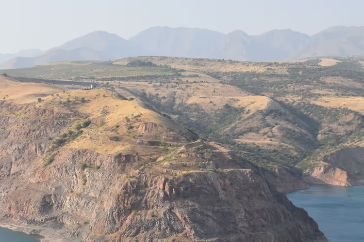
Pick a weekday morning, before the heat rises into the valley. That way you can descend before the worst of it and get back to Tashkent while it is still light.
4. Greater Chimgan Peak
Greater Chimgan rises to 3,309 m. This route is harder and suits hikers in good shape. Right after the start there is a steep climb, then a gentler section, and before the summit the slope becomes steep again.
You start from Ugam-Chatkal National Park, where you climb onto the ridge and follow it to the summit. Along the way you will see soaring eagles, flocks of sheep, and local wildlife. Before the final push, hikers take a break at the Grotto. The ascent usually takes 6 to 7 hours.
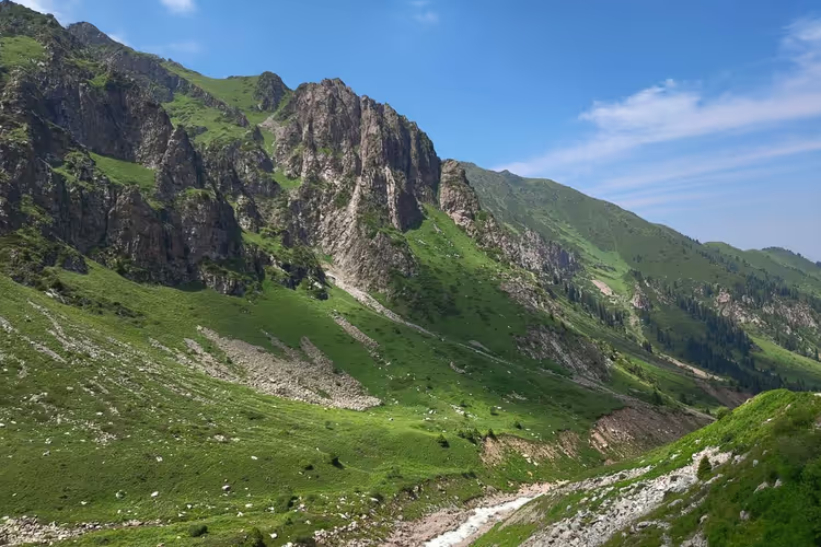
If you do not want to figure out the route on your own, check out day tours on GetYourGuide.
5. Mount Babaytag
Babaytag rises to 3,555 m and consists of several false summits (as of 09/2026, massif description). Nearby stands a peak locally called Shakhtyor at 3,100 m. The challenge is that there is no real trail: it appears and disappears, and the slope angle reaches 60 degrees in places.
The climb starts from the village of Yangiabad, where you first climb onto a mountain ridge and then walk along the crest near Mount Shakhtyor to the best viewpoints of the massif. The reward is a panorama of the Akhangaran River valley with its reservoir, the Kurama Range, Mount Kyzylnur, Greater Chimgan, Okhotnichiy Peak, and the Dzhekindek Gorge.
Besides Babaytag, the Uzbek part of the system is worth visiting for the Gulkam Gorge, the Aksarsay Waterfall, Lake Urungach, and the Kok-Su River (according to the Uzbekistan Tourism Committee). These are easy short day routes.
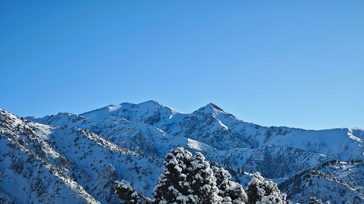 © Галиев Ярослав · CC BY-SAPhoto: Галиев Ярослав, CC BY-SA (https://creativecommons.org/licenses/by-sa/4.0), Wikimedia Commons
6. Pulatkhan Plateau
The Pulatkhan Plateau lies 11 km southeast of Greater Chimgan Peak. It is hard to reach, which is exactly why the place remains wild. The ascent takes about 3 days.
Along the way and on the plateau itself you will see eagles, vultures, mountain goats, and endemic Menzbier's marmots. The animals have riddled the slopes with burrows. Medicinal herbs grow here, and karst caves hide in the rock.
A legend about the treasures of the Pulat-khan cave is tied to the plateau. So far only one entrance has been found, which drops through vertical shafts to a depth of 500 m. An ordinary person cannot get in there, but the plateau itself is open to everyone.
The trek starts from the village of Gidzhal. From there you walk upstream along the Aksakata River through its confluence with the Nurekata, then along the Aksakata Gorge to the confluence with the Tekeli stream. After that the route follows the right tributary Karangur to the Aksakata Pass and below Karangur Peak to the source of the Karaarcha. The route ends with a radial out-and-back over Karangur Peak onto the plateau itself.
7. Lake Issyk-Kul
Issyk-Kul ranks first by area among Kyrgyzstan's lakes. The name translates as "hot lake," because the water in the basin does not freeze even in winter. The lake sits at an elevation of 1,608 m, and its depth reaches 668 m (as of 09/2026, lake description). By depth it ranks seventh in the world (according to the official portal of Kyrgyzstan).
The lake has two legends. The first tells of a powerful earthquake: a city sank completely underground, and the depression filled with water. The girls who had been gathering brushwood that day returned to the shore and wept for a long time for their loved ones, who had gone under the water together with their homes and streets. There were so many tears that the water became bitter and salty.
The second legend is about love. A ruler brought a beautiful girl to his palace by force, but she did not return his feelings and pined for a shepherd. From grief she threw herself out of a window, water came down from the mountains, flooded the palace, and a lake appeared in its place.
Swimming remains the main activity at the lake. The water can be both warm and cool, so the comfortable season lasts from June through August (according to the tourism portal of Kyrgyzstan). Book shoreline accommodation in advance: hotels on Issyk-Kul on Trip.com show prices and available dates.
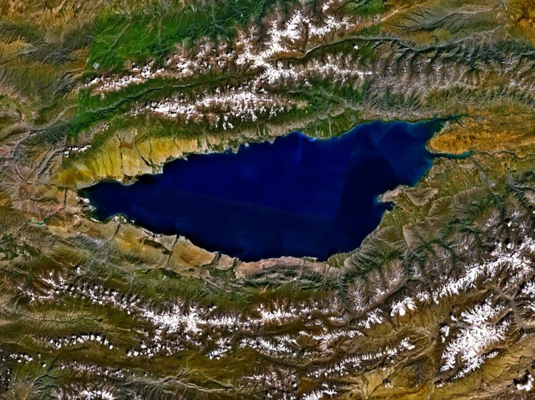
You cannot see the lake in one day. Plan for at least two or three days on the shore so you can combine swimming with short walks in the surrounding area.
Tours and tickets
Guided tours, skip-the-line tickets and activities — most offers can be cancelled free of charge.
See offers on GetYourGuideThe widget loads once you give your consent.
⁉️🤔 Frequently asked questions
When is the best time to go to the Tien Shan?
The season depends on the route. For trekking to Patandazbashi and Big Chimgan, the period from May through September works well, when the trails are free of snow (according to seasonal information for the Western Tien Shan). For climbing Peak Pobeda and Khan Tengri, the window is short: July and August. At Issyk-Kul, swimming is comfortable from June through August.
Do you need a guide for the seven-thousanders?
Yes, people do not go to Peak Pobeda and Khan Tengri without a guide. The routes cross glaciers, the altitude exceeds 7,000 m, camps sit as high as 6,918 m, and some sections are done at night (according to the peak description). You need acclimatization and high-altitude climbing experience, and adjusting to the altitude can take up to 25 days.
Can you climb Chimgan with children?
Patandazbashi, at 1,823 m with about 4 hours of ascent, is doable with school-age children (according to national park trail information). Big Chimgan at 3,309 m is harder: a steep climb, a sharp slope before the summit, and 6 to 7 hours on the trail (according to the Chimgan description). Take that route only if the children have already been in the mountains.
How do you get to Issyk-Kul?
The lake lies at 1,608 m in the northeastern part of Kyrgyzstan (according to the lake description). The most convenient option is to fly into Bishkek and drive or take a bus to the shore. Book accommodation in advance: in summer, places near the water go fast. The swimming season runs from June through August.
What should you bring for trekking?
For day hikes, a backpack, water, a hat, and a windbreaker are enough. On Babaytag and Pulatkhan the trail disappears, so bring trekking shoes and poles. For the seven-thousanders you need a high-altitude kit: a tent, a sleeping bag rated to minus 30, crampons, an ice axe, and a helmet (according to the gear recommendations).
In short: what to book
Pick a destination based on your fitness, not on pretty photos. The matrix by reader ability looks like this.
- If this is your first time: choose Patandazbashi, 1,823 m and 4 hours of ascent.
- If you are fit and like long trails: your option is Big Chimgan, 3,309 m and 6 to 7 hours.
- If you want the seven-thousanders: plan an expedition to Peak Pobeda or Khan Tengri a year ahead, with a guide and acclimatization.
- If you want a break by the water: choose Issyk-Kul from June through August.
It is easier to lock in travel and lodging ahead of time: compare tours on GetYourGuide and lakeside hotels for your travel dates.

A small editorial team writing guides for independent travel. We travel ourselves, but we haven’t been everywhere, so we check prices, opening hours and how to get there against official sources.