















5 Hiking trails of the world for those ready for risk
Five hiking trails in the world demand a cool head and solid preparation. Here, a mistake leaves almost no room for a second chance.
We've put together routes where weather, gear, and experience matter more than courage. For each trail, we've added practical details: how to get there, what to arrange in advance, and who should stay away.
Ad: this article contains affiliate links, we earn a commission if you book through them, at no extra cost to you.
Our picks: five trails and their main risk
💡 In short:
- All five routes require experience, gear, and dry weather.
- Book tickets and access to El Caminito del Rey in advance: entry is by time slot only.
- Prices and trail access: as of 09/2026, verified on the official Caminito del Rey website
First, compare the trails by type of risk. That way you'll understand which one you shouldn't start with.
# | Trail | Country | Format | Main risk |
|---|---|---|---|---|
1 | Huashan | China | suspended plank path near the summit | exposed rock section |
2 | Via Ferrata | Italy | cables and rungs on a vertical face | falling without self-belaying |
3 | Aonach Eagach | Scotland | narrow ridge with drops | no escape routes from the middle |
4 | El Caminito del Rey | Spain | boardwalk over a gorge | one-way route and time slots |
5 | Snowman Trek | Bhutan | 24 days and 11 passes (operator data) | altitude and weather |
1. Huashan, China
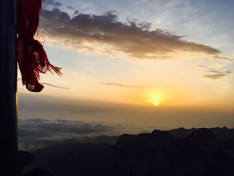 © 老张1613 · CC BY-SAPhoto: 老张1613, CC BY-SA (https://creativecommons.org/licenses/by-sa/4.0), Wikimedia Commons
Huashan, or "Splendid Mountain," is the westernmost of China's five Great Mountains. Its five peaks together form the shape of a flower, hence its folk name. The highest point, South Peak, rises to 2,154 meters (as of 09/2026, Huashan guide). Taoist temples stand on its slopes, so visitors include not only tourists but also pilgrims.
For centuries, monks carved trails to all five peaks. The most famous section is the "plank path": narrow boards attached directly to a sheer cliff. The dangerous stretch is about 100 meters long. Over time, safety cables and railings were added, but the exposed slope hasn't gone anywhere.
The number of deaths on the mountain isn't officially published, and the popular figure of "more than 100 per year" is unconfirmed. Treat it as legend, not statistics.
- Getting there: from Xi'an a high-speed rail line runs to the foot of the mountain, about 30 minutes (as of 2026, data).
- Access: you go up by cable car from the West or North Peak; entry and ascent are paid separately.
- Who it's for / Not for: for those who can stay calm at height; if you panic on narrow boards, don't go.
- The catch: in rain and snow the plank section is closed, so the trip depends on the weather.
2. Via Ferrata, Italy
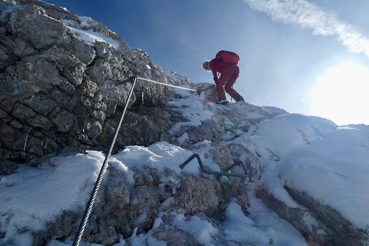 © Bruno Rijsman · CC BY-SAPhoto: Bruno Rijsman, CC BY-SA (https://creativecommons.org/licenses/by-sa/2.0), Wikimedia Commons
Via Ferrata translates from Italian as "iron path." It's a way to cross a vertical section using metal rungs, cables, and safety lines. These routes are not designed for the unprepared: without gear and technique, they are deadly.
Via ferrata has its roots in military history. In 1915-1918, Italian and Austro-Hungarian units drove the first cables and rungs into the limestone of the Dolomites to move soldiers and supplies along the vertical front line (route history). Today, those same lines have become sport routes.
Iron trails vary in length: from a few hundred meters to more than a kilometer. If you're a beginner, it makes sense to go with a guide who provides gear and leads the rope team.
- Gear: harness, helmet, via ferrata lanyards, gloves.
- Who it's for / Not for: for those who aren't afraid of heights; beginners only with a guide on a rope team.
- The catch: on difficult lines, rockfall is possible, so the helmet stays on.
3. Aonach Eagach, Scotland
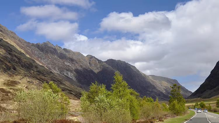 © Paul Hermans · CC BY-SAPhoto: Paul Hermans, CC BY-SA (https://creativecommons.org/licenses/by-sa/3.0), Wikimedia Commons
Aonach Eagach translates from Gaelic as "notched ridge." It is the narrowest mountain ridge on the British mainland (ridge data). The crest runs along the north wall of Glen Coe and includes two Munros: Sgùrr nam Fiannaidh at 967 meters and Meall Dearg at 952 meters.
The trail is less than ten kilometers long, but it takes a full day on your feet. The main challenge is Grade 2-3 scrambling, with sections that border on rock climbing (route description). You cross the narrow section one at a time, with no rope from above.
The main trap is that there is no escape route from the middle of the ridge (traverse tips). Some hikers turn back before even reaching the first summit. There have been fatal falls on the ridge, including group accidents.
- Route: two Munros along Glen Coe, usually in one long day.
- Difficulty: Grade 2-3 scrambling, climbing experience required.
- Who it's for / Not for: experienced hikers only; people without experience and a guide do not go there.
- The catch: there is no escape route from the middle of the ridge, so you have to complete the traverse.
4. El Caminito del Rey, Spain
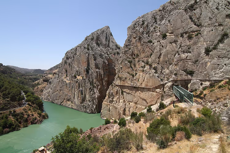 © Malopez 21 · CC BY-SAPhoto: Malopez 21, CC BY-SA (https://creativecommons.org/licenses/by-sa/4.0), Wikimedia Commons
El Caminito del Rey, or the "King's Little Path," hangs over a gorge in the province of Malaga. The boardwalk rests on brackets driven into the rock. In places it is about a meter wide, with the riverbed running below.
The trail got its name after a visit by King Alfonso XIII. It was originally built for dam workers. In the early 2000s the route was closed after accidents, and in 2015 it reopened with a new walkway and safety cables.
Today access is by time slots only. Tickets start at €10, and children under 8 are not allowed (as of 09/2026, tickets and rules). In high season you book a slot in advance: it runs from March through October.
- Tickets: check tickets and slots on Tiqets
- Getting there: from Malaga to El Chorro by train or car, about an hour.
- Who it's for / Not for: for people who are not afraid of heights; small children are not allowed.
- The catch: the route is one-way, so you have to return from El Chorro by transport.
5. Snowman Trek, Bhutan
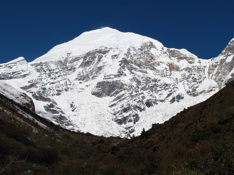 © Christopher Fynn · CC BY-SAPhoto: Christopher Fynn, CC BY-SA (https://creativecommons.org/licenses/by-sa/3.0), Wikimedia Commons
The Snowman Trek, or "Snowman Trail," runs through northern Bhutan along the border with Tibet. It is one of the most difficult treks in the Himalayas. Some settlements along the route are supplied only via this trail.
The trail is about 290 kilometers long, and the duration starts at 24 days (operator's description). Most of the route runs at altitudes between 4,000 and 5,332 meters, so acclimatization is essential. Eleven passes rise above 4,500 meters, and the weather can change within an hour.
You can only hike this route during a short autumn window. In winter, snow closes the passes. The trek is only permitted as part of a group and with a permit, so this trip is never cheap.
- Altitude: 4,000-5,332 meters, serious acclimatization required.
- Conditions: permit, licensed operator, and accompaniment are mandatory.
- Who it's for / Not for: only for experienced and well-prepared hikers; you can't go there solo.
- The catch: the weather window is short, and snow closes the passes even in summer.
⁉️🤔 Frequently asked questions
How dangerous are these trails really?
There is a fatal risk on all five routes, but it is manageable. On the via ferrata and Aonach Eagach it drops to almost zero with a guide and proper safety gear. On Hua Shan, weather is often the deciding factor, and on the Snowman Trek the main enemy is altitude and mountain sickness.
Do you need a guide on the via ferrata and Aonach Eagach?
Yes, a beginner should not go there without a guide. The guide provides a harness, helmet and via ferrata lanyards, leads the rope team and knows where to shelter from rockfall or bad weather. On Aonach Eagach there are no escape routes from the middle of the ridge, so a mistake costs far too much.
Can you do El Caminito del Rey without a reservation?
In high season, almost impossible. Entry is only available in timed slots, and in summer and on weekends places sell out in advance. Book through the official portal or a trusted seller.
What kind of fitness do you need for the Snowman Trek?
You need multi-day endurance and experience with high-altitude trekking. The route takes several weeks and crosses high passes. You build your fitness in advance, and the route is only done with an operator and a permit.
When is the best time to go to Hua Shan?
The dry months without summer heat are optimal. The plank section closes in rain and snow, so check the weather before you set off. A Tuesday morning is calmer than the weekend because the cable car queues are shorter.
In short: what to book
The five trails demand different levels of preparation, and it is better not to start with the hardest one. For a first experience, El Caminito del Rey is a better fit because it has a walkway and safety cables. Save Aonach Eagach and the Snowman Trek for later, once you have built up your fitness.
If you are short on time, go for El Caminito del Rey with a timed slot. If you have gear and experience, do a via ferrata in the Dolomites. If you are ready for a multi-day trek, plan the Snowman Trek months ahead.

A small editorial team writing guides for independent travel. We travel ourselves, but we haven’t been everywhere, so we check prices, opening hours and how to get there against official sources.