







Crete by rental car: 20 places, tickets and route around the island
The bus to Balos runs twice a day. That way you won't see even half of Crete. Public transport is tied to the north coast, while the most striking places lie away from the E75 highway.
With a rental car, you decide where to turn off to a beach and how long to spend at the ruins. Below we've gathered 20 places in Crete that are realistic to see behind the wheel, and laid them out along the route from Rethymno and Heraklion to Chania. Prices and opening hours were checked on official websites in September 2026.
Ad: this article contains affiliate links, we earn a commission if you book through them, at no extra cost to you.
Benefits of renting a car
💡 In short:
- The E75 highway runs along the north coast through Chania, Rethymno, Heraklion and Agios Nikolaos, and driving it is easy.
- South of the E75, narrow switchbacks and dirt roads begin, so allow extra time.
- Tickets and opening hours for the main sites: 09/2026, verified on the official portal of the Greek Ministry of Culture.
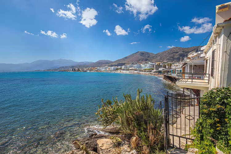
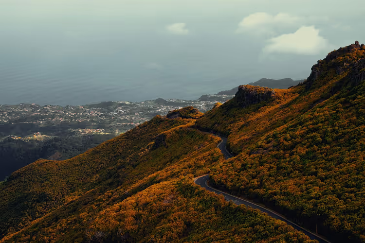
On Crete, the main road is the E75 national highway. It connects Chania, Rethymno, Heraklion and Agios Nikolaos. The surface is good and driving is comfortable. From Heraklion toward Messara, there are also European-standard highways. South of the E75, the roads are noticeably worse: narrow, winding, and partly unpaved. You should factor in road quality when planning a day's drive.
What a rental car gives you:
- Independence from schedules. You don't have to work around a sparse bus service.
- Your own pace. You decide how long to stay at the ruins and when to head down to the sea.
- Convenience with kids. The trunk fits water, umbrellas, mats and food, while on a bus you carry all of that in your hands.
- Flexible lodging. You can drive around the island and stay overnight in different towns instead of being based in one village.
When renting, read the contract carefully. Take full insurance and immediately note in the document every scratch and dent you spot during inspection. A small car will use less fuel. It's convenient to compare options on Discover Cars: the service shows the final price including insurance and delivers the car to the location you need.
Many people plan their route as a loop. They start in Rethymno, head south to monasteries and lakes, and return to the coast by evening. That way you cover both mountains and sea in a single day. Parking at monasteries and popular beaches is usually paid, so keep some change handy.
The island's main cultural sites are located far from public transport stops. Buses run there on a loose schedule, so getting there eats up a lot of time. With a car, you spend that buffer on sightseeing rather than waiting. From here we move along the E75: from Rethymno and Heraklion east to Agios Nikolaos and Sitia, then west to Chania.
Gas stations and cafes line the entire E75, but it's better to head onto dirt roads with a full tank.
Book hotels for your trip in advance, especially in Rethymno and Chania. The main rule behind the wheel on Crete: don't overestimate your daily mileage. Switchbacks in the south take twice as long as the map suggests.
Arkadi Monastery
 © Prekario · CC BY-SAPhoto: Prekario, CC BY-SA (http://creativecommons.org/licenses/by-sa/3.0/), Wikimedia Commons
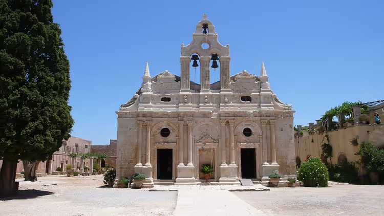
Arkadi Monastery sits in the mountains about 25 km from Rethymno (on the map). Drive toward Heraklion on the main highway. At the Tsesme Platania sign, turn onto the old national road and continue another 16 km. Past the village of Amnatos, Arkadi begins.
The monastery lies at an altitude of about 500 meters above sea level (on the map). The road twists, with climbs and descents, so watch for warning signs. Here you need calm driving, not speed.
The first monks settled in Arkadi as early as the 5th century, and the main buildings were constructed in the 16th and 17th centuries. A 15th-century church stands separately. But the place is known not for its architecture, but for a tragedy.
In 1866, an uprising against Ottoman rule broke out on Crete. The monks sheltered about 1,000 Orthodox Christians, soldiers and civilians. After three days of siege, the Ottomans broke into the monastery, and the defenders blew themselves up in the powder magazine along with the ammunition. Arkadi was declared a monument to Freedom, and after Greece gained independence, the buildings were restored.
Today you can see:
- The church with its double bell tower and a cypress altar from 1902.
- The refectory, where tables and benches hacked by Ottoman sabers still stand.
- A tree with a shell lodged in its trunk after the assault.
- The ruins of the powder magazine, now a small museum with a bullet-riddled door and part of a Gospel.
- The former windmill, where those who died in 1866 are buried.
- Outbuildings and monks' cells.
Under monastic rule, monks are forbidden to take up arms without the permission of a hierarch, so laypeople took part in the fighting. News of what happened at Arkadi strengthened the liberation movement across the island.
The monastery stands amid the mountains, and the road to it is already part of the experience. Stop at the viewpoint below the gate: from there the double bell tower is clearly visible.
Check the entrance fee on site. An hour is enough for a visit.
Kournas freshwater lake
 © Ιωσηφίνα Γεωργούλη · CC BY-SAPhoto: Ιωσηφίνα Γεωργούλη, CC BY-SA (https://creativecommons.org/licenses/by-sa/4.0), Wikimedia Commons
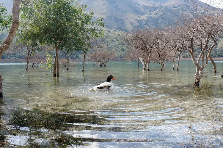
Kournas is the only freshwater lake on Crete that doesn't dry up in summer. It has been included in the list of protected natural areas. From Rethymno, drive toward Georgioupoli, then turn toward the village of Kournas.
The village has paid parking. Leave your car there and continue to the water on foot. Two springs feed the lake: one is always hidden, the other opens up in August when the water level drops.
It's at the end of summer that you can walk around the lake in a loop, about 3.5 km (on the map). The Almyros River flows out of Kournas and into the sea near Kavros. Its water is clean and clear.
The lake is shallow near the shore, but in the center it drops to more than 20 meters. Divers have plenty to see here: the water is blue and transparent. The shore is divided into two parts:
- A developed side, with loungers, umbrellas, boat rentals and cafes.
- A wild side, where birds nest and turtles crawl to the water at dawn.
Kournas formed when water filled a basin. It's an important freshwater reserve for Crete, which suffers from water shortages, which is why the lake was placed under protection.
The developed side is convenient with kids: the water entry is gentle.
On the wild side, don't step onto the white sand near the water. It's soft silt, and you can sink into it like a bog. The catch: the bottom near the shore is muddy, so wear water shoes for swimming.
In the village of Kournas itself, stop by the Byzantine church of Saint George. Local shops sell ceramics and souvenirs.
Kourtaliotiko gorge
 © logopop · CC BY-SAPhoto: logopop, CC BY-SA (https://creativecommons.org/licenses/by-sa/3.0), Wikimedia Commons
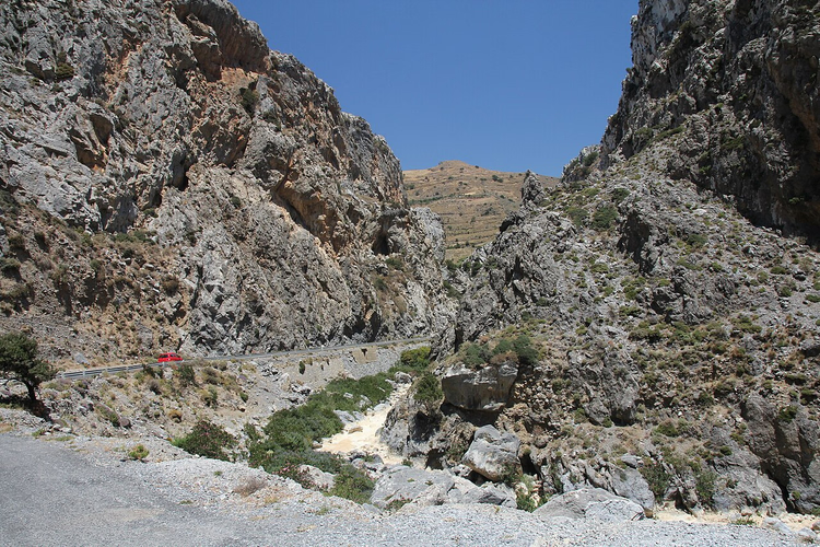
Kourtaliotiko lies about 25 km from Rethymno (on the map). You leave the E75 at the Spili sign heading south, drive through the village of Koxare, turn right at the Preveli sign and continue to Plakias. The gorge entrance starts here.
The place is narrow and shady. Water rushes below, while sheer cliffs close in overhead. The beauty is best viewed from two roadside viewpoints.
If you descend the stone staircase, you can fill up with ice-cold drinking water from the Big River. At the fork, keep left: the right branch leads to a pumping station. At the end of the descent stands the church of Saint Nicholas of Kourtaliotis.
The catch: the path is rocky and steep, so wear sturdy shoes in any season. Bring water, the climb back takes effort.
Preveli Monastery
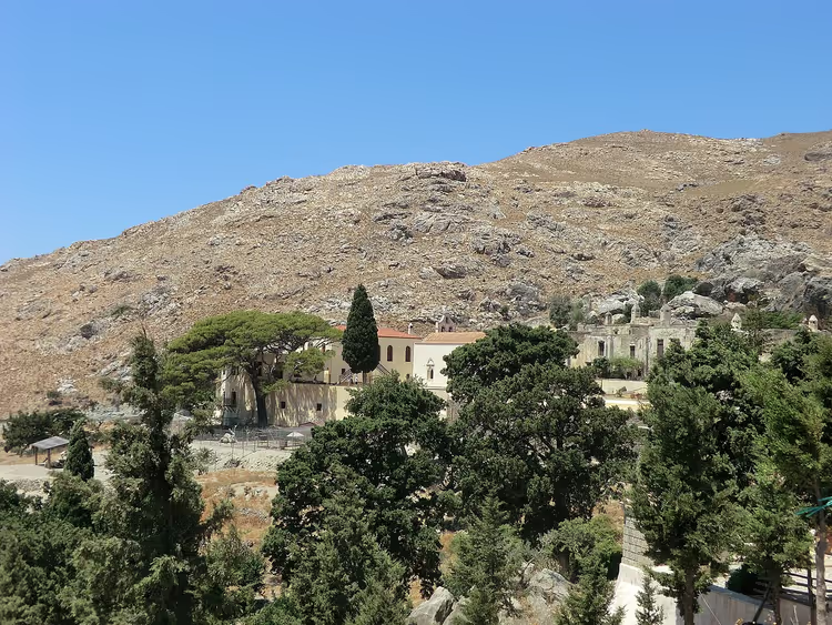
To reach Preveli, you'll drive about 32 km from Rethymno (on the map). The route is the same as to Kourtaliotiko: leave the E75 at the Spili sign, drive through Koxare and turn right at the Preveli sign. Parking at Kato Preveli is paid, and there's a small cafe nearby.
The monastery was founded in the 16th century, although the first hermits lived here as early as the 10th century. The wealthy Cretan Prevelis family donated funds for construction, and the first abbot came from that lineage.
The monastery was destroyed many times: five times by the Ottomans, and the last time by the fascists. A path descends from here to a bay, where ships once docked with weapons and the wounded.
The lower part, consecrated in honor of John the Baptist, suffered heavy damage. The upper part, dedicated to John the Theologian, was restored to a lesser extent and now houses three monks. A tour of the monastery takes just over an hour. Here you can venerate the miraculous cross of Ephraim of Preveli. The catch: some of the buildings still lie in ruins.
Preveli palm beach
 © Mihael Grmek · CC BY-SAPhoto: Mihael Grmek, CC BY-SA (https://creativecommons.org/licenses/by-sa/4.0), Wikimedia Commons
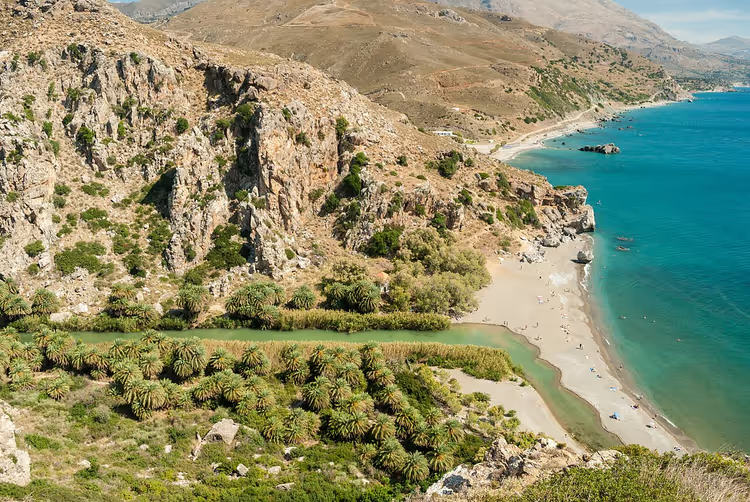
Preveli beach is also about 32 km from Rethymno (on the map). You leave your car in the paid parking lot at Kato Preveli and walk down a stone staircase. The descent is long, about a kilometer (on the map).
The beach got its name from the date palms that grew here without any human involvement. This is a protected natural area. The Megalopotamos River with fresh drinking water flows into the bay, so the Libyan Sea here is cleaner and cooler.
There is no typical tourist infrastructure, the only activity is catamaran rental. The catch: no sun loungers, umbrellas, or cafes, so you carry your own water and food.
Fortezza fortress
 © Jerzy Strzelecki · CC BYPhoto: Jerzy Strzelecki, CC BY (https://creativecommons.org/licenses/by/3.0), Wikimedia Commons
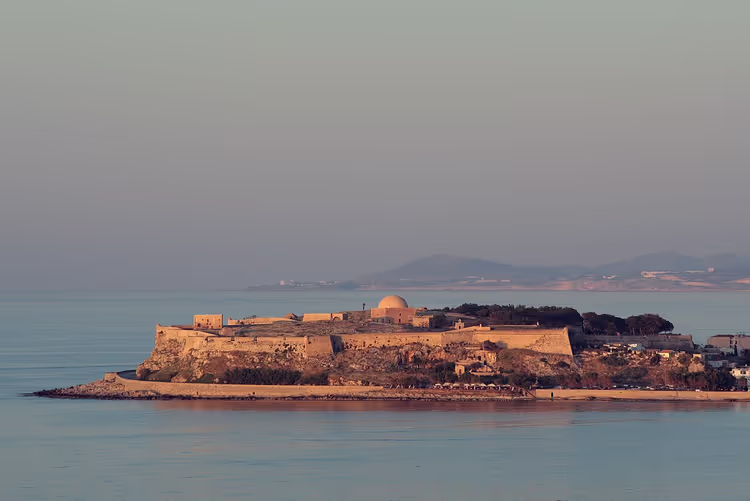
Fortezza stands in Rethymno at Leof. Emmanouil Kefalogianni, 27. Construction began in 1540, when merchants started settling in the convenient bay. The Venetians built it to defend against pirates, and later the Ottomans used the fortification.
Today you walk around the surviving walls and inner courtyards. The arsenal building hosts themed exhibitions. Admission is paid, check the exact price on site.
Knossos Palace
 © Александр Спиридонов · CC BYPhoto: Александр Спиридонов, CC BY (https://creativecommons.org/licenses/by/3.0), Wikimedia Commons
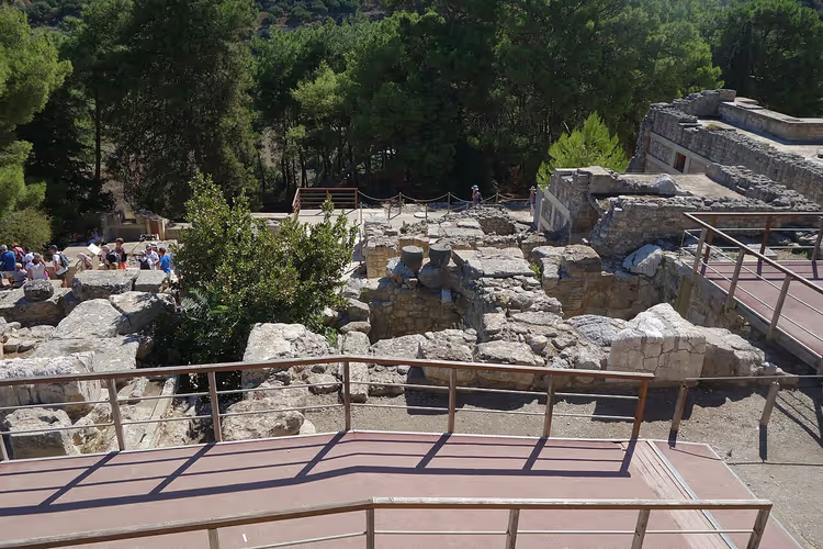
Knossos Palace lies less than 5 km from Heraklion (on the map), and getting here by car is easy. There is free parking near the entrance.
A ticket costs 20 €, reduced 10 € (as of 09/2026, official portal of the Greek Ministry of Culture). Buy tickets in advance, the line is long in summer.
The Minoans built the first palace around 2000 BC after a devastating earthquake. In the 16th century BC, nature destroyed it as well. The palace was forgotten for centuries.
In the late 19th century, Kalokairinos carried out the first excavations, and in the early 20th century Arthur Evans bought the land for large-scale work. Today you walk around a cleared area measuring 130 by 180 meters (as of 09/2026, palace description on the Ministry of Culture portal). There are more than a thousand rooms and confusing passageways. The ruins contained the labrys symbol, meaning labyrinth, so historians linked the site to the Minotaur's labyrinth.
The throne room, which could hold up to fifteen people at once, is well preserved. The walls are decorated with frescoes from 1700 BC depicting scenes from Minoan life. You can explore the palace on your own, with an audio guide, or on a tour from Heraklion.
Matala beach
Matala lies about 70 km from Heraklion (on the map). You drive along the E75 toward Gazi, turn south toward Tymbaki there, and in the village of Mires follow the sign to Matala. The road climbs into the mountains and descends into valleys, the drive itself is scenic.
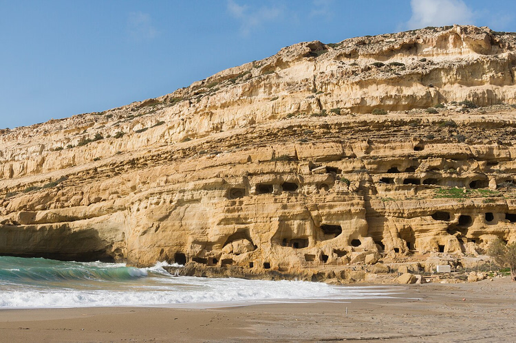
Matala is known for its sunsets: the sun sets directly into the Libyan Sea. The coastal cliffs are riddled with man-made caves.
In the mid-20th century, hippies from all over the world lived in these grottoes. Today you can visit the caves, but overnight stays are prohibited. Nearby stand a small church of the Blessed Virgin Mary and a cave that, according to legend, Brutus once entered.
In June the beach hosts the Matala Beach Festival, which runs for several days, so buy concert tickets in advance. Matala holds a Blue Flag. Infrastructure is well developed, and the village serves national and European dishes. The catch: in summer the beach is packed, so come early in the morning.
Archaeological museum of Agios Nikolaos
 © Tomisti · CC BY-SAPhoto: Tomisti, CC BY-SA (https://creativecommons.org/licenses/by-sa/4.0), Wikimedia Commons
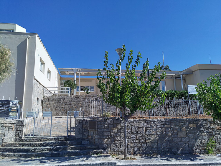
Agios Nikolaos is easy to reach from Heraklion via the E75 eastbound, about 63 km (on the map). The museum stands near the waterfront at Paleologou, 74.
The exhibition is new. Previously, finds were taken to the capital's museum in Heraklion, but storage space ran out, and a branch was opened here. You will see objects from the Neolithic to the Roman era, most in good condition.
Lake Voulismeni
 © Cayambe · CC BY-SAPhoto: Cayambe, CC BY-SA (https://creativecommons.org/licenses/by-sa/4.0), Wikimedia Commons
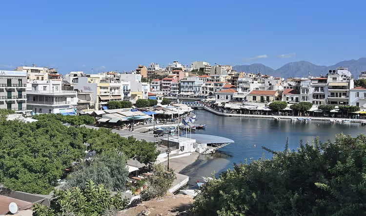
Voulismeni lies right in the center of Agios Nikolaos, 63 km from Heraklion (on the map). It is a freshwater body shaped like a saucer, less than 140 meters in diameter (on the map). Locals like to say it has no bottom.
This belief was disproved twice: first by Admiral Spratt in 1853, then by Jacques-Yves Cousteau in the 1980s. There is a bottom, with a depth of up to 64 meters (according to measurements). The water in the lake is almost black, cliffs surround it from the west, and cafes and small restaurants line the east side. The spot is convenient for memorable photos.
Cave of Zeus
 © Jerzy Strzelecki · CC BY-SAPhoto: Jerzy Strzelecki, CC BY-SA (https://creativecommons.org/licenses/by-sa/3.0), Wikimedia Commons
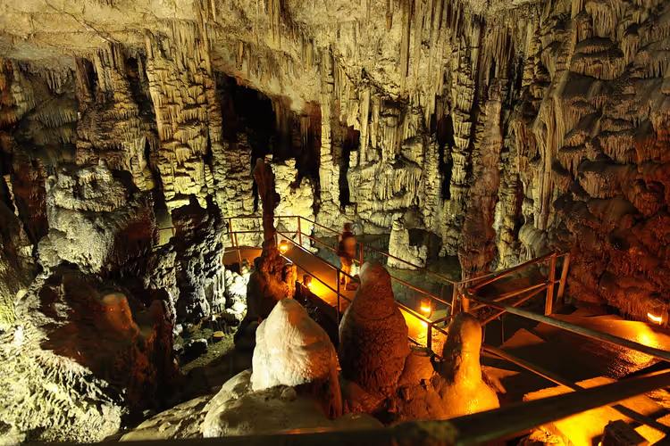
You drive to the cave from the E75 near Heraklion and turn southeast following the sign to Psychro. Past the village of Psychro, a winding dirt road heads west and ends at a parking lot. From there you continue on foot: the trail is steep, but there are benches in the shade for resting. For those completely exhausted, donkeys will carry you up to the cave.
The cave is located in the Dikti Mountains. According to legend, this is where Zeus was born. It was discovered in 1886 by Joseph Hatzidakis, and the artifacts found there were taken to the Heraklion museum.
The ticket costs 15 €, reduced 8 € (as of 09/2026, official portal of the Greek Ministry of Culture).
Inside, you are surrounded by stalactites and stalagmites, with metal staircases lit by colored lamps. The catch: the steps are slippery in places, so you need comfortable shoes. Near the exit there is a viewing platform overlooking the Lasithi Plateau.
Heraklion Archaeological Museum
 © Zde · CC BY-SAPhoto: Zde, CC BY-SA (https://creativecommons.org/licenses/by-sa/4.0), Wikimedia Commons
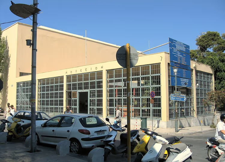
The exhibition is located in central Heraklion at 1 Xanthoudidou Street. The museum was founded by Joseph Hatzidakis, and the building was erected directly on the ruins of a temple destroyed in an earthquake. You can see part of the ancient masonry in the courtyard.
The permanent exhibition occupies 20 halls. It brings together finds from all over Crete: from the first settlements to Roman Greece. There is a separate section for jewelry and ceramics, and the main exhibit is the Phaistos Disc with impressions on both sides.
In winter the museum operates on a shorter schedule, and from late April to late October it is open until late evening. Check the price and exact hours on the museum's official website before your trip.
Vai Beach
 © Mihael Grmek · CC BY-SAPhoto: Mihael Grmek, CC BY-SA (https://creativecommons.org/licenses/by-sa/4.0), Wikimedia Commons
Getting to Vai is not easy even by car. From Heraklion you head east on the E75 to Agios Nikolaos. After that the road becomes narrow and winding. You drive to Sitia, and then about another 29 km on a dirt road (according to the map). In total, it is about 150 km from Heraklion (according to the map).
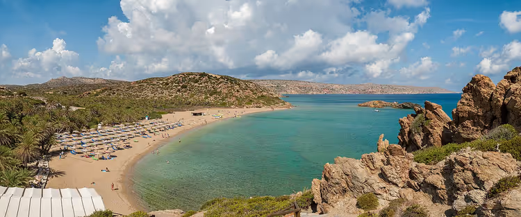
There is an organized parking lot near the beach and an unofficial but free one. The beach itself has been awarded the Blue Flag: white sand, a palm grove, and a gentle entry into the water. The sand is interspersed with slippery rocks, so enter carefully. The sea water is warm.
The infrastructure is decent: loungers and umbrellas for rent, wooden walkways, free changing cabins and showers. The catch: there are a lot of visitors, so arrive early. Setting up tents and staying overnight is prohibited, as this is a protected natural area.
Sunken City of Olous
To reach Olous, you drive east from Heraklion on the E75 to Agios Nikolaos, then take Route 90 and head north to Pissidos, and from there to Elounda. The sunken city lies in the very center of Elounda, near the square on Mirabello Bay.
It was once a prosperous city-state. It traded with its neighbors and minted its own coin. Scientists do not know exactly why Olous sank. The remains of the buildings were found in 1960 by Anastasios Orlandos.
In calm weather you can make out the underwater walls right from the shore, and some of them can even be walked on. Divers can see entire houses during a dive.
Ancient City of Gortyna
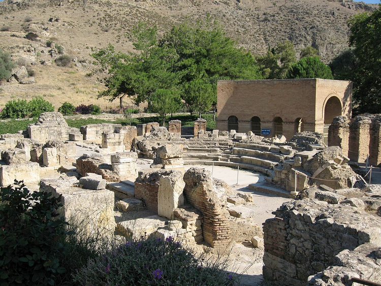
Gortyna is most convenient to visit from Heraklion. From the E75, turn south following the sign to Mires and drive to the town of Agioi Deka. The ancient city begins right after it.
 © Olaf Tausch · CC BY-SAPhoto: Olaf Tausch, CC BY-SA (http://creativecommons.org/licenses/by-sa/3.0/), Wikimedia Commons
It was once a wealthy city-state with its own coin. After the Christianization of Greece, Gortyna was the capital of Crete for a thousand years. The city was destroyed in an earthquake.
Today the ruins lie on both sides of the highway, spanning about 10 km in diameter (according to the map). Opening hours vary by season; check the current schedule on the official portal of the Greek Ministry of Culture. Near the Cathedral of Saint Titus, the walls of the city's ruler, the praetor, have been preserved.
Historical Museum of Crete
 © Lourakis · CC BY-SAPhoto: Lourakis, CC BY-SA (https://creativecommons.org/licenses/by-sa/4.0), Wikimedia Commons
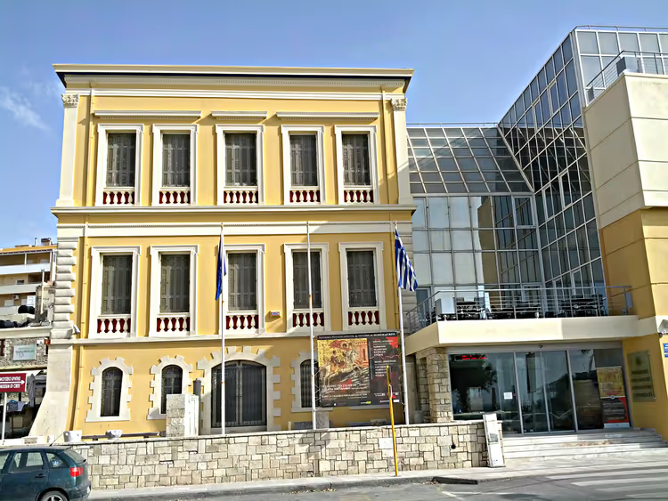
The museum occupies a building in Heraklion at 27 Sofokli Venizelou Ave. The exhibition opened in 1953. Today it houses important artifacts from all over the island.
You walk through the halls in chronological order: from the first settlements to World War II. There are interactive models that are easy for children to understand.
Koules Fortress
 © Γεώργιος Γιαννόπουλος · CC BY-SAPhoto: Γεώργιος Γιαννόπουλος, CC BY-SA (https://creativecommons.org/licenses/by-sa/3.0), Wikimedia Commons
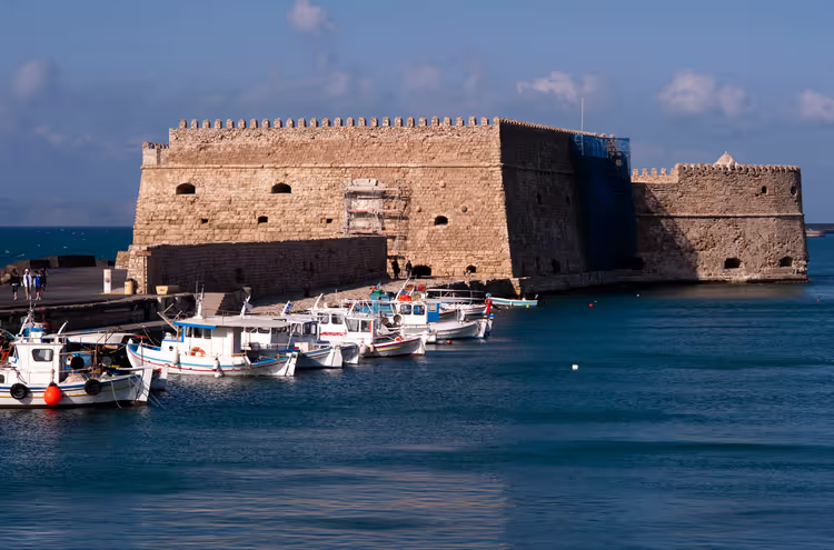
Koules stands in Heraklion right by the port and is one of the city's symbols. The Byzantines began building the fortress, the Venetians continued it, and the Ottomans finished it. The fortress walls vary in thickness: the outer walls are more massive than the inner ones.
The permanent exhibition is small: cannonballs, cannons, and edged weapons. The fortress hosts themed exhibitions, and concerts are held on the open terrace in summer. Admission is paid; check the exact schedule on site.
Balos Bay
 © Sergio Alvarez · CC BY-SAPhoto: Sergio Alvarez, CC BY-SA (https://creativecommons.org/licenses/by-sa/2.0), Wikimedia Commons
Balos lies about 50 km from Chania (on the map). Drive toward Kissamos, then follow the sign to the village of Kaliviani. 2 km after leaving the village, a dirt road begins: narrow and 8 km long (on the map). You drive along it at 12-15 km/h until you reach a small parking lot. From there you walk down a trail to the bay.
Cape Tigani and the uninhabited island of Imeri Gramvousa shelter Balos from wind and waves. The sea here is calm and clear, and the water changes color.
The main surprise is the Balos lagoon. It was formed by two sandbars between Cape Tigani and the Gramvousa peninsula. The lagoon is shallow, the water is always warm and calm, and both children and adults enjoy swimming here.
The bay is a national reserve, so infrastructure is minimal. The catch: the last 8 km are on a dirt road, so check your insurance before the trip. It may not cover damage on this kind of road.
Elafonisi Beach
 © dronepicr · CC BYPhoto: dronepicr, CC BY (https://creativecommons.org/licenses/by/2.0), Wikimedia Commons
Elafonisi has been awarded the Blue Flag. It lies 75 km from Chania (on the map); drive via Kissamos. The highway ends at an informal parking area, so arrive early: finding a spot is difficult. A gentle descent leads to the beach, but the road is mountainous, with sharp turns and climbs.
Plan your timing precisely. All beach services, including the lifeguard service, stop working at 6:00 PM. If you stay late, there will be nowhere to get help.
Elafonisi is separated from Crete by an underwater isthmus 100 meters long (on the map), which is easy to wade across. The sand here is pink, a color produced by particles of coral and shells. Taking sand with you is prohibited.
The sea is warm and clean, and in places the depth barely reaches half a meter. Infrastructure is good: showers, toilets, changing cabins, a small cafe, and sports equipment rental. Elafonisi is a protected area home to rare plant and animal species, so follow the rules.
There is plenty to see nearby as well. In the Topolia Gorge, along which the road runs, there is the Cave of Saint Sophia. An icon that survived the fall of Constantinople was found there. 5 km from the beach stands the rock monastery of Chrysoskalitissa, founded in the 17th century. A staircase of 90 steps leads up to it, and the terrace offers a panorama of the Libyan Sea.
Maritime Museum
The Maritime Museum occupies a building in Chania at 21 Halidon Str. The building is visible from various points in the city. The exhibition tells the story of shipbuilding on the island and local traditions.
You start with the section on Crete's union with Greece in 1913. Next come finds from shipwrecks, sailors' household items, and ship models. The displays are interactive. In the museum's branch at the docks of the Venetian harbor, full-size ships reconstructed from old engravings are on display. The equipment is functional and can be touched and turned.
Crete driving route on the map
Below is a map with the points we covered above. Open it on your phone and plan your day at your own pace.
Road trip route around Crete
Places on the map
- 1Arkadi Monastery Monastery with the 1866 tragedy, church with a double bell tower
- 2Lake Kournas Crete's only freshwater lake that never dries up
- 3Kourtaliotiko Gorge Narrow shady gorge with sheer cliffs and a spring
- 4Preveli Monastery 16th-century monastery, destroyed many times by Ottomans and fascists
- 5Preveli Palm Beach Beach with wild date palms at the mouth of the Megalopotamos river
- 6Fortezza Fortress Venetian fortress from 1540 in Rethymno
- 7Palace of Knossos Minoan palace with a throne room and frescoes, legend of the labyrinth
- 8Matala Beach Beach with cave-rocks once home to hippies, Blue Flag
- 9Archaeological Museum of Agios Nikolaos Branch of the Heraklion museum, finds from the Neolithic to Roman era
- 10Lake Voulismeni Freshwater lake in the centre of Agios Nikolaos, up to 64 m deep
- 11Cave of Zeus Cave in the Dikti mountains, said to be Zeus's birthplace
- 12Heraklion Archaeological Museum The Phaistos Disc and finds from across Crete in 20 halls
- 13Vai Beach Beach with a palm grove and Blue Flag on the east of the island
- 14Sunken city of Olous Underwater walls of a city-state in the Bay of Mirabello
- 15Ancient city of Gortyn Ruins of Crete's former capital on both sides of the highway
- 16Historical Museum of Crete Artefacts from the earliest settlements to World War II
- 17Koules Fortress Fortress at the port of Heraklion, built by Byzantines and Venetians
- 18Balos Lagoon Lagoon with three seas and an 8 km dirt road from Kissamos
- 19Elafonisi Beach Pink sand and shallow water, protected area near Chania
- 20Maritime Museum of Crete History of the island's shipbuilding, full-size ships
The north is fast, the south is slow. Allow one day for one side of the island; otherwise all your time will be spent on the road.
Find hotels
Compare prices across booking sites and filter for rooms with free cancellation.
Compare prices on Discover CarsThe widget loads once you give your consent.
⁉️🤔 Frequently asked questions
How many days do you need to drive around Crete?
To see the 20 places from this article, allow at least a week behind the wheel. The E75 highway is fast, but descents to the south take time. In a day you can realistically cover two or three sites if you want not just to reach them but also to look around.
Do you need an SUV for Balos and Elafonisi?
The last 8 km to Balos are on a dirt road, but in summer regular cars can handle it at 12-15 km/h. An SUV is more comfortable but not required. A highway leads to Elafonisi, so a regular car is enough there. The road is mountainous, with sharp turns, so drive calmly. The main thing is to check your insurance: not all policies cover damage on dirt roads. After rain, these sections are noticeably harder.
Where do you park in Heraklion and Chania?
In central Heraklion and Chania, parking is paid and full during the day. Leave your car at the hotel parking lot and walk. There is parking near the Palace of Knossos and most museums. Do not drive into the old town; the streets there are narrow and have no free spaces.
Can you see Crete by car in one day?
In one day you can cover only one area. Either Heraklion with the Palace of Knossos and the museum, or Rethymno with Arkadi, Kourtaliotiko, and Preveli. A trip across the whole island to Elafonisi will take a full day without stops. Divide Crete into two or three areas.
When should you go to avoid crowds?
In May, June, and late September there are fewer people, and the sea is already warm. In July and August it is hot, and Balos, Vai, and Elafonisi are crowded; arrive at opening time. Keep in mind that beach services run until 6:00 PM, so plan your return in advance.
In short: what to book
If you are going for a week: use Heraklion as your base and rent a car for three or four days; that is enough for the Palace of Knossos, Arkadi, Kournas, and Preveli. If you are drawn to the pink sand: stay in Chania, and from there one day goes to Elafonisi and Balos. If you are traveling with children: choose Kournas, Matala, and Voulismeni instead of the steep switchbacks in the south.
Book your car in advance and check the insurance. Hotels in Rethymno and Chania sell out quickly in summer.
Find Crete hotels on Trip.com · Tours and tickets on GetYourGuide

A small editorial team writing guides for independent travel. We travel ourselves, but we haven’t been everywhere, so we check prices, opening hours and how to get there against official sources.