













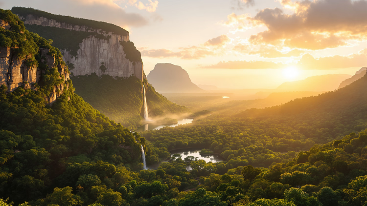
 AIIllustrative image: AI-generated
Canaima and Angel Falls: tepuis, the road and what to see in the park
Venezuela is known for the Caribbean, but its greatest wonder is hidden in the jungle. Canaima National Park covers 30,000 km² in the southeast of the country, near the borders with Brazil and Guyana (as of 09/2026, official UNESCO data). Inside stand the flat-topped tepui mountains, and from one of them falls Angel Falls, 979 m high.
There are almost no roads here. The nearest major city is over a hundred kilometers away, so you get here by small aircraft and by river canoe. Canaima remains one of the most inaccessible natural attractions on the planet.
The park is known for its tepuis, the waterfall, and the way of life of the Pemón people. Below we'll look at what to see inside, how to arrange the flight, and how much time to allow for the journey.
Ad: this article contains affiliate links, we earn a commission if you book through them, at no extra cost to you.
Where Canaima National Park is located
💡 In short:
- The park lies in southeastern Venezuela, in Bolívar State, near the borders with Brazil and Guyana.
- Area of 30,000 km², UNESCO World Heritage status since 1994.
- Main attractions: tepuis, Angel Falls, rivers, and the way of life of the Pemón people.
- Park and waterfall data: as of 09/2026, verified on the official UNESCO website.
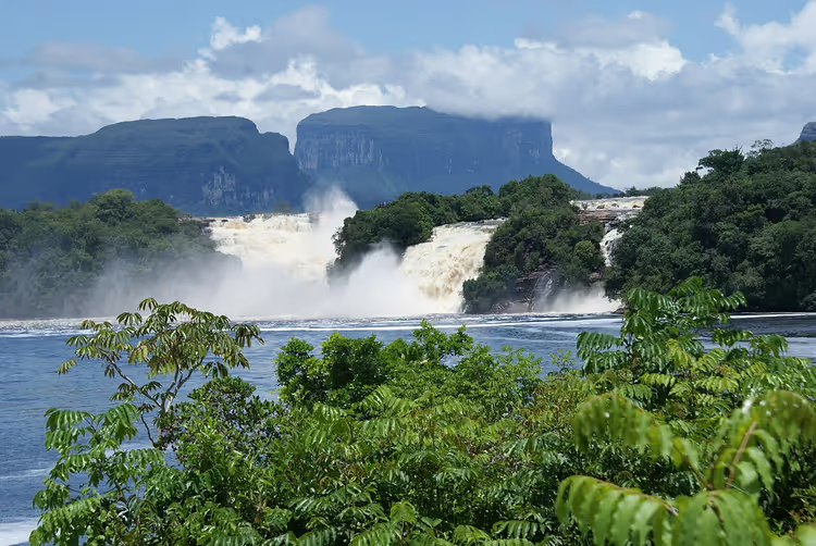
Canaima is located in Bolívar State and almost exactly follows the boundaries of the Gran Sabana region (as of 09/2026, site listing on the UNESCO website).
The area was placed under protection in 1962, and in 1994 UNESCO added it to the World Heritage list (as of 09/2026, World Heritage registry). About 65% of the area is covered by flat-topped tepui mountains. Major cities are far away, so the park has kept its pristine appearance.
 © Tyraelux · CC BY-SAPhoto: Tyraelux, CC BY-SA (https://creativecommons.org/licenses/by-sa/3.0), Wikimedia Commons
You can also get here on foot across the savanna. The long journey explains why you won't encounter crowds of tourists in the park.
Attractions: the tepui table mountains
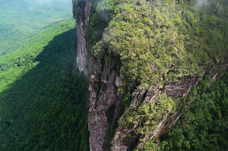
The main attraction of Canaima is the flat-topped tepui mountains. The Pemón people call them the "home of the gods." There are about a hundred such mountains in total, each rising hundreds of meters above the jungle.
 © Jorge Paparoni · CC BY-SAPhoto: Jorge Paparoni, CC BY-SA (https://creativecommons.org/licenses/by-sa/3.0), Wikimedia Commons
The tepuis are sandstone in composition and very ancient. They formed when South America and Africa were parts of a single supercontinent. The summits resemble truncated pyramids, and the slopes are almost vertical. Such mountains exist nowhere else in the world.
The tallest are Roraima and Auyán-tepui. Explorer Robert Schomburgk's expedition to Roraima inspired Arthur Conan Doyle's novel "The Lost World." Read about the mountain itself in our article: Mount Roraima.
You approach Roraima from many kilometers away. Because of its height, the mountain gathers moist air masses, so its summit is almost always covered by a cloud, and thunderstorms are frequent here.
Angel Falls
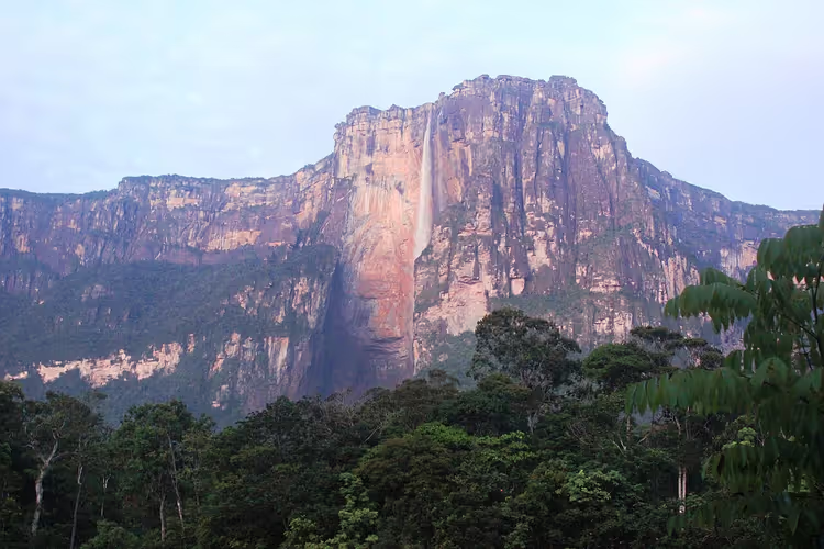
Angel Falls remains the park's most recognizable landmark. Its total height is 979 m, with an uninterrupted drop of 807 m (as of 09/2026, Britannica). It is the tallest uninterrupted waterfall in the world.
 © Sinfinitu · CC BYPhoto: Sinfinitu, CC BY (https://creativecommons.org/licenses/by/3.0), Wikimedia Commons
The falls were named after the American aviator James Angel. In the 1930s, his plane got stuck on the Auyantepui plateau, and the crew spent several days making their way out of the jungle (as of 09/2026, Wikipedia). News of the flight spread around the world, and the waterfall was named after him.
Below, the falls collect into cool lagoons at the base. The park's major rivers, the Churun, Carrao, Caroni, and Yuruani, hold large reserves of fresh water. The Caroni River is darker than usual because of humic acids from decaying organic matter, which is why it is called a "blackwater" river, like Brazil's Rio Negro.
Nature: flora and fauna
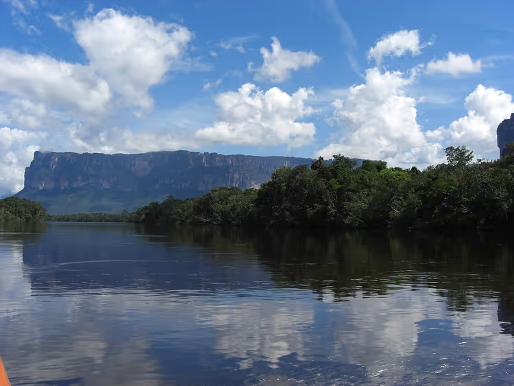
Canaima sits at the transition from lowlands to mountains. Savannas spread out at the foot of the tepuis, while evergreen forests grow on the slopes. This mix of habitats produces exceptional species diversity.
 © Diego Delso · CC BYPhoto: Diego Delso, CC BY (https://creativecommons.org/licenses/by/3.0), Wikimedia Commons
The park is known for endemic plants found nowhere else. Orchids are the most numerous: high temperatures and humidity create ideal conditions for them. Mosses and lichens grow on rocks and tree trunks, and the carnivorous sundew Drosera roraimae appears in damp areas.
The wildlife is typical of Venezuela's foothills: agoutis, tapirs, jaguars, peccaries, pumas, and caimans. Birdwatchers spot owls, parrots, and hummingbirds here.
The Pemon: Canaima's indigenous people
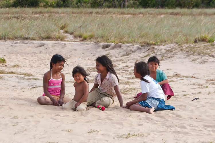
The historical homeland of the Pemon people lies right here. For them, the tepui mountains are sacred, considered places of power. The Pemon work as guides in tourism because they know the park's trails and rivers well.
 © Paolo Costa Baldi · CC BY-SAPhoto: Paolo Costa Baldi, CC BY-SA (https://creativecommons.org/licenses/by-sa/3.0), Wikimedia Commons
Rock inscriptions show that the people have lived here for a very long time. They practice gathering, hunting, and small garden plots where they grow fruits and vegetables. Additional income comes from building huts in the traditional style: visitors pay to stay overnight in them.
Some communities live in isolation. Children do not attend school, there is no electricity, and people rely on traditional remedies instead of modern medicine. This way of life has persisted precisely because of the park's remoteness.
How to get to Canaima
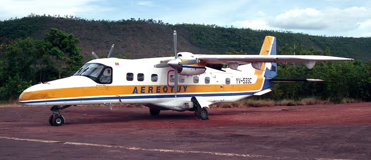
Most visitors fly into the village of Canaima on small aircraft from Caracas, Ciudad Bolivar, or Puerto Ordaz.
 © Steve Knight from Halstead, United Kingdom · CC BYPhoto: Steve Knight from Halstead, United Kingdom, CC BY (https://creativecommons.org/licenses/by/2.0), Wikimedia Commons
From the village, you travel by canoe along the rivers to the base of Auyantepui. Hiking across the savanna is also possible, but it takes time and requires good preparation. For unprepared travelers, such a route is dangerous.
Several camps inside the park accommodate tourists. The best-known camps are called Parakaupa Camp Lodge and Arekuna Camp Lodge. They look like small palm-thatched huts and blend well into the landscape.
The usual route to the falls is done as part of an organized group with a Pemon guide. Overnight stays are mostly in hammocks under mosquito nets at a riverside camp. To see Angel Falls from the water, you need a separate trip up the river, and it depends on the water level that season.
- Who it's for: you love wild nature and don't mind a long journey.
- Not for: you want a comfortable poolside vacation without any travel between places.
- The catch: the trip is expensive and long, and you can't see the park in one day.
Organized tours to the falls should be booked in advance: Angel Falls tours on GetYourGuide.
Tours and tickets in Canaima
Guided tours, skip-the-line tickets and activities — most offers can be cancelled free of charge.
See offers on GetYourGuideThe widget loads once you give your consent.
Canaima National Park on the map
The park is enormous, and the map shows how far it lies from major cities. Below is an interactive map with the park boundary and the area around Angel Falls.
Canaima National Park
Places on the map
- Canaima National Park 30,000 km² in southeastern Venezuela, tepuis and Angel Falls
⁉️🤔 Frequently asked questions
When is the best time to visit Canaima?
To reach Angel Falls itself by canoe, choose the rainy season with high water. Rain falls almost every day at that time. The dry season runs roughly from December to March, with less rain. But river levels are lower then, and canoes sometimes can't reach the falls. In that case, you view Angel Falls from a lookout point.
How many days do you need for the trip?
The classic route takes 3 days and 2 nights. In that time, you can see Canaima Lagoon, the waterfalls, and make it to the base of Auyantepui. If you want to add Roraima, plan for at least 6-7 days including travel.
Can you visit the park independently?
Technically yes, but in practice almost everyone goes with a tour. Charter flights to the village fill up with groups, and without a guide it's easy to get lost among the river channels. An organized group also solves the question of lodging and meals at the camp.
Bring light clothing and a rain jacket, insect repellent, sunscreen, and a flashlight. You need closed, non-slip shoes because the rocks near the falls are wet. A small backpack is more convenient than a suitcase, since part of the route is by canoe.
Do you need a visa for Venezuela?
Entry rules have changed in recent years, so check them in advance on the official website of your country's foreign affairs agency. Your passport must be valid for several months after the trip. Flights and accommodation are easier to book together with a tour.
In short: what's worth booking
Canaima is known for its tepuis, Angel Falls, and the way of life of the Pemón people. The trip takes at least three days, and almost all of that time is spent in transit: plane, canoe, savanna.
If you have 3-4 days, take the classic route to Canaima Lagoon and the falls. If you're drawn to the mountains, add Roraima as a separate tour. If time is short, book seats on a charter flight in advance so you don't have to work around the schedule.
A suitable tour for this trip: see tours on GetYourGuide.

A small editorial team writing guides for independent travel. We travel ourselves, but we haven’t been everywhere, so we check prices, opening hours and how to get there against official sources.