













Mount Roraima: trek to the tepui plateau, season and park rules
Venezuela hides a mountain in its south that stands apart from all its neighbors. Roraima reaches 2,810 m above sea level, and its walls rise 400-1,000 m above the savanna. The flat plateau lives its own life in the clouds (according to Wikipedia, 09/2026). You can only get there on foot, and climbing without a guide is prohibited.
Black-and-pink rocks, rivers with quartz beds, and pools of a rare pink color: you won't find this landscape anywhere else. The route to the summit is organized by Pemon communities, and groups spend the night right on the rock.
In short: the trek starts in the village of Paratepui, lasts 6-8 days, and requires a permit for the national park (according to the operator, 09/2026). Porters carry food, tents, and gear. The best window for the climb runs from December to April: fewer clouds, lower water in the rivers.
Ad: this article contains affiliate links, we earn a commission if you book through them, at no extra cost to you.
Roraima: what kind of mountain it is
💡 In short:
- Roraima stands in southeastern Venezuela, in Canaima National Park.
- The massif lies at the junction of Venezuela, Brazil, and Guyana: the highest point is 2,810 m, the plateau area is 31 km² (according to Wikipedia, 09/2026).
- Climbing is allowed only with a licensed Pemon guide and an Inparques permit.
- The trek from Paratepui takes 6-8 days, with groups spending nights in tents and under rock overhangs (according to local operators, 09/2026).
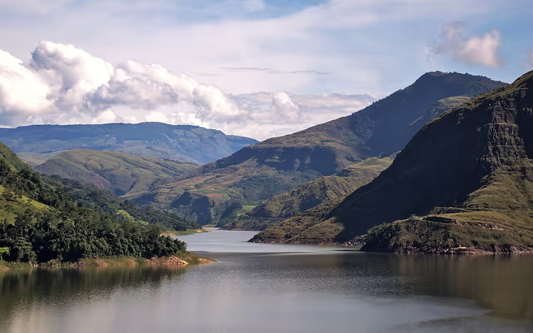 © Davevzla · CC BY-SAPhoto: Davevzla, CC BY-SA (https://creativecommons.org/licenses/by-sa/4.0), Wikimedia Commons
Geologists call mountains with flat tops and sheer walls table mountains. On the Guiana Shield, such plateaus carry the indigenous name "tepui," and Roraima is among the highest of them. The walls rise 400-1,000 m above the savanna, while the surface stays as flat as a table (according to Wikipedia, 09/2026).
Key figures for the mountain (according to Wikipedia, 09/2026):
Parameter | Value |
|---|---|
Highest point | 2,810 m |
Plateau area | 31 km² |
Walls above the savanna | 400-1,000 m |
Location | Venezuela, Brazil, Guyana |
Venezuela got most of the massif and the gentle slope where the ascents begin. Brazil and Guyana got sheer walls on their side of the border. Canaima Park covers about 3 million hectares, and roughly 65% of its area is made up of tepuis (according to UNESCO, 09/2026).
How tepuis formed
Tepuis grew out of a huge sandstone plateau that in ancient times stretched from the Atlantic to the Orinoco, Amazon, and Rio Negro basins. Over millions of years, water and wind eroded the rock, and only isolated flat islands remained from the monolith.
The quartzites of Roraima date back to the Precambrian, and the age of the rock is measured at nearly two billion years (according to Wikipedia, 09/2026). Cracks break the plateau into blocks, so sinkholes and labyrinths occur on top. The descents to water in these fractures are steep, and without a guide it is easy to lose your bearings here.
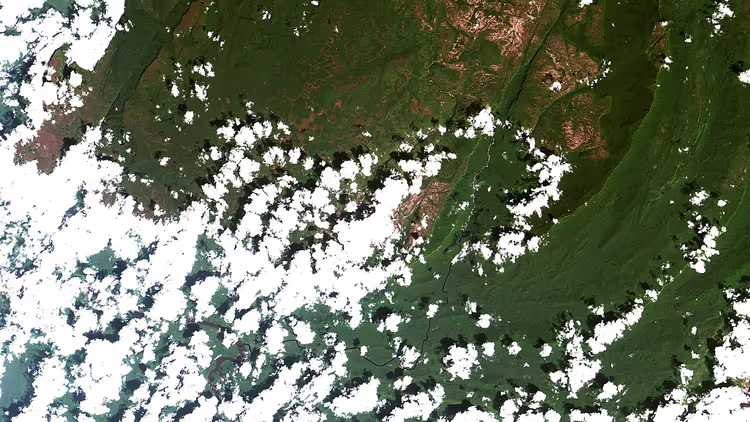 © Coordenação-Geral de Observação da Terra/INPE · CC BY-SAPhoto: Coordenação-Geral de Observação da Terra/INPE, CC BY-SA (https://creativecommons.org/licenses/by-sa/2.0), Wikimedia Commons
Where the gods live
In the Pemon language, the word "tepui" means "house of the gods." Many legends have formed around Roraima: according to one, a tree once grew where the mountain now stands, and all the fruits on earth came from it. The felled trunk turned to stone. In other versions, the mother of all people lived on the plateau.
Local savanna dwellers do not risk climbing up, because the place is considered the abode of evil spirits. The reason for this respect is clear: lightning constantly strikes the plateau, and the rock is scarred with discharge marks. The mountain's name translates as "big blue-green mountain."
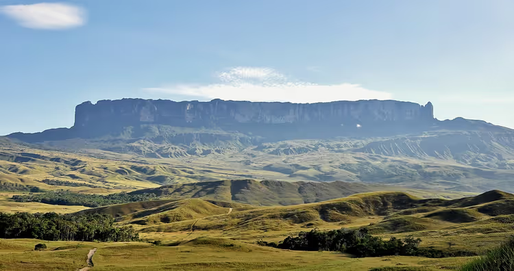 © Paolo Costa Baldi · CC BY-SAPhoto: Paolo Costa Baldi, CC BY-SA (https://creativecommons.org/licenses/by-sa/3.0), Wikimedia Commons
What you will see on the plateau
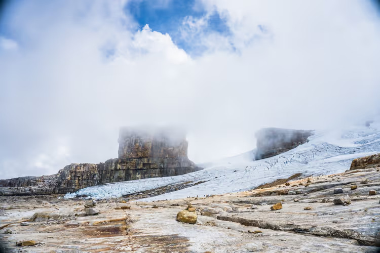
Roraima is almost always wrapped in a cloud, and the outlines of the walls appear from it suddenly. On top, you will feel as if you have stepped inside a fantasy film: the rocks take the shapes of mushrooms, castles, and figures, with scattered stones lying between them.
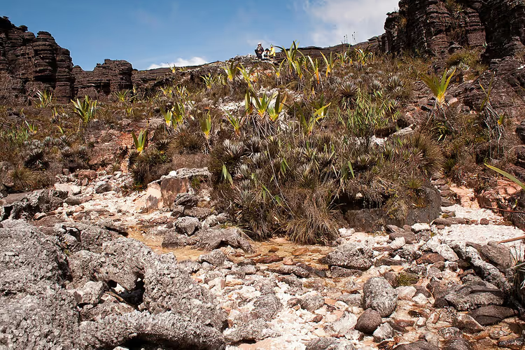 © Roberta Martins · CC BY-SAPhoto: Roberta Martins, CC BY-SA (https://creativecommons.org/licenses/by-sa/3.0), Wikimedia Commons
Because of the constant humidity, algae cover the rock surfaces, turning them black. Where there is no algae, the true color of the sandstone shows through: bright pink. A fifth of the plateau is covered by water, so you will come across rivers with a glittering quartz bed, transparent lakes, peat bogs, and stone pools that look like jacuzzis.
A separate chapter of walking the plateau involves waterfalls: long streams fall from the high walls and are visible from the other side of the savanna.
When to go to Roraima
The higher you climb, the colder and more humid the air becomes. At night on the plateau you freeze even in the tropics, so a warm sleeping bag is essential. Rain can fall for several days in a row, and then instead of a panorama you will see only milky fog.
Season | What to expect |
|---|---|
December-April | Less rain, more clear days, lower water levels at river crossings |
May-November | Frequent downpours and clouds on the plateau, but fewer groups and more blooming orchids |
The dry window lasts from December to April, and the rainy season lasts from May to November (according to the route guide, 09/2026). Plan your trip with a buffer of a day or two: the weather on the wall changes quickly, and the ascent is canceled in strong winds.
Plants and animals of the plateau
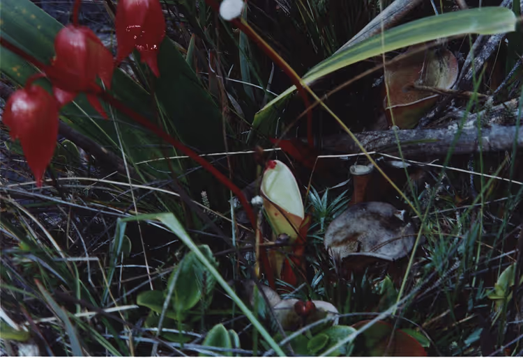
Almost all plants and animals on top are endemic, meaning they live only in this area. Rain washes away the soil, so there is little greenery: you will find islands of trees that look like bonsai, cushions of moss, and gunnera with leaves the size of burdock. Carnivorous plants that trap insects grow in the bogs (according to Wikipedia, 09/2026).
Among the animals you will encounter lizards, scorpions, mice, and coatis, and leeches sit in the wet grass. Many of the plateau's inhabitants are black in color. The most famous resident of the summit, the pebble toad, does not jump but crawls, drops like a little stone when threatened, and whistles before rain.
 © Christian Hummert ( ixitixel · CC BY-SAPhoto: Christian Hummert ( ixitixel, CC BY-SA (https://creativecommons.org/licenses/by-sa/2.5), Wikimedia Commons
Secrets of the table mountain
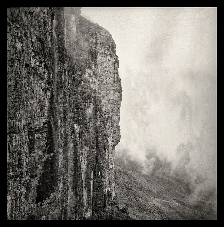
For a long time Roraima remained unexplored: sheer walls and dense tropical forests blocked the ascent. The first European at its foot was Robert Schomburgk, and in 1884 the botanist Everard im Thurn, together with Harry Perkins, managed to climb onto the plateau (according to Wikipedia, 09/2026).
 © Jonathan Wilkins · CC BY-SAPhoto: Jonathan Wilkins, CC BY-SA (https://creativecommons.org/licenses/by-sa/4.0), Wikimedia Commons
Arthur Conan Doyle heard Turner's account and wrote The Lost World (1912). The novel gave the mountain its second name, which guides still use today, and the story has since been adapted for the screen more than once (source: climbing history, 09/2026).
Stories about petroglyphs and quartz labyrinths on the plateau are still debated, but most of the finds have no confirmation. The mountain has plenty of mysteries without them: fog, lightning, and constant rain quickly erase human traces.
How to get to Roraima
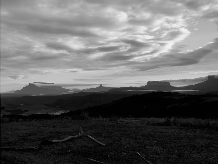
The journey starts in Caracas or Puerto Ordaz. From Puerto Ordaz, buses and shuttles run to the border town of Santa Elena de Uairén; the trip takes about ten hours (according to route operators, 09/2026). From Santa Elena to the village of Paraitepui, you travel by jeep for a couple of hours.
 © Roberto Layouss · CC BY-SAPhoto: Roberto Layouss, CC BY-SA (https://creativecommons.org/licenses/by-sa/3.0), Wikimedia Commons
After that, you walk. The trek takes 6 to 8 days round trip, and on the third day the climb up the rock ramp La Rampa begins. Groups spend nights in tents, and on the plateau they shelter under rock overhangs that locals call "hotels." Pemon porters carry the tents and food, leaving you with your personal belongings. You can carry everything yourself, and then the trek costs less.
Day | What happens | Overnight |
|---|---|---|
1 | Hike from Paraitepui across the savanna, two river crossings | Camp by the Tek River |
2 | Savanna and the foot of Kukenan Tepui | Base camp |
3 | Climb up the rock ramp La Rampa | Plateau |
4 | Rocks, labyrinths, and natural stone pools | Plateau |
5 | Descent to base camp | Base camp |
6 | Return to Paraitepui | Santa Elena de Uairén |
The national park permit is arranged through an operator or at the Inparques post in Paraitepui, and groups are not allowed onto the plateau without a guide. Before the trip, check safety recommendations: the German Foreign Office maintains a dedicated page on Venezuela (as of 09/2026, Auswärtiges Amt). Cash dollars will come in handy, because cards are not accepted everywhere (according to the trekking guide, 09/2026).
The package price is calculated based on the number of days, porters, and the vehicle to Paraitepui, so figures vary between operators. Compare offers in advance: during high season, spots in groups fill up faster.
Tours and tickets
Guided tours, skip-the-line tickets and activities — most offers can be cancelled free of charge.
See offers on GetYourGuideThe widget loads once you give your consent.
Mount Roraima on the map
The mountain stands far from Venezuela's major cities. Reference points for planning: Santa Elena de Uairén, the village of Paratepui, and the border with Brazil.
Mount Roraima in Venezuela
Places on the map
- Roraima Table-top tepui mountain 2810 m high on the border of Venezuela, Brazil and Guyana
⁉️🤔 Frequently asked questions
How many days does the Roraima trek take?
From Paratepui to the plateau and back takes 6-8 days (according to plateau tour operators, 09/2026). The first two days you walk across open savanna and wade across rivers; on the third day the rock ramp begins. Groups usually spend two nights on the plateau, and a spare day for weather is a good idea.
Can you climb to the plateau without a guide?
No. Roraima is part of Canaima National Park, and the Inparques service only allows organized groups with a Pemón guide onto the route. Besides the permit, you need someone who knows the river crossings and the local weather: fog on the wall closes in and hides the landmarks within minutes.
When is the best time to go?
The dry window lasts from December to April: less rain, clouds clear, and river levels are lower (according to the seasonal overview, 09/2026). From May to November downpours are more frequent, but there are fewer groups on the plateau and orchids bloom in the marshes. In any season, leave a spare day or two.
How cold is it on the plateau?
At night you will be freezing: at 2,810 m the temperature drops to near zero, even though the savanna below is tropically hot (according to the climbing guide, 09/2026). Rain and wind make it feel colder. Bring a warm sleeping bag, several layers of clothing, a hat, and a waterproof jacket.
Where do you sleep on the summit?
There are no hotels on the plateau: tents are pitched under rock overhangs that local guides call "hotels." Below, at the foot of the tepui, people sleep in a base camp by the river. Bring your own sleeping bag and mat; the overhang protects you from rain but not from the cold.
In short: what to book
The Roraima trek works like this: you cannot get onto the plateau without a guide and porters, so the main booking is a spot in an operator's group. If your time is limited, take a ready-made 6-8 day package with transfer from Santa Elena and gear included. If you are an experienced hiker and want to save money, arrange porters directly in Paratepui and carry your own food.
The choice matrix is simple. If you have a week and this is your first mountain trek, take a package with a guide, porters, and a tent. If you are going independently, plan the route for eight days and leave a buffer for weather. Check dates before booking: season, permits, and forecast (as of 09/2026, route checklist).
It is easier to look at excursions and tickets for the route in advance: a selection of tours on GetYourGuide.

A small editorial team writing guides for independent travel. We travel ourselves, but we haven’t been everywhere, so we check prices, opening hours and how to get there against official sources.