
















16 Historic routes no worse than the Camino de Santiago
Almost everyone knows the Camino de Santiago. But it is not the only path where centuries lie underfoot. We have put together sixteen historic routes on six continents: from the Namib Desert to the Hawaiian Islands. You walk across land once traveled by pilgrims, armies, and gold prospectors.
Some trails require permits and advance hut reservations, while others can be done in a single day. According to UNESCO, the Great Wall of China alone stretches for more than 20,000 kilometers (source). We have described the length, season, and access for each trail so you can choose a route that matches your fitness level.
Ad: this article contains affiliate links. We earn a commission if you book through them, at no extra cost to you.
How to choose a route that matches your fitness level
💡 In short:
- The list is based on historical significance, not advertising.
- Duration: from one day to an eight-day loop in Namibia.
- Seasons, permits, and access: 09/2026, verified on official park and organization websites.
A quick reference by difficulty level so you can find your option fast:
Route | Country | Level |
|---|---|---|
Naukluft Trail | Namibia | hard |
Laugavegur | Iceland | moderate |
Kalalau Trail | USA, Hawaii | moderate |
Great Stones Way | England | easy |
Great Wall of China | China | easy |
El Mirador | Guatemala | hard |
Appian Way | Italy | easy |
Jesus Trail | Israel | moderate |
Inca Trail | Peru | hard |
Ciudad Perdida | Colombia | hard |
Shikoku Pilgrimage | Japan | moderate |
Camino Francés | Europe | hard |
Headhunters' Trail | Malaysia | moderate |
Chilkoot Trail | USA and Canada | hard |
Berliner Mauerweg | Germany | easy |
Sydney Coastal Walk | Australia | easy |
1. Naukluft Trail
 © Diego Delso · CC BY-SAPhoto: Diego Delso, CC BY-SA (https://creativecommons.org/licenses/by-sa/4.0), Wikimedia Commons
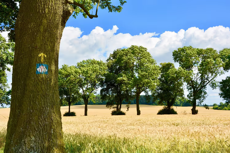
The Naukluft Trail runs through the Naukluft Mountains on the edge of the world's oldest desert. The Namib is older than any landscape you have seen before. Here you walk through canyons and encounter oryx, weavers, and quiver trees. Only well-prepared hikers can complete the full loop.
- Getting there: the start is at the Naukluft camp (park data).
- Duration: eight days for the full loop or four days for the first half (same source).
- The catch: overnight stays must be booked in advance, and the number of spots is limited.
2. Laugavegur
 © Borvan53 · CC BY-SAPhoto: Borvan53, CC BY-SA (https://creativecommons.org/licenses/by-sa/4.0), Wikimedia Commons
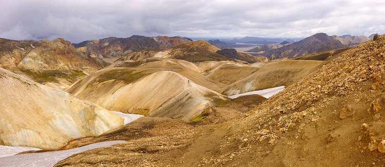
Laugavegur leads from the Landmannalaugar camp to the glacial valley of Þórsmörk. The landscape changes every day: thermal springs, fields of solidified lava, rhyolite mountains. You walk across the Icelandic highlands and spend nights in huts.
- Duration: 55 km, usually three to four days (data from Iceland.org).
- Season: huts operate from late June to early September (same source).
- Getting there: during the season, buses run from Reykjavik to the start and finish points.
- The catch: huts are booked months in advance, and the weather changes quickly.
Look for accommodation in Reykjavik before the start on Trip.com.
3. Kalalau Trail
 © sergejf · CC BYPhoto: sergejf, CC BY (https://creativecommons.org/licenses/by/2.0), Wikimedia Commons
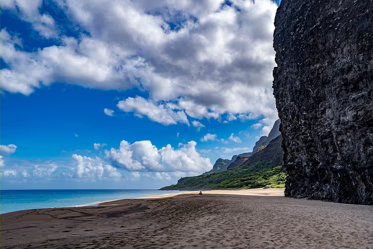
The Kalalau Trail cuts along the Na Pali Coast on the island of Kauai. On one side the Pacific Ocean roars, on the other a sheer cliff rises. Kauai is older than the other islands of the archipelago, so the surf has had time to carve narrow valleys and waterfalls here.
- Length: about 18 km one way (Hawaii state parks data).
- Permit: camping in Kalalau Valley requires a separate permit (same source).
- The catch: the trail closes after heavy rains due to landslides.
4. Great Stones Way
 © Diego Delso · CC BY-SAPhoto: Diego Delso, CC BY-SA (https://creativecommons.org/licenses/by-sa/4.0), Wikimedia Commons
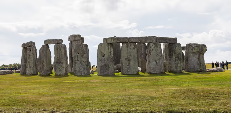
Great Stones Way connects the North Wessex Downs with the Salisbury Plain. The trail takes you past Stonehenge, ancient burial mounds, Roman roads, and Norman churches. It is a walking lesson in British history from the Neolithic to the Middle Ages.
- Length: four to five days; with detours the route is longer than the straight-line distance.
- Getting there: the closest station to the trail is Salisbury.
- The catch: part of the trail runs along roads, and entry at Stonehenge is paid.
5. The great wall of china
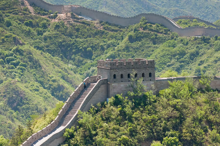 © CEphoto, Uwe Aranas · CC BY-SAPhoto: CEphoto, Uwe Aranas, CC BY-SA (https://creativecommons.org/licenses/by-sa/3.0), Wikimedia Commons
The Great Wall of China is not one wall but a network of defensive sections. Different dynasties built them over nearly two thousand years as protection against nomads from the north (UNESCO data). Today several sections are open to visitors, and the climb takes anywhere from a couple of hours to two days.
- Length: from a few hours to two days, depending on the section.
- Tickets: for the Badaling section, book a time slot in advance; the line is long in summer.
- The catch: open sections have little shade, so bring water with you.
Tours to the wall with transfers are available on GetYourGuide.
6. El Mirador
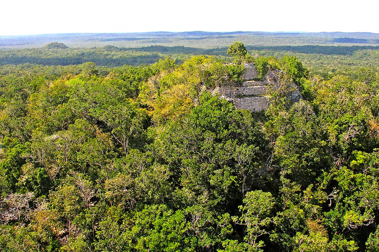 © Dennis G. Jarvis · CC BY-SAPhoto: Dennis G. Jarvis, CC BY-SA (https://creativecommons.org/licenses/by-sa/2.0), Wikimedia Commons
At its peak, the Maya city of El Mirador was twice the size of Tikal. It was home to the La Danta pyramid, one of the tallest Maya structures. Around the second century AD, the inhabitants left, and the jungle swallowed the city until archaeologists rediscovered it.
- Getting there: only on foot from the village of Carmelita, in a guided group.
- Length: about five days to the ruins and back.
- The catch: logistics and a guide must be arranged in advance; there is almost no signal on the route.
7. The Appian Way
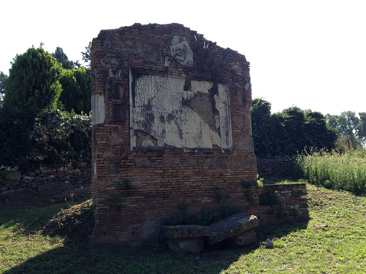 © Sarah E. Bond · CC BYPhoto: Sarah E. Bond, CC BY (https://creativecommons.org/licenses/by/2.0), Wikimedia Commons
The Appian Way (Via Appia) connected Rome and the port of Brindisi. You can still walk along it today: the route passes through the Appia Antica park, past the Church of Domine Quo Vadis and ancient tombs. The pedestrian section in the park fits into one day, so you don't need a week's worth of backpacking gear.
- Duration: about five hours along the paved section.
- How to get there: bus to the Porta San Sebastiano.
- The catch: part of the road is open to cars, so it's better to walk in the morning.
8. The Jesus Trail
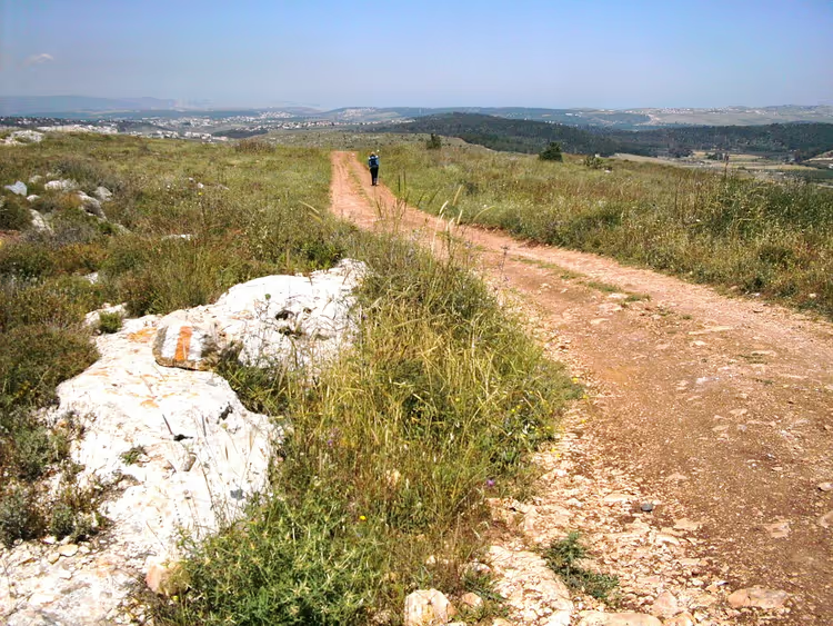 © Zeromancer44 · CC BY-SAPhoto: Zeromancer44, CC BY-SA (https://creativecommons.org/licenses/by-sa/3.0), Wikimedia Commons
The Jesus Trail starts in Nazareth and ends at the ruins of Capernaum. Between them lie biblical landscapes: Zippori, the village of Kfar Kana, the Arbel Valley, and the shores of the Sea of Galilee. You walk through places described in the Gospels, and you don't need any mountain hiking experience.
- Duration: usually three to four days.
- How to get there: start in Nazareth, finish at Lake Kinneret.
- The catch: it's hot in summer, so it's better to go in spring or autumn.
9. The Inca Trail
 © Martin St-Amant ( S23678 ) · CC BY-SAPhoto: Martin St-Amant ( S23678 ), CC BY-SA (https://creativecommons.org/licenses/by-sa/3.0), Wikimedia Commons
The Inca Trail leads through the Andes to Machu Picchu. The Inca civilization left behind staircases, ceremonial baths, and fragments of paving here. The classic route takes four days, and the number of spots per day is limited by permits.
- How to get there: start near Cusco, finish at Machu Picchu.
- Duration: the classic four-day option.
- Permit: permits are sold by Peru's Ministry of Culture, so book in advance.
You can find ready-made Inca Trail tours on GetYourGuide.
10. Ciudad Perdida
 © Gavin Rough from Waterloo, Canada · CC BYPhoto: Gavin Rough from Waterloo, Canada, CC BY (https://creativecommons.org/licenses/by/2.0), Wikimedia Commons
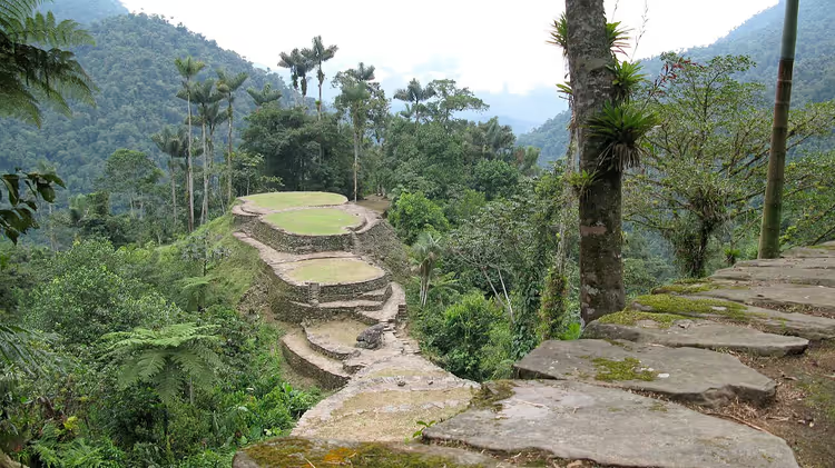
Ciudad Perdida, or the "Lost City," is hidden in the jungles of the Sierra Nevada. The Tairona people built it on stone terraces reached by a long staircase. The only way to get there is on foot, through humid forest and vines.
- How to get there: start at the foot of the Sierra Nevada, only in a group with a guide.
- Duration: usually four to six days.
- The catch: independent access is closed, the trail requires a guide.
11. The Shikoku Pilgrimage
 © Dokudami · CC BY-SAPhoto: Dokudami, CC BY-SA (https://creativecommons.org/licenses/by-sa/3.0), Wikimedia Commons
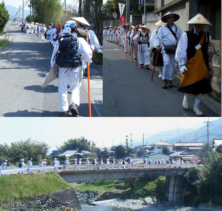
The Shikoku Pilgrimage is associated with the monk Kobo Daishi. The route connects eighty-eight temples across the island of Shikoku, the fourth largest in Japan. Henro, as pilgrims are called, walk in white vests and chant mantras at each temple.
- Duration: the full circuit takes weeks on foot.
- How to get there: the island is connected to Honshu by bridges, and you can start at any temple.
- The catch: the route has no beginning or end, and you plan your own lodging.
12. The Via Francigena
 © This Photo was taken by Wolfgang Moroder . Feel free to use my photos, but please mention me as the author and send me a · CC BY-SAPhoto: This Photo was taken by Wolfgang Moroder . Feel free to use my photos, but please mention me as the author and send me a, CC BY-SA (https://creativecommons.org/licenses/by-sa/3.0), Wikimedia Commons
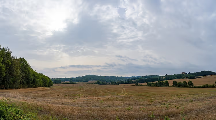
The Via Francigena leads from Canterbury to Rome. It crosses Kent, France, Switzerland, and Italy, passes through the Alps and the Tuscan hills, and ends at St. Peter's Basilica. The route was first described by Archbishop Sigeric in the 10th century.
- Length: the full route is over two thousand kilometers (Via Francigena Association).
- Getting there: you can walk individual stages rather than the entire route.
- The catch: in the Alps the passes are closed in winter, so your season will be short.
Look for train tickets across Europe for individual stages on Trip.com.
13. The Headhunters' Trail
The Headhunters' Trail in Malaysia connects Gunung Mulu National Park with the river port of Limbang. The Kayan tribes once used it to raid their neighbors. In the 1840s, Governor James Brooke banned headhunting, and today the route is safe.
- Getting there: first fly to Miri, then transfer to Gunung Mulu.
- Duration: usually three to four days with overnight stays in the jungle.
- The catch: there is almost no mobile signal or internet on the route.
14. The Chilkoot Trail
 © Kurt Minard · CC BY-SAPhoto: Kurt Minard, CC BY-SA (https://creativecommons.org/licenses/by-sa/3.0), Wikimedia Commons
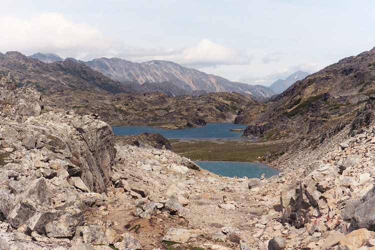
The Chilkoot Trail leads to the sites of the Klondike Gold Rush. In the late 19th century, gold was found on the Klondike River, and thousands of people walked over the Yukon passes. Some abandoned items are still visible along the trail today.
- Getting there: start in Dyea, Alaska, finish at Bennett Lake.
- Duration: usually three to five days.
- The catch: the route requires a permit and mandatory registration at the trailhead.
15. Berliner Mauerweg
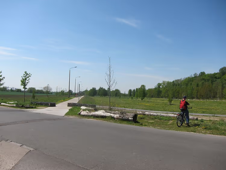 © Radaxel · CC BY-SAPhoto: Radaxel, CC BY-SA (https://creativecommons.org/licenses/by-sa/4.0), Wikimedia Commons
The Berliner Mauerweg follows the path of the Berlin Wall. For almost thirty years, it divided the city and the entire continent. A small section of the actual wall remains on the route, and memorial plaques remind you of the division.
- Getting there: the route starts at any point within Berlin.
- Duration: it is comfortable to walk in a few days, faster by bike.
- The catch: this is an urban trail, so there is plenty of pavement and noise.
16. Sydney Coastal Walk
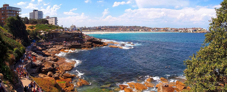 © Maurice van Creij · CC BYPhoto: Maurice van Creij, CC BY (https://creativecommons.org/licenses/by/3.0), Wikimedia Commons
The Sydney Great Coastal Walk stretches along the ocean from Bondi to Botany Bay. Here beaches sit next to the city, and cliffs stand beside colonial buildings. Around Botany Bay, the memory of Aboriginal people and Captain Cook's landing is preserved.
- Getting there: start at Bondi Beach, then continue by public transport.
- Duration: the full route takes one to two days.
- The catch: in summer, open sections have almost no shade.
For Sydney hotels near the route, see Trip.com.
⁉️🤔 Frequently asked questions
Which route is best for a beginner?
Start with the Appian Way or Berliner Mauerweg: neither route requires permits. The Appian Way can be done in a day, and the Mauerweg is easy to split over several days. If you want a long hike, choose the Laugavegur: straightforward logistics, huts, and a marked trail (as of 09/2026, source).
Do I need permits for these trails?
Yes, some routes are restricted. The Inca Trail and Kalalau Valley require separate permits, and overnight stays in Icelandic huts must be booked in advance (as of 09/2026, source). Without a booking, you will not be allowed in during the season.
When is the best time to hike these routes?
Northern trails are open in the short summer: Laugavegur huts operate from late June to early September, and alpine passes also open during this period. Southern routes, such as the Inca Trail, are easier to hike in the dry season, when rain does not get in your way.
How much does it cost to hike these routes?
It all depends on permits, overnight stays, and guides. The Inca Trail and Kalalau require paid permits, while the Appian Way and the Berlin Wall route are free. Accommodation along long trails is booked separately (as of 09/2026, source).
Can I hike these routes without a guide?
Marked trails such as the Appian Way, the Laugavegur, and the Berliner Mauerweg can be done independently. Ciudad Perdida and Gunung Mulu National Park require a guide: entry without one is not allowed. Check the park website for rules before your trip.
In short: what to book
Choose a route based on your time and experience, and sort out the logistics in advance. The matrix below suggests what to book first.
- If you have one free day: choose the Appian Way or one section of the Berliner Mauerweg.
- If this is your first long hike: choose the Laugavegur and book the huts right away.
- If you want Mayan history and jungle: choose El Mirador or Ciudad Perdida.
- If you want ocean and cliffs: choose the Kalalau Trail or the Sydney Coastal Walk.
Book tours and excursions on GetYourGuide, accommodation in starting cities through Trip.com, and for long trails add insurance comparison.

A small editorial team writing guides for independent travel. We travel ourselves, but we haven’t been everywhere, so we check prices, opening hours and how to get there against official sources.