






Vatnajokull: ice caves, iceberg lagoon and volcanoes under the ice
In Iceland, volcanoes, blue caves, and icebergs are hidden under a single glacier. This is Vatnajökull National Park, the largest in the country and the second largest in Europe by area. Here, ice meets fire and covers nearly a fifth of the island.
People come here for the blue ice of the ice caves and for the Jökulsárlón lagoon. The park stretches for hundreds of kilometers along the south and east of the island, and the roads inside are often gravel. Below, we have gathered the main sights, visitor centers, and an option for traveling without a car.
Ad: this article contains affiliate links, we earn a commission if you book through them, at no extra cost to you.
Vatnajökull National Park: size and origins
💡 In short:
- The park covers 14,967 km², and inside lies a glacier with an area of 8,100 km² (Vatnajökull National Park).
- Access and season: 09/2026, verified on the national park website.
The park was established on June 7, 2008, by merging the glacier with two former parks in the south and north. Since 2019, it has been a UNESCO World Heritage Site (according to Wikipedia about the park). It is one of the largest national parks in Europe.
The park takes its name from the Vatnajökull glacier, the largest in Europe outside the Arctic. The average ice thickness is 400-600 meters, and in places it reaches up to 950 meters (glacier data). Active volcanoes are hidden beneath the ice, so the landscape here is constantly changing.
Iceland was born from volcanic activity. Lava breaks through the ice sheet, and real wonders are created here. You will see black lava fields, white ice, and green grassy slopes side by side.
Natural beauty of the park
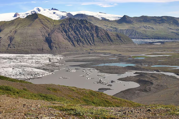
In the southeast of the island, black lava fields, green oases, and white ice sit next to each other. The park stretches from Skaftafell on the south coast to Dettifoss in the north of the island. Each area has its own character, and you should plan a separate day for each one.
 © Justraveling.com · CC BY-SAPhoto: Justraveling.com, CC BY-SA (https://creativecommons.org/licenses/by-sa/4.0), Wikimedia Commons
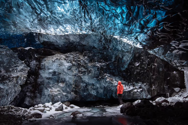
In winter, people come here for the ice caves. They are carved out by subglacial rivers, and the ice deep inside is blue because it contains almost no air bubbles. Each season, the water opens new passages, so old maps do not work. You can only enter with a guide, because going in on your own is dangerous.
The south of the park is home to Skaftafell, with its green slopes and glacier. Above it rises Hvannadalshnúkur, the highest peak in the country. The sands on the coast consist of volcanic ash carried by subglacial floods from the Grímsvötn volcano.
These floods wash away bridges and change river courses, so some roads are closed in summer. Before heading out, check the road status on the park website and the weather forecast. In the highlands, the weather can change within an hour even in July.
Waterfalls: Dettifoss and Svartifoss
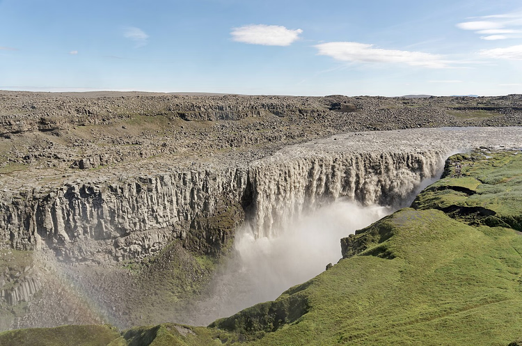
Dettifoss sits on the Jökulsá á Fjöllum river and is considered the second most powerful waterfall in Europe after the Rhine Falls. It drops water from a height of 44 meters, and the width of the flow is about 100 meters (Wikipedia about Dettifoss). The average flow rate is almost 193 m³/s, so the roar can be heard from far away.
 © Jakub Hałun · CC BYPhoto: Jakub Hałun, CC BY (https://creativecommons.org/licenses/by/4.0), Wikimedia Commons
To the west of the waterfall, paved road 862 leads there and stays open almost all year. The east bank is served by gravel road 864, usually passable only in summer (roads to the waterfall). On the west side you will find a viewing platform and a toilet, while on the east side there are boards with information about the park.
The second waterfall, Svartifoss, sits in Skaftafell. It got its name from the black basalt columns around the flow. A short uphill trail from the visitor center leads to it, and you can do it without any preparation.
Routes to volcanic craters
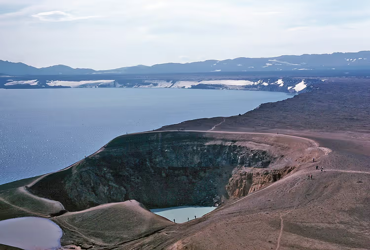
A car will only take you to the edge of the lava fields; hiking trails lead to the craters themselves. Most often travelers head to the Askja volcano on the highland plateau. Askja last erupted in 1961 (Wikipedia on Askja), and Lake Öskjuvatn formed inside its caldera.
The lake is deep and enclosed by cliffs on all sides. In a neighboring crater lies the warm lake Víti, heated by the volcano. After landslides, swimming in Víti is not recommended.
 © User Wolfgangbeyer on de.wikipedia · CC BY-SAPhoto: User Wolfgangbeyer on de.wikipedia, CC BY-SA (http://creativecommons.org/licenses/by-sa/3.0/), Wikimedia Commons
The Laki volcano is structured differently. What you see is not a mountain but a fissure tens of kilometers long, with craters lined up along it (national park page). The Laki eruption of 1783-1784 was the largest lava eruption in the island's history and caused famine in Europe.
Nearby lies the Eldgjá canyon, left over from the eruption of 934. It is considered one of the largest volcanic canyons in the world. In the highlands you should drive only with four-wheel drive: the local F-roads open in summer and are easily washed out by rain.
Jökulsárlón glacier lagoon
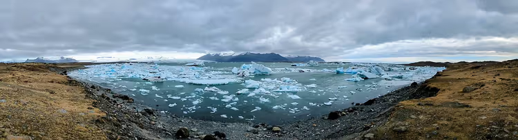
The Jökulsárlón lagoon lies at the mouth of a glacier tongue right by the ring road. Its area is about 25 km², and its depth reaches 284 meters (Wikipedia on Jökulsárlón). No lake in Iceland is deeper.
Icebergs break off from the glacier and slowly drift toward the ocean. The denser the ice, the deeper its blue color. In summer, boats run between the icebergs, and on the shore you will often see seals and Arctic terns.
 © Manticorp · CC BYPhoto: Manticorp, CC BY (https://creativecommons.org/licenses/by/4.0), Wikimedia Commons
The lagoon has grown fourfold since the 1970s because the glacier retreats by about 200 meters per year (lagoon page). Hollywood films were shot here, including Bond movies and Lara Croft. The view will change over the years, so the chance to see it is worth taking.
The bridge over the lagoon is always crowded. Arrive at dawn, and you will get soft light and an empty parking area.
Activities and tours
The park has enough activities for any group. For a relaxed day, hiking routes of varying length and difficulty work well. For excitement, take snowmobiles, glacier jeep safaris, kayaking among icebergs, or ice climbing.
Most tours start from Jökulsárlón, Höfn, or Skaftafell. Ice caves are open only in winter. In summer, glacier hikes with crampons and ice axes are available.
Book tours in advance, because spots run out in July and August. If you want to see blue ice up close, choose Vatnajökull glacier tours on GetYourGuide.
Tours and tickets
Guided tours, skip-the-line tickets and activities — most offers can be cancelled free of charge.
See offers on GetYourGuideThe widget loads once you give your consent.
Visitor centers and fees
Information about trails, roads, and weather is available at the park's visitor centers. There are six of them: Gamlabúð in Höfn, Gígur, Gljúfrastofa, Skaftafellsstofa, Skaftárstofa, and Snæfellsstofa (list of visitor centers). The Hrauneyjar information center also operates in the highlands.
In summer, the park offers free ranger-led walks; the schedule is on the website. Cards are accepted almost everywhere, so you will hardly need cash. There is a separate fee for camping in Ásbyrgi and for parking at Skaftafell and Jökulsárlón. This information was verified on 09/15/2026 on the park's official website.
Bring warm clothes even in summer; without a shell jacket and a hat, you will be uncomfortable.
Getting there on your own
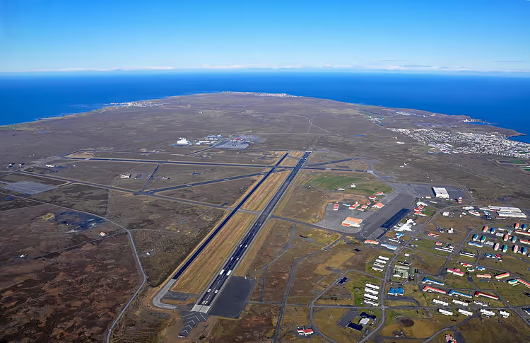
You can fly to Iceland on direct flights to Keflavík Airport (KEF) from major European hubs, including Copenhagen, Amsterdam, and Frankfurt. From the airport, a bus or transfer will take you to Reykjavík.
A ferry from Denmark goes to the island by sea, and it takes cars on board. This route is chosen by those who are not in a hurry and want to arrive in their own vehicle.
From Reykjavík, you then drive east on Ring Road 1. It will take you to Skaftafell and Jökulsárlón, and in the north to Dettifoss and Ásbyrgi.
Road 1 is paved almost everywhere, but turnoffs into the park are often gravel. They require four-wheel drive, especially on F-roads in the highlands. In winter, some roads are closed, so check your route in advance.
If you are traveling without a car, scheduled buses run from Reykjavík to Skaftafell and Höfn. In winter, some services are canceled, so check the schedule in advance.
 © SuperJet International · CC BY-SAPhoto: SuperJet International, CC BY-SA (https://creativecommons.org/licenses/by-sa/2.0), Wikimedia Commons
Having your own car is more convenient for the ring route: you choose your own stops and can make it for sunrise. Compare car rental on DiscoverCars to avoid overpaying in high season.
⁉️🤔 Frequently asked questions
Do I need to buy a ticket to Vatnajökull National Park?
Entry to the park is free, no tickets needed. Visitor centers operate on a seasonal schedule; check hours on the park website.
When is the best time to visit Vatnajökull?
In summer all roads are open and hiking trails are accessible, but waterfalls and the lagoon get crowded. In winter ice caves are available, but daylight hours are short. The shoulder season gives you empty trails, but some roads are already closed, so check conditions in advance.
Can I see Jökulsárlón and the ice caves in one day?
Yes, if you base yourself in Höfn or near Skaftafell. In the morning you go to an ice cave, in the afternoon you drive to the lagoon. It makes for a packed day, and driving takes several hours. Book both in advance, otherwise you won't make it before dark.
Do I need a 4x4?
A regular car is enough for Ring Road 1. You need four-wheel drive on F-roads in the highlands: they open only in summer, and rental companies almost always prohibit driving them without separate insurance. Check rental terms before your trip.
How much does a glacier trip cost?
Prices depend on the season and the tour operator. Glacier hikes and ice cave tours are noticeably more expensive in July and around New Year's. Compare several options in advance to pick a convenient time and avoid overpaying.
In short: what to book
Vatnajökull belongs on the itinerary of anyone visiting Iceland. Allow several days for the region and check the weather every day. If you're short on time, book a guided glacier tour and save the rest for next time.
- If you're traveling in winter: an ice cave and the northern lights.
- If you're traveling in summer: a glacier hike and the Ring Road.
- If you're with kids: short trails near Skaftafell and the Jökulsárlón lagoon.
- If you have a 4x4: a hike to the Askja volcano crater.
Most importantly, book ahead: glacier tour on GetYourGuide. In high season, spots sell out weeks in advance.

A small editorial team writing guides for independent travel. We travel ourselves, but we haven’t been everywhere, so we check prices, opening hours and how to get there against official sources.