
















Marble caves in Chile: season, road and boat trips
The "marble" cliffs rise straight out of the lake and change color every minute. These are the Marble Caves, a natural monument of Chile on the western shore of Lake General Carrera. From Coyhaique to the cliffs it is 223 km along the Carretera Austral (monument description), and you cannot reach them on foot. Below is a breakdown of the trip: how to get there, when to get on the water, and what you will see from the boat.
General Carrera lies in Patagonia, on the border between Chile and Argentina. The lake covers 1,850 km², with a maximum depth of 590 m (encyclopedia data). By these numbers, the water ranks first in Chile and second in Argentina.
Ad: this article contains affiliate links. We earn a commission if you book through them, at no extra cost to you.
Where the Marble Caves are located
💡 In short:
- The cliffs stand on the western shore of Lake General Carrera (source).
- The nearest village and dock: Puerto Río Tranquilo on the Carretera Austral.
- The cliffs are accessible only from the water, by boat or kayak.
- You should get on the water on a clear day with completely calm conditions.
- Location and status of the site: 09/2026, according to the Chilean natural monuments registry.
The cliffs lie on the western shore, in the Aysén Region (same page). The nearest settlement with a dock is called Puerto Río Tranquilo. The village sits right on the Carretera Austral, the main road of Chilean Patagonia, which is why almost all boats to the cliffs depart from here rather than from larger cities.
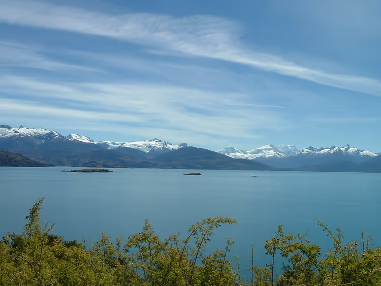
The lake itself stretches along the border between two countries. In Argentina it is called Lago Buenos Aires, in Chile General Carrera. Both names are official, so you will see both on maps, in navigation apps, and on road signs along the way (lake information).
 © Manxuc · CC BY-SAPhoto: Manxuc, CC BY-SA (https://creativecommons.org/licenses/by-sa/4.0), Wikimedia Commons
The lake is of glacial origin. In the southwest, water flows through the Deseado channel into Lake Bertrand, and from there the Baker River carries it to the Pacific Ocean (hydrography description). Small towns are scattered along the shores: Chile Chico, Puerto Ibáñez, and Puerto Guadal on the Chilean side, Los Antiguos on the Argentine side.
For a long time, the Chilean shore was almost cut off from the rest of the country, and roads here went through Argentina. The Carretera Austral was opened only in the early 1990s, and that is when tourists began arriving on the lake's shores (road history).
How to get to the caves
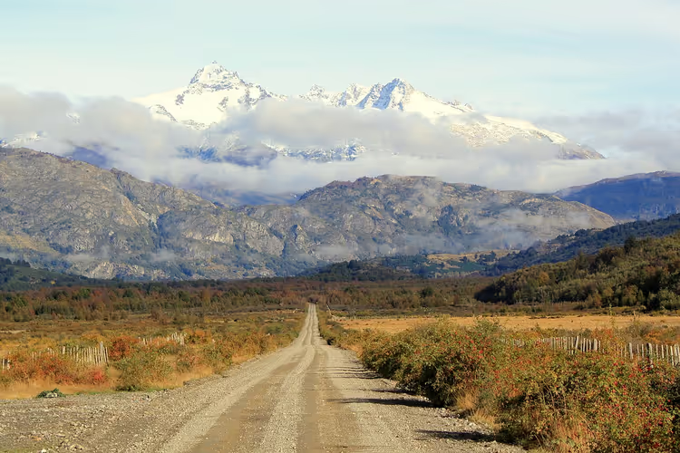
The route is long but straightforward. First, fly to Santiago, then take a flight to Balmaceda near Coyhaique. From Coyhaique, the Carretera Austral runs south, and after 223 km you are there (location data). Allow half a day for the drive: part of the route is gravel, and there will be plenty of stops for photos.
Keep three things in mind. Gas stations are rare along the route, so fill up in Coyhaique. A vehicle with high clearance is more practical here than a sedan. Navigation apps do not work everywhere, so download an offline map in advance.
 © Rakela · CC BY-SAPhoto: Rakela, CC BY-SA (https://creativecommons.org/licenses/by-sa/3.0), Wikimedia Commons
There is also a second approach, via Chile Chico on the southern shore. Boats and ferries run from Chile Chico to the northern side, to Puerto Ibáñez.
Accommodation in Puerto Río Tranquilo is limited, and in summer it books up quickly. Reserve in advance, otherwise you will have to spend the night in Coyhaique and drive to the caves at dawn: hotels in Puerto Río Tranquilo on Trip.com.
Why the caves are called marble
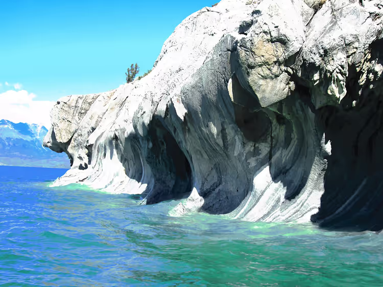
The name accurately reflects the rock composition. The caves are made of real marble, that is, metamorphosed calcium carbonate (geology of the site). The lake water has polished this rock for thousands of years, carving grottoes, overhangs, and columns into it.
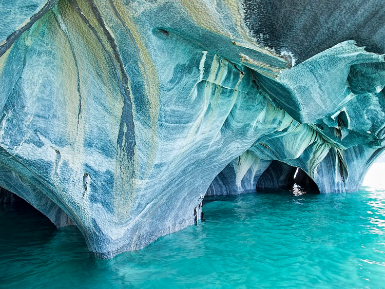
Look at the color of the walls: white, gray, and in places blue. The shades come from impurities in the rock and the depth of the water beneath the caves. Each grotto therefore looks unique, and no two photos here are ever the same.
 © Wescottm · CC BYPhoto: Wescottm, CC BY (https://creativecommons.org/licenses/by/4.0), Wikimedia Commons
Locals call the rocks Capilla de Mármol, and the most famous group is Catedral de Mármol (monument page). Both groups stand as separate islets, with a narrow boat passage between them. According to the same description, the site is protected as a natural monument of Chile.
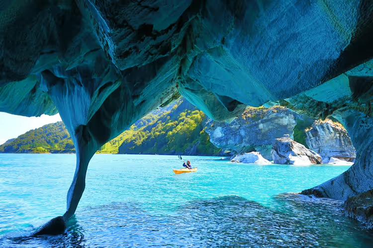
On a clear day, the sun enters the openings and lights up the water from within. That is when the grottoes look almost turquoise, and this is the most recognizable shot of the area. Once the waves pick up, the picture immediately fades: the color depends on the light and on how calm the water is.
What to see on the water
You reach the rocks by small boat or kayak. Boats depart from the pier in Puerto Río Tranquilo, and captains decide for themselves whether to go out on the lake: strong wind cancels trips without hesitation.
Go in the morning. The water is smooth at that time, the wind has not picked up yet, and the light falls into the openings at its best. During the day the lake almost always gets breezier, so expect not only a bumpy ride but also a less vivid picture.
 © Dan Lundberg · CC BY-SAPhoto: Dan Lundberg, CC BY-SA (https://creativecommons.org/licenses/by-sa/2.0), Wikimedia Commons
A kayak works if you are confident on the water. The lake is glacial, the water is freezing all year round, and waves from passing boats are possible near the rocks. Bring a windbreaker and a warm layer even in midsummer.
Water and a snack are enough to take with you: there is no infrastructure on the water. Put your phone and camera in a dry bag, spray and wind near the rocks are guaranteed.
If you want to arrive with a ready-made itinerary and a guide who knows the boat schedule: Marble Caves tours on GetYourGuide.
When to go: climate and weather
The season for the rocks matches the Chilean summer, from November to March. The climate in Patagonia is cold and windy, but the lake itself lies in a mild microclimate, which is why the larger settlements appeared on these shores rather than in the surrounding mountains (shore climate).
The main rule: go out on the water on a clear day and in calm conditions. Waves here are dangerous, so leave a spare day in your plan in case of wind.
Even in summer the air is cool, and the water remains icy. June and July are winter in this area: cold, short daylight hours, and few boats operating.
Lake General Carrera on the map
Below is a map. The rocks are marked near the western shore, with Puerto Río Tranquilo next to them. The point shows the general location of the lake on the border between Chile and Argentina, so you can easily gauge the scale of the journey ahead.
⁉️🤔 Frequently asked questions
Can you reach the rocks on foot?
No. The Marble Caves stand right in the water, and the surrounding shores are steep. The only way to reach them is by water, from the Puerto Río Tranquilo pier by boat or kayak. On foot you can only get to viewpoints on the shore, where you can see the lake but not the grottoes themselves.
How long is the trip and how much does it cost?
Local operators offer short outings to one group of rocks and longer routes to both groups at once. The price depends on the season and the size of the boat, so check it at the pier. It is better to book the evening before, as spots sell out quickly in high season.
When is the best time to visit the Marble Caves?
The best time is from November to March, during the Chilean summer. Go out in the morning while the lake is calm. If you want the perfect shot, watch the forecast: you need a clear day with no wind, when the water is transparent and the grotto walls glow blue.
How do you get there from Europe?
There are no direct flights. You usually fly to Santiago with a connection, then take a domestic flight to Balmaceda near Coyhaique. From there you drive to the rocks along the Carretera Austral. Check visa rules on the Chilean consulate website before your trip, as they change.
What can you do near the Marble Caves?
The lake is fished for trout and salmon, so sport fishing is popular here (local fishing). All around lies Patagonia with the glaciers of the Aysén region and trekking routes. If your trip is long, add a night in Chile Chico or in Los Antiguos on the Argentine side.
In short: what is worth booking
The Marble Caves do not sell tickets. The only things worth arranging in advance are a night in Puerto Río Tranquilo and transport. If you have one day in the region, take a short outing to Catedral de Mármol and move on. If you have two or three days, add Chile Chico, Los Antiguos in Argentina, and fishing on the lake (lake shores).
For the gravel roads of the Carretera Austral, your own car is more convenient: car rental on DiscoverCars. Check the dates, pick up the car in Coyhaique, and plan to return before dark so you do not drive on gravel at night.

A small editorial team writing guides for independent travel. We travel ourselves, but we haven’t been everywhere, so we check prices, opening hours and how to get there against official sources.